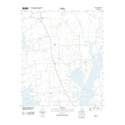
2010 Map of Yantis
USGS Topo · Published 2010About this map
Yantis serves as the central hub of this Wood County landscape, where the sprawling fingers of the Lake Fork Reservoir dominate the southern and eastern horizons. The terrain is a mixture of established rural settlements and industrial extraction, most notably the Yantis Gas and Oil Field located east of the main town. Genealogists will find significant value in the distribution of family and community burial sites, including Seymore Cemetery in the north near Crossroads, and Sharp Cemetery and Holland Cemetery further south.
Find a feature on this map
62 named features on this map. Tap any name to fly to it.
Don’t see what you’re looking for? This feature index may not catch every label — zoom into the map to look around manually.
Map Details
Editions of this 2010 Yantis Map
This is the sole edition of this map. No revisions or reprints were ever made.
Other maps of this area

1953 · Texarkana
USGS Topo · 1:250,000

1956 · Texarkana
USGS Topo · 1:250,000

1956 · Tyler
USGS Topo · 1:250,000

1958 · Arbala
USGS Topo · 1:24,000

1958 · Alba
USGS Topo · 1:24,000

1959 · Calvary
USGS Topo · 1:24,000

1959 · Yantis
USGS Topo · 1:24,000

1959 · Alba
USGS Topo · 1:62,500

1960 · Pleasant Grove
USGS Topo · 1:24,000

1960 · Quitman
USGS Topo · 1:24,000