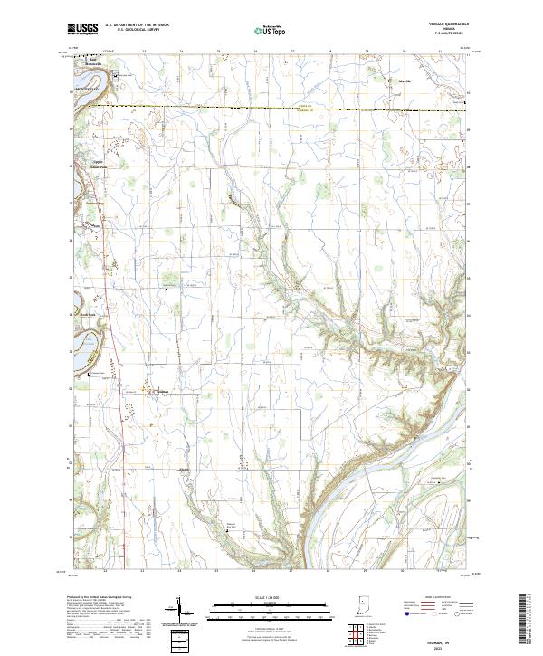
2023 Map of Yeoman
USGS Topo · Published 2023About this map
Monticello and the surrounding river valleys define the northern and southern reaches of this landscape on the border of White and Carroll Counties. The Tippecanoe River feeds into Lake Freeman, where residential clusters like Patton, Terrace Bay, and Upper Sunset Park line the eastern shore. Further south, the community of Yeoman sits centrally among a network of rural roads, while Sleeth is positioned near the winding course of the Wabash River. Numerous family and community burial grounds, including Yeoman Cem, Schock Cem, and Bostetter Cem, are scattered across the township, offering essential reference points for local genealogists. The land is characterized by an extensive system of waterways and drainage, such as Rattlesnake Creek and Hardy Ditch, which support the agricultural tracts between the two major river systems.
Find a feature on this map
60 named features on this map. Tap any name to fly to it.
Don’t see what you’re looking for? This feature index may not catch every label — zoom into the map to look around manually.
Map Details
Editions of this 2023 Yeoman Map
This is the sole edition of this map. No revisions or reprints were ever made.
Other maps of this area

1953 · Danville
USGS Topo · 1:250,000

1955 · Danville
USGS Topo · 1:250,000

1956 · Danville
USGS Topo · 1:250,000

1962 · Flora
USGS Topo · 1:24,000

1962 · Burrows
USGS Topo · 1:24,000

1962 · Monticello South
USGS Topo · 1:24,000

1962 · Delphi
USGS Topo · 1:24,000

1962 · Burnettsville
USGS Topo · 1:24,000

1962 · Monticello North
USGS Topo · 1:24,000
1962 · Yeoman
USGS Topo · 1:24,000