1956 Map of York Harbor
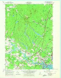
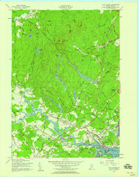
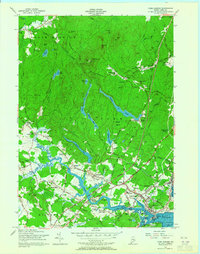
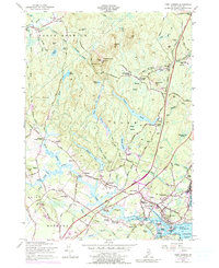
USGS Topo · Published 1974About this map
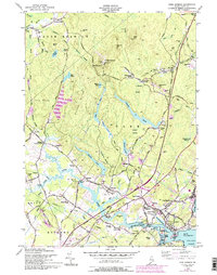
The MacIntire Garrison stands as a testament to early colonial defense on this 1950s survey of coastal Maine, which captures the region before extensive modern development. The landscape is a mix of tidal waters and interior hills, centered on the historic cluster of York Village, York Corner, and the active waterfront at York Harbor. Settlement patterns follow the winding course of the York River, while the interior remains dominated by significant wooded elevations such as Mt Agamenticus and the sprawling York Woods.
Find a feature on this map
97 named features on this map. Tap any name to fly to it.
Don’t see what you’re looking for? This feature index may not catch every label — zoom into the map to look around manually.
Map Details
Editions of this 1956 York Harbor Map
5 editions found
Other maps of this area

1891 · Berwick
USGS Topo · 1:62,500

1891 · Kennebunk
USGS Topo · 1:62,500

1893 · Kennebunk
USGS Topo · 1:62,500

1893 · Dover
USGS Topo · 1:62,500

1893 · Berwick
USGS Topo · 1:62,500

1893 · York
USGS Topo · 1:62,500

1898 · Kennebunk
USGS Topo · 1:62,500

1916 · Dover
USGS Topo · 1:62,500

1918 · Dover
USGS Topo · 1:62,500

1920 · York
USGS Topo · 1:62,500