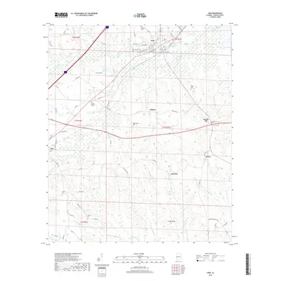
2018 Map of York
USGS Topo · Published 2018About this map
York serves as the primary municipal center in this section of Sumter County, where the street grid is dense with residential avenues like Kentucky Ave and Virginia Ave. The landscape is defined by the winding course of Alamuchee Cr and its various tributaries, which create a complex drainage network through the central lowlands. Notable elevations such as Alamuchee Hill and Scratch Hill provide a geographic contrast to the wetlands and small lakes, including Lake Louise and Lake Carolyn.
Find a feature on this map
88 named features on this map. Tap any name to fly to it.
Don’t see what you’re looking for? This feature index may not catch every label — zoom into the map to look around manually.
Map Details
Editions of this 2018 York Map
This is the sole edition of this map. No revisions or reprints were ever made.
Other maps of this area

1929 · Epes
USGS Topo · 1:48,000

1932 · Epes
USGS Topo · 1:62,500

1953 · Meridian
USGS Topo · 1:250,000

1957 · Meridian
USGS Topo · 1:250,000

1965 · Meridian
USGS Topo · 1:250,000

1971 · Gaston
USGS Topo · 1:24,000

1971 · Bellamy
USGS Topo · 1:24,000

1974 · Boyd
USGS Topo · 1:24,000

1974 · Ward
USGS Topo · 1:24,000
1974 · Tamola
USGS Topo · 1:24,000