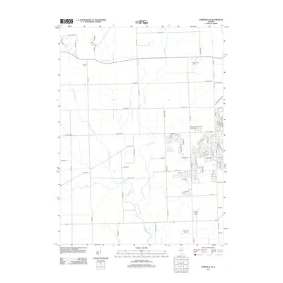
2012 Map of Yorkville SE
USGS Topo · Published 2012About this map
E Aux Sable Cr and its tributaries define the drainage of this prairie landscape as it transitioned toward suburban development in the early 21st century. The map shows the expanding residential street grids north of Joliet, punctuated by local landmarks like the NaAuSay Cem and a series of private airfields including Riley's Field Airport and Rossi's Farm Airport. A distinctive local landmark, S Indian Boundary Rd, cuts diagonally across the northeastern corner of the map, following a historical line of demarcation that predates the modern section lines. Genealogists and local historians can trace the older rural foundations through names like Grove Rd and Schlapp Rd, while observing the burgeoning subdivisions such as those along Whitetail Ridge Dr and Caton Farm Rd.
Find a feature on this map
78 named features on this map. Tap any name to fly to it.
Don’t see what you’re looking for? This feature index may not catch every label — zoom into the map to look around manually.
Map Details
Editions of this 2012 Yorkville SE Map
This is the sole edition of this map. No revisions or reprints were ever made.
Other maps of this area

1892 · Morris
USGS Topo · 1:62,500

1892 · Joliet
USGS Topo · 1:62,500

1892 · Wilmington
USGS Topo · 1:62,500

1918 · Wilmington
USGS Topo · 1:62,500

1918 · Morris
USGS Topo · 1:62,500

1923 · Joliet
USGS Topo · 1:62,500

1925 · Yorkville
USGS Topo · 1:62,500

1953 · Plattville
USGS Topo · 1:24,000

1953 · Lisbon
USGS Topo · 1:24,000

1953 · Yorkville
USGS Topo · 1:24,000