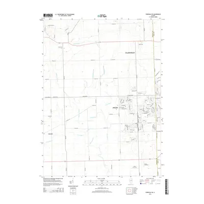
2015 Map of Yorkville SE
USGS Topo · Published 2015About this map
Plattville and the western reaches of Joliet and Plainfield define this landscape as it appeared in the mid-2010s, straddling the boundary between Kendall and Will counties. The map provides a detailed view of suburban expansion meeting traditional agricultural land, anchored by the historic NaAuSay Cem. The drainage pattern is dictated by the various branches of the Aux Sable Creek system, including W Aux Sable Cr, E Aux Sable Cr, and Middle Aux Sable Cr. Unique landmarks like Riley's Field and Rossi's Farm Airport highlight the specialized land use in the area. Local history is etched into the road grid with routes like Indian Boundary Dr reflecting early territorial divisions, while newer residential developments are seen emerging around W Caton Farm Rd.
Find a feature on this map
98 named features on this map. Tap any name to fly to it.
Don’t see what you’re looking for? This feature index may not catch every label — zoom into the map to look around manually.
Map Details
Editions of this 2015 Yorkville SE Map
This is the sole edition of this map. No revisions or reprints were ever made.
Other maps of this area

1892 · Morris
USGS Topo · 1:62,500

1892 · Joliet
USGS Topo · 1:62,500

1892 · Wilmington
USGS Topo · 1:62,500

1918 · Wilmington
USGS Topo · 1:62,500

1918 · Morris
USGS Topo · 1:62,500

1923 · Joliet
USGS Topo · 1:62,500

1925 · Yorkville
USGS Topo · 1:62,500

1953 · Plattville
USGS Topo · 1:24,000

1953 · Lisbon
USGS Topo · 1:24,000

1953 · Yorkville
USGS Topo · 1:24,000