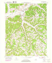
1952 Map of Yosemite
USGS Topo · Published 1979About this map
Yosemite and Middleburg serve as central points in this mid-century portrait of Casey County, where the Green River carves a winding path through the northern landscape. The terrain is defined by a series of prominent ridges and knobs, including Hatter Knob and Salyer Knob, which dictate the placement of early rural infrastructure. Small community hubs are scattered across these uplands, often identified by local institutions like Freedom Sch, Poplar Hill Sch, and Mt Olive Ch. The drainage patterns of Hatter Creek and Lick Creek illustrate the historical reliance on these waterways for early land divisions. Genealogists will find particular value in the clearly marked family-named burial grounds such as Hatter Cem and Durham Cem, alongside several one-room schoolhouses that reflect a decentralized rural education system prior to modern consolidation.
Find a feature on this map
58 named features on this map. Tap any name to fly to it.
Don’t see what you’re looking for? This feature index may not catch every label — zoom into the map to look around manually.
Map Details
Editions of this 1952 Yosemite Map
Other maps of this area

1935 · Somerset
USGS Topo · 1:62,500

1952 · Ellisburg
USGS Topo · 1:24,000

1952 · Halls Gap
USGS Topo · 1:24,000

1952 · Eubank
USGS Topo · 1:24,000

1952 · Hustonville
USGS Topo · 1:24,000

1952 · Liberty
USGS Topo · 1:24,000

1952 · Yosemite
USGS Topo · 1:24,000

1953 · Phil
USGS Topo · 1:24,000

1953 · Mintonville
USGS Topo · 1:24,000

1954 · Science Hill
USGS Topo · 1:24,000