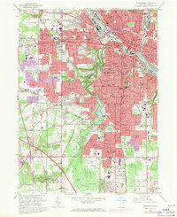
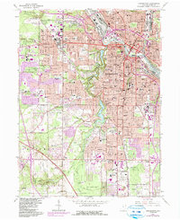
1963 Map of Youngstown
USGS Topo · Published 1971About this map
Mill Creek Park forms a deep green spine through this industrial landscape, following the winding Mill Creek through a series of reservoirs including Lake Glacier, Lake Cohasset, and Newport Lake. The map captures the urban density of Youngstown and its surrounding townships during a period of post-war expansion, visible in the purple-tinted growth reaching into Boardman and Austintown. The Mahoning River corridor serves as the industrial heart, flanked by the Penn Central RR and Erie Lackawanna RR, while the residential uplands are dotted with dozens of parochial and public schools like Chaney High Sch and St Edwards Sch. Notable landmarks of the era include the mid-century Boardman Plaza Shopping Center and the legendary Idora Park amusement grounds, offering a detailed view of the city's commercial and social infrastructure before later decades of transition.
Find a feature on this map
136 named features on this map. Tap any name to fly to it.
Don’t see what you’re looking for? This feature index may not catch every label — zoom into the map to look around manually.
Map Details
Editions of this 1963 Youngstown Map
5 editions found
Other maps of this area

1906 · Youngstown
USGS Topo · 1:62,500

1907 · Columbiana
USGS Topo · 1:62,500

1908 · Youngstown
USGS Topo · 1:62,500

1908 · Warren
USGS Topo · 1:62,500

1909 · Lisbon
USGS Topo · 1:62,500

1909 · Columbiana
USGS Topo · 1:62,500

1950 · Cleveland
USGS Topo · 1:250,000

1951 · Canton
USGS Topo · 1:250,000

1951 · Columbiana
USGS Topo · 1:24,000

1951 · Campbell
USGS Topo · 1:24,000