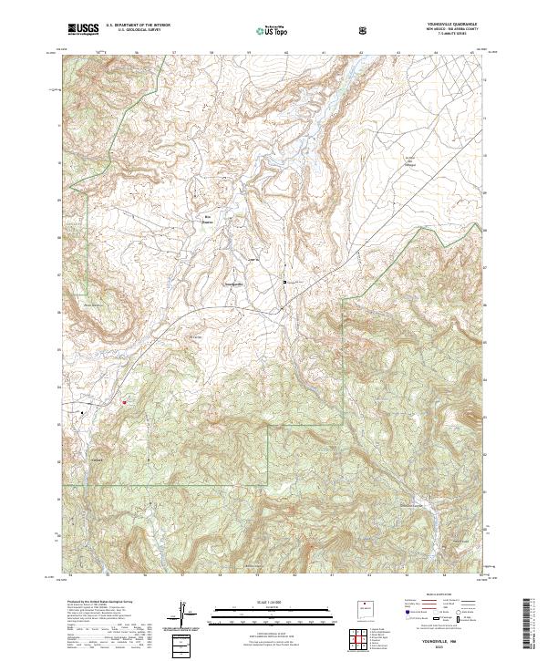
2023 Map of Youngsville
USGS Topo · Published 2023About this map
Rio Puerco meanders through this High Desert landscape, serving as a primary drainage for the surrounding mesas and canyons in Rio Arriba County. The settlement of Youngsville sits centrally, supported by a network of local roads such as Farm Rd 100 and Forest Rd 100, while the neighboring village of Coyote lies to the southwest near the mouth of Coyote Canyon. These communities are framed by significant landforms, including the prominent Mesa Naranja and Mesa Escoba, which define the local topography.
Find a feature on this map
32 named features on this map. Tap any name to fly to it.
Don’t see what you’re looking for? This feature index may not catch every label — zoom into the map to look around manually.
Map Details
Editions of this 2023 Youngsville Map
This is the sole edition of this map. No revisions or reprints were ever made.
Other maps of this area

1909 · Gallina
USGS Topo · 1:125,000

1918 · Abiquiu
USGS Topo · 1:125,000

1953 · Canones
USGS Topo · 1:24,000

1953 · Cerro Del Grant
USGS Topo · 1:24,000

1953 · Polvadera Peak
USGS Topo · 1:24,000

1953 · Echo Ampitheater
USGS Topo · 1:24,000

1953 · Arroyo Del Agua
USGS Topo · 1:24,000
1953 · Jarosa
USGS Topo · 1:24,000

1953 · Laguna Peak
USGS Topo · 1:24,000

1953 · Youngsville
USGS Topo · 1:24,000