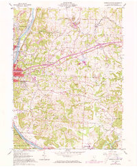
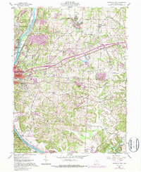
1961 Map of Zanesville East
USGS Topo · Published 1973About this map
The Muskingum River corridor serves as the industrial and transit spine of this mid-century landscape, where the city of Zanesville expands eastward from its historic riverbanks. Three major rail lines—the Baltimore and Ohio, Penn Central, and Norfolk and Western—converge here, reflecting the area's importance as a regional transportation hub. Outside the urban center, the terrain is defined by extractive industry and rural infrastructure, from numerous strip mines to the sprawling Zanesville Municipal Airport. Genealogists will find a wealth of local markers, including several significant burial grounds like Greenwood Cemetery and St Thomas Cem, alongside country schools such as Parkinson Sch and Monroe Sch. The transition from river-town commerce to upland coal mining is clearly visible through the numerous mine labels and the small settlements of Sunray and Sonora that dot the hillsides.
Find a feature on this map
52 named features on this map. Tap any name to fly to it.
Don’t see what you’re looking for? This feature index may not catch every label — zoom into the map to look around manually.
Map Details
Editions of this 1961 Zanesville East Map
5 editions found
Other maps of this area

1908 · Conesville
USGS Topo · 1:62,500

1910 · Frazeysburg
USGS Topo · 1:62,500

1910 · Philo
USGS Topo · 1:62,500

1910 · Zanesville
USGS Topo · 1:62,500

1910 · Conesville
USGS Topo · 1:62,500

1947 · Columbus
USGS Topo · 1:250,000

1949 · Clarksburg
USGS Topo · 1:250,000

1950 · Marion
USGS Topo · 1:250,000

1951 · Canton
USGS Topo · 1:250,000

1953 · Canton
USGS Topo · 1:250,000