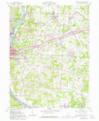
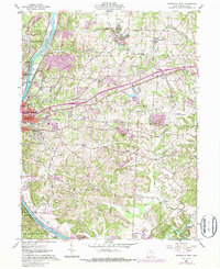
1961 Map of Zanesville East
USGS Topo · Published 1977About this map
The Muskingum River corridor serves as the primary artery for this 1961 survey, showing Zanesville and its eastern surroundings as they transitioned through mid-century industrial and residential growth. This landscape is a patchwork of early infrastructure and active resource extraction, notably marked by numerous Strip Mines and the Paul Mine. The presence of several long-standing cemeteries, such as Greenwood Cemetery and Mt Olive Cemetery, alongside local schools like McKinley Sch and Parkinson Sch, provides significant detail for researchers tracing the social geography of Muskingum County.
Find a feature on this map
59 named features on this map. Tap any name to fly to it.
Don’t see what you’re looking for? This feature index may not catch every label — zoom into the map to look around manually.
Map Details
Editions of this 1961 Zanesville East Map
5 editions found
Other maps of this area

1908 · Conesville
USGS Topo · 1:62,500

1910 · Frazeysburg
USGS Topo · 1:62,500

1910 · Philo
USGS Topo · 1:62,500

1910 · Zanesville
USGS Topo · 1:62,500

1910 · Conesville
USGS Topo · 1:62,500

1947 · Columbus
USGS Topo · 1:250,000

1949 · Clarksburg
USGS Topo · 1:250,000

1950 · Marion
USGS Topo · 1:250,000

1951 · Canton
USGS Topo · 1:250,000

1953 · Canton
USGS Topo · 1:250,000