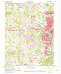
1961 Map of Zanesville West
USGS Topo · Published 1973About this map
The Muskingum River and Licking River converge at the heart of this mid-century survey, defined by the iconic Y Bridge in Zanesville. This era captures the city's westward expansion through neighborhoods like Owens Hills and Licking View, while industrial patterns are visible in the numerous Strip Mines and Gravel Pits dotting the Springfield and Newton townships. The landscape preserves numerous genealogical anchors, including Woodlawn Cem and the United Jewish Cem, alongside rural landmarks like McKendree Cem and Meadow Farm Ch. Transportation networks are well-established, with the Baltimore and Ohio and Penna Central railroads serving the river valleys. Outside the urban core, the creation of Dillon Lake has altered the northern terrain, while the County Fairground remains a prominent fixture of local civic life.
Find a feature on this map
79 named features on this map. Tap any name to fly to it.
Don’t see what you’re looking for? This feature index may not catch every label — zoom into the map to look around manually.
Map Details
Editions of this 1961 Zanesville West Map
4 editions found

Other maps of this area

1908 · Conesville
USGS Topo · 1:62,500

1910 · Frazeysburg
USGS Topo · 1:62,500

1910 · Philo
USGS Topo · 1:62,500

1910 · Zanesville
USGS Topo · 1:62,500

1910 · Conesville
USGS Topo · 1:62,500

1947 · Columbus
USGS Topo · 1:250,000

1949 · Clarksburg
USGS Topo · 1:250,000

1950 · Marion
USGS Topo · 1:250,000

1951 · Canton
USGS Topo · 1:250,000

1953 · Canton
USGS Topo · 1:250,000