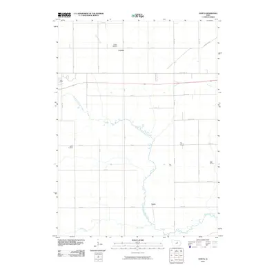
2010 Map of Zaneta
USGS Topo · Published 2010About this map
North Fork Black Hawk Creek meanders through this portion of Black Hawk County, anchoring a landscape defined by its agricultural grid and dispersed rural settlements. The map highlights the localized community points of Fredsville in the north and Zaneta further south, alongside the smaller junction at Bois d'Arc. This 2010 survey reflects the enduring layout of township roads like Grundy Rd and Viking Rd, which have served the region's farmsteads for generations. Genealogists will find significant value in the preservation of several local burying grounds, including the Zion Lutheran Cemetery and Fairfield Township Cemetery, which remain central landmarks in this quiet corner of the Iowa prairie. The confluence of Willow Creek and the main branch of Black Hawk Creek in the south provides a natural contrast to the rigid geometry of the surrounding section lines.
Find a feature on this map
39 named features on this map. Tap any name to fly to it.
Don’t see what you’re looking for? This feature index may not catch every label — zoom into the map to look around manually.
Map Details
Editions of this 2010 Zaneta Map
This is the sole edition of this map. No revisions or reprints were ever made.
Other maps of this area

1954 · Waterloo
USGS Topo · 1:250,000

1955 · Waterloo
USGS Topo · 1:250,000

1963 · Buckingham
USGS Topo · 1:24,000

1963 · Hudson
USGS Topo · 1:24,000

1963 · Cedar Falls
USGS Topo · 1:24,000

1971 · Zaneta
USGS Topo · 1:24,000

1971 · Dike
USGS Topo · 1:24,000

1971 · Lincoln
USGS Topo · 1:24,000

1971 · Stout
USGS Topo · 1:24,000

1971 · Reinbeck
USGS Topo · 1:24,000