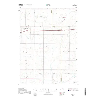
2018 Map of Zaneta
USGS Topo · Published 2018About this map
The border of Grundy and Black Hawk counties runs vertically through this Iowa landscape, where agricultural tradition meets the suburban reach of Cedar Falls. The settlement of Fredsville serves as a focal point in the north, anchored by the Fredsville Evangelical Lutheran Church Cem, while the namesake locality of Zaneta sits further south along the North Fork Black Hawk Creek. The area is defined by its watercourses, including Hammers Cr and Willow Cr, which cut through the gridded road network. Genealogists will find significant value in the documentation of several rural burial grounds, such as Saint Mary's Cem and the Zion Lutheran Cem near County Highway D25. The western edge includes a portion of Dike, showing the town's expansion toward the county line.
Find a feature on this map
45 named features on this map. Tap any name to fly to it.
Don’t see what you’re looking for? This feature index may not catch every label — zoom into the map to look around manually.
Map Details
Editions of this 2018 Zaneta Map
This is the sole edition of this map. No revisions or reprints were ever made.
Other maps of this area

1954 · Waterloo
USGS Topo · 1:250,000

1955 · Waterloo
USGS Topo · 1:250,000

1963 · Buckingham
USGS Topo · 1:24,000

1963 · Hudson
USGS Topo · 1:24,000

1963 · Cedar Falls
USGS Topo · 1:24,000

1971 · Zaneta
USGS Topo · 1:24,000

1971 · Dike
USGS Topo · 1:24,000

1971 · Lincoln
USGS Topo · 1:24,000

1971 · Stout
USGS Topo · 1:24,000

1971 · Reinbeck
USGS Topo · 1:24,000