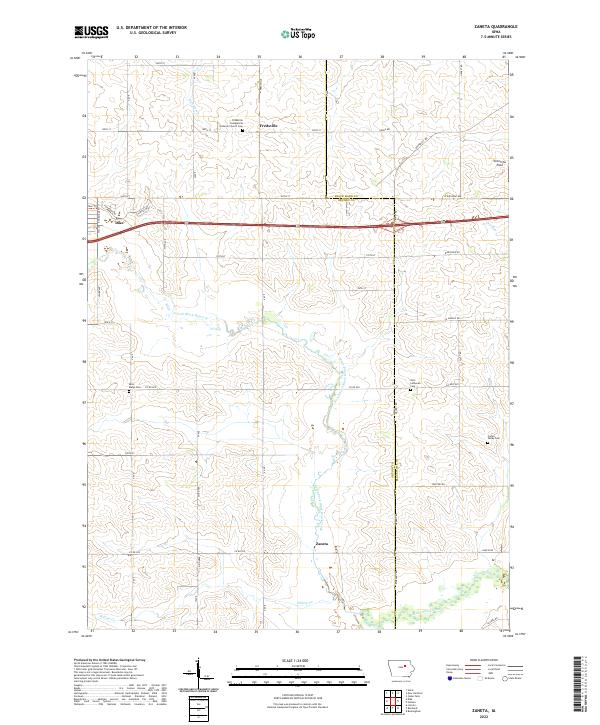
2022 Map of Zaneta
USGS Topo · Published 2022About this map
Fredsville and the surrounding farmland of the Black Hawk and Grundy County line anchor this mid-continent agricultural landscape. The area is defined by the dendritic drainage patterns of North Fork Black Hawk Creek and Hammers Cr, where rolling topography meets the structured grid of rural section roads. For family historians, the map preserves the locations of several foundational religious and memorial sites, including Saint Marys Cem and the Fredsville Evangelical Lutheran Church Cem. The small settlement of Zaneta sits in the southern portion of the quadrangle, while the town of Dike appears in the northwest. This layout reflects the late-20th and early-21st-century evolution of the region, where legacy farmsteads and rural churches remain the primary landmarks amidst a landscape dedicated to large-scale grain production and local transit corridors like University Ave.
Find a feature on this map
46 named features on this map. Tap any name to fly to it.
Don’t see what you’re looking for? This feature index may not catch every label — zoom into the map to look around manually.
Map Details
Editions of this 2022 Zaneta Map
This is the sole edition of this map. No revisions or reprints were ever made.
Other maps of this area

1954 · Waterloo
USGS Topo · 1:250,000

1955 · Waterloo
USGS Topo · 1:250,000

1963 · Buckingham
USGS Topo · 1:24,000

1963 · Hudson
USGS Topo · 1:24,000

1963 · Cedar Falls
USGS Topo · 1:24,000

1971 · Zaneta
USGS Topo · 1:24,000

1971 · Dike
USGS Topo · 1:24,000

1971 · Lincoln
USGS Topo · 1:24,000

1971 · Stout
USGS Topo · 1:24,000

1971 · Reinbeck
USGS Topo · 1:24,000