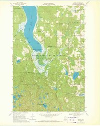
1969 Map of Zerkel
USGS Topo · Published 1972About this map
Lower Rice Lake and the dense woodlands of the White Earth State Forest dominate this landscape on the Clearwater County border. The 1969 survey captures a region defined by its complex hydrology and state-managed conservation lands, including the Lower Rice Lake State Wildlife Management Area. Four distinct landings along the western shore—Bonga Landing, Big Bear Landing, Bush Landing, and Ponsford Landing—point to the lake's importance for local access and travel through the wetlands.
Find a feature on this map
29 named features on this map. Tap any name to fly to it.
Don’t see what you’re looking for? This feature index may not catch every label — zoom into the map to look around manually.
Map Details
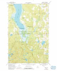
Editions of this 1969 Zerkel Map
2 editions found
Other maps of this area

1954 · Bemidji
USGS Topo · 1:250,000

1957 · Bemidji
USGS Topo · 1:250,000

1958 · Bemidji
USGS Topo · 1:250,000

1969 · Ebro
USGS Topo · 1:24,000

1969 · Roy Lake
USGS Topo · 1:24,000

1969 · Tulaby Lake
USGS Topo · 1:24,000

1969 · Anchor Hill
USGS Topo · 1:24,000

1969 · Long Lost Lake
USGS Topo · 1:24,000

1969 · Heart Lake
USGS Topo · 1:24,000
1969 · Zerkel NW
USGS Topo · 1:24,000