Old Maps of Alabama
Explore old maps of Alabama, spanning from 1885 to today. These high-resolution historic maps reveal how streets, neighborhoods, landmarks, and natural features evolved over time — perfect for genealogy, metal detecting, research, and local history exploration.
What you can do with these maps:
- See how Alabama changed over time: Compare historical maps to modern-day views to trace roads, homesites, rail lines & more.
- View detailed metadata: Each map includes creators, publishers, year, scale, and archive source.
- Overlay maps with satellite & LiDAR: Visualize the past alongside modern tools to explore terrain & human change.
- Trusted historical sources: Maps sourced from the USGS, Library of Congress, and other archives.
- Access maps your way: View online, download high-res files, or order prints for personal or research use.
Start exploring old maps of Alabama to uncover forgotten places, hidden landmarks, and the deep history beneath your feet.
Alabama maps
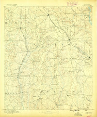
- 1885 Map of Gadsden
 1885 Gadsden1885 Print · USGSCovers Alabama, including Gadsden, Albertville, and other nearby areas
 - 1886 Map of Rome
 1886 Rome1886 Print · USGSCovers Alabama, including Rome, Cedartown, and other nearby areas
 - 1886 Map of Stevenson
 1886 Stevenson1886 Print · USGSCovers Alabama, including Scottsboro, Fort Payne, and other nearby areas
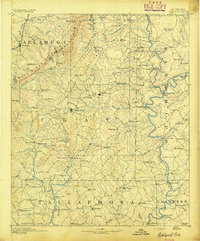
 - 1888 Map of Cullman
 1888 Cullman1888 Print · USGSCovers Alabama, including Decatur, Cullman, and other nearby areas
 - 1888 Map of Gadsden
 1888 Gadsden1888 Print · USGSCovers Alabama, including Gadsden, Albertville, and other nearby areas
 - 1888 Map of Scottsboro
 1888 Scottsboro1888 Print · USGSCovers Alabama, including Huntsville, Scottsboro, and other nearby areas
 - 1888 Map of Huntsville
 1888 Huntsville1888 Print · USGSCovers Alabama, including Huntsville, Decatur, and other nearby areas
 - 1889 Map of Tallapoosa
 1889 Tallapoosa1889 Print · USGSCovers Alabama, including Carrollton, Cedartown, and other nearby areas
 - 1889 Map of Springville
 1889 Springville1889 Print · USGSCovers Alabama, including Gadsden, Oxford, and other nearby areas
 - 1889 Map of Birmingham
 1889 Birmingham1889 Print · USGSCovers Alabama, including Birmingham, Vestavia Hills, and other nearby areas
 - 1890 Map of Bessemer
 1890 Bessemer1890 Print · USGSCovers Alabama, including Birmingham, Hoover, and other nearby areas
 - 1890 Map of Talladega
 1890 Talladega1890 Print · USGSCovers Alabama, including Talladega, Pell City, and other nearby areas
 - 1891 Map of Clanton
 1891 Clanton1891 Print · USGSCovers Alabama, including Prattville, Clanton, and other nearby areas5 unique versions available
 - 1891 Map of Ashland
 1891 Ashland1891 Print · USGSCovers Alabama, including Lineville, Ashland, and other nearby areas5 unique versions available
 - 1892 Map of Cullman
 1892 Cullman1892 Print · USGSCovers Alabama, including Decatur, Cullman, and other nearby areas4 unique versions available
 - 1892 Map of Birmingham
 1892 Birmingham1892 Print · USGSCovers Alabama, including Birmingham, Vestavia Hills, and other nearby areas
 - 1892 Map of Springville
 1892 Springville1892 Print · USGSCovers Alabama, including Gadsden, Oxford, and other nearby areas7 unique versions available
 - 1892 Map of Huntsville
 1892 Huntsville1892 Print · USGSCovers Alabama, including Huntsville, Decatur, and other nearby areas6 unique versions available
 - 1892 Map of Scottsboro
 1892 Scottsboro1892 Print · USGSCovers Alabama, including Huntsville, Scottsboro, and other nearby areas7 unique versions available
 - 1892 Map of Talladega
 1892 Talladega1892 Print · USGSCovers Alabama, including Talladega, Pell City, and other nearby areas6 unique versions available
 - 1892 Map of Stevenson
 1892 Stevenson1892 Print · USGSCovers Alabama, including Scottsboro, Fort Payne, and other nearby areas
 - 1892 Map of Tallapoosa
 1892 Tallapoosa1892 Print · USGSCovers Alabama, including Carrollton, Cedartown, and other nearby areas
 - 1892 Map of Gadsden
 1892 Gadsden1892 Print · USGSCovers Alabama, including Gadsden, Albertville, and other nearby areas
 - 1892 Map of Bessemer
 1892 Bessemer1892 Print · USGSCovers Alabama, including Birmingham, Hoover, and other nearby areas2 unique versions available
 - 1893 Map of Jasper
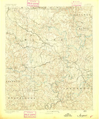 1893 Jasper1893 Print · USGSCovers Alabama, including Birmingham, Jasper, and other nearby areas7 unique versions available
Showing maps 1-25
Top cities of Alabama
- Huntsville historical maps
- Birmingham historical maps
- Montgomery historical maps
- Mobile historical maps
- Tuscaloosa historical maps
- Hoover historical maps
See more
Top counties of Alabama
- Jefferson County historical maps
- Mobile County historical maps
- Madison County historical maps
- Baldwin County historical maps
- Montgomery County historical maps
- Tuscaloosa County historical maps
See more
Frequently asked questions
- What are the different types of historical maps available for Alabama?
- What is the oldest map of Alabama?
- Where can I purchase historical maps of Alabama for my home or office?
- Where can I download high-res historical maps of Alabama?
- Are there historical topographic maps available for Alabama?
- Is there historical aerial imagery available for Alabama?
- Where are historical maps of Alabama sourced from?