1930s Maps of Alabama
Explore 155 historic maps of Alabama from the 1930s. These maps offer a rare glimpse into what life looked like during the 1930s — showing old roads, neighborhoods, homes, and landmarks that have changed or disappeared over time.
Whether you're researching your family's past, planning a metal detecting trip, or studying how Alabama's landscape evolved across the 1930s, these high-resolution maps are a powerful tool for exploring the history of this region.
- Focus on a specific era: All maps on this page are from the 1930s, giving you a focused view of this time period.
- See what’s changed: Compare century-old streets, trails, and buildings to today's modern landscape using overlays and satellite layers.
- Research with precision: Use these maps for genealogy, historical research, land use analysis, or educational projects.
- View, download, or print: Maps are fully viewable online in high resolution, and can be downloaded or printed for your own records.
Start exploring Alabama's history through authentic maps from the 1930s. This is your window into the past.
Alabama maps
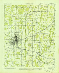
(155)- 1930 Map of Montgomery
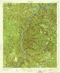
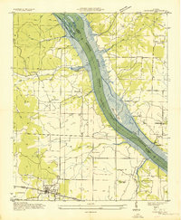
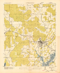
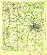 1930 Montgomery1930 Print · USGSThe Alabama state capital is seen here as a bustling rail and river crossroads in the late twenties. Trace the historic growth of the city and its surrounding rural communities through sites like Maxwell Aviation Field, Kilby Prison, and Oakwood Cemetery.4 unique versions available
 - 1931 Map of Cottondale
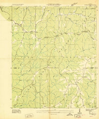
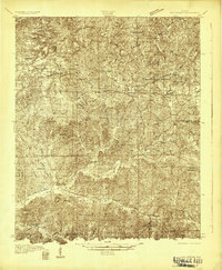 1931 Cottondale1931 Print · USGSTuscaloosa County at the start of the 1930s shows a landscape of timber rails and rural churches. Genealogists and historians can trace the Kaul Lumber Co (Abandoned) line or locate old community centers like Andrews Chapel and Duncanville.
 - 1931 Map of Eutaw
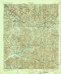
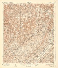
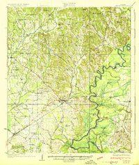 1931 Eutaw1931 Print · USGSThe Black Warrior River valley in the late twenties was a landscape of river locks and rail junctions centered on Eutaw. Local historians can trace early rural infrastructure like the Rosenwald School, the County Poor Farm, and Pinckes Ferry.4 unique versions available
 - 1932 Map of Epes
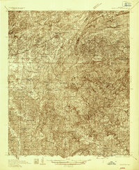
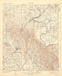 1932 Epes1932 Print · USGSSumter and Greene counties are shown in the early 1930s as the regional economy relied heavily on the Southern Railway and river transport. Genealogists can locate family landmarks like Wesley Chapel, Hillman Ferry, and the Industrial School.4 unique versions available
 - 1932 Map of Yolande, 1964 Print
 1932 Yolande1964 Print · USGSThe industrial corridor southwest of Birmingham comes alive in this survey of the early thirties, where coal and iron roots run deep. Trace the rail lines serving Gilmore Mines and Connellsville or locate family sites near McCalla and Yolande.
 - 1934 Map of Searles
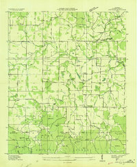
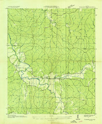
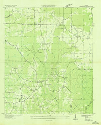
 1934 Searles1934 Print · USGSThe industrial hills and river locks of Tuscaloosa and Jefferson counties are captured here in the early 1930s. Genealogists can trace family roots in mining settlements like Searles and Kellerman, or locate rural landmarks such as Antioch Ch & Cem.6 unique versions available
 - 1934 Map of Cottondale
 1934 Cottondale1934 Print · USGSDuring the mid-1930s, the rail corridors of the Southern Railway and Mobile and Ohio Railroad shaped the growth of eastern Tuscaloosa County. Genealogists can trace family footprints near Cottondale and Duncanville or locate long-standing landmarks like Emerson Chapel and Howell Sch.3 unique versions available
 - 1934 Map of Blocton
 1934 Blocton1934 Print · USGSCentral Alabama's coal and rail corridor comes to life in the 1930s, showing the intersection of the Cahaba River and intensive industrial development. Researchers can locate old mining sites like Hill Creek Mine and numerous rural landmarks including Rock Institute Sch and Ada Chapel.3 unique versions available
 - 1935 Map of Moulton
 1935 Moulton1935 Print · USGSLawrence County during the mid-thirties reveals a rural landscape poised between the plateau farms and the timbered heights of the national forest. Researchers can trace family history through local sites like the Rosenwald Sch, Shoemaker Cem, and the settlement at Wren.
 - 1935 Map of Cherokee
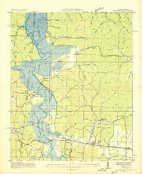
 1935 Cherokee1935 Print · USGSNorthern Alabama is captured in the mid-1930s as the TVA prepares to inundate the valley for the Pickwick Landing Reservoir. Genealogists and historians can trace family-named sites like Perkins Cem, Moontown Ch, and the town of Cherokee.
 - 1935 Map of Upshaw
 1935 Upshaw1935 Print · USGSLawrence and Winston counties are captured here in the mid-1930s, documenting a landscape of rural schoolhouses and forest management lookouts. You can trace early twentieth-century life at Upshaw, Templeton Sch, and the Friendship Cem.
 - 1935 Map of Danville
 1935 Danville1935 Print · USGSIn the mid-thirties, the borderlands of Lawrence and Morgan counties featured a landscape of remote stores and hilltop churches. Genealogists can trace family footprints at Strauge Crossroads or locate the ancient Indian Mounds near Oakville.2 unique versions available
 - 1935 Map of Oakville
 1935 Oakville1935 Print · USGSLawrence County, Alabama, is documented here in the mid-1930s as a landscape of small schools, family cemeteries, and ancient landmarks. Genealogists and historians can trace the locations of the Indian Mounds, Hodges Store, and several rural anchors like Oakville Sch.
 - 1935 Map of Wright
 1935 Wright1935 Print · USGSLauderdale County and the Tennessee River are shown here in the mid-1930s during the early development of the Tennessee Valley Authority. Genealogists can trace early landmarks such as Williams Chapel, Youngs Store, and the historic Nathez Trace.
 - 1935 Map of Port Birmingham
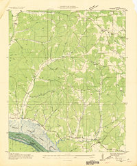
 1935 Port Birmingham1935 Print · USGSThe coal and power corridor of the Black Warrior River is captured here in the mid-1930s, showing a landscape defined by mines and industrial camps. Genealogists can locate family sites at Pennsylvania Camp, Satterfield Cem, or the Barney Mine community.
 - 1935 Map of Yolande
 1935 Yolande1935 Print · USGSThe Jefferson and Tuscaloosa county line was a hub of coal production and rail activity in the 1930s. Researchers can trace the layout of mining communities like Yolande and Johns or locate family roots at Dogwood Ch and Kniss Store.3 unique versions available
 - 1935 Map of Athens
 1935 Athens1935 Print · USGSMid-1930s Limestone County comes into focus as an agricultural landscape transitioning into a new era of infrastructure. Family researchers can locate rural anchors like Holt Store, Johnson Cem, and several local schools from Turner Hill Sch to St John Sch.
 - 1935 Map of Pleasant Site
 1935 Pleasant Site1935 Print · USGSNorth Alabama rural life is captured here in the mid-1930s along the boundary of Colbert and Franklin Counties. Genealogists and historians can trace family roots through sites like Bates Hill Ch, Harmony Cem, and the settlement at Pogo.
 - 1936 Map of Russellville
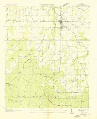
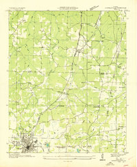 1936 Russellville1936 Print · USGSFranklin County in the mid-1930s shows a landscape of small agricultural settlements and nascent industrial infrastructure along the Southern Railway. Genealogists can trace family landmarks and schools like Mountain Star Sch, the Iron Mine (Abandoned), and Osborn Cem.
 - 1936 Map of Trenton
 1936 Trenton1936 Print · USGSThe Georgia and Alabama borderlands are captured here in the mid-1930s as mountain life met the era's emerging highway and rail networks. Genealogists can locate family landmarks like Sand Mtn Academy, Hanna Cem, and the community of Rising Fawn.
 - 1936 Map of Scottsboro
 1936 Scottsboro1936 Print · USGSJackson County is captured during the mid-1930s TVA transformations, showing the valley just before the reservoir waters rose. Trace family roots at Cedar Hill Cem, Larkinsville, or the curiously named House of Happiness Sch.
 - 1936 Map of Newburg
 1936 Newburg1936 Print · USGSFranklin County's rural ridge-and-valley landscape is captured here in the mid-1930s as the Black Warrior National Forest was being established. Family historians can locate specific community centers like Kimbrough Chapel, Newburg, and Little Trapp Sch among the winding hollows.
 - 1936 Map of Painter
 1936 Painter1936 Print · USGSDeKalb and Marshall counties are shown here during the mid-1930s, documenting a landscape of plateau farms and essential creek crossings. Genealogists can trace family roots through landmarks like Blessing Sch, Dalrymple Cem, and rural centers like Whiton and Lathamville.
 - 1936 Map of Margerum
 1936 Margerum1936 Print · USGSThe Alabama-Mississippi borderland is captured during a time of immense change as the Tennessee Valley Authority prepares for the Pickwick Landing Reservoir. Local historians can trace family roots through sites like Carytown Ch, Crenshaw Cem, and the settlement of Margerum.
 - 1936 Map of Jeff
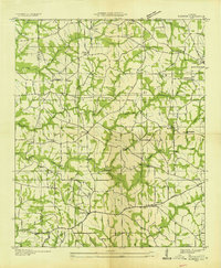
 1936 Jeff1936 Print · USGSMadison County rural life is captured in the mid-1930s, showing a landscape defined by ancestral lines and small-town centers. Trace family roots through Indian Creek Cem, St John Cem, and old schools like Little Indian Creek Sch.
Showing maps 1-25 of 155
Top cities of Alabama
- Huntsville historical maps
- Birmingham historical maps
- Montgomery historical maps
- Mobile historical maps
- Tuscaloosa historical maps
- Hoover historical maps
See more
Top counties of Alabama
- Jefferson County historical maps
- Mobile County historical maps
- Madison County historical maps
- Baldwin County historical maps
- Montgomery County historical maps
- Tuscaloosa County historical maps
See more
Frequently asked questions
- What are the different types of historical maps available for Alabama?
- What is the oldest map of Alabama?
- Where can I purchase historical maps of Alabama for my home or office?
- Where can I download high-res historical maps of Alabama?
- Are there historical topographic maps available for Alabama?
- Is there historical aerial imagery available for Alabama?
- Where are historical maps of Alabama sourced from?