1960s Maps of Alabama
Explore 242 historic maps of Alabama from the 1960s. These maps offer a rare glimpse into what life looked like during the 1960s — showing old roads, neighborhoods, homes, and landmarks that have changed or disappeared over time.
Whether you're researching your family's past, planning a metal detecting trip, or studying how Alabama's landscape evolved across the 1960s, these high-resolution maps are a powerful tool for exploring the history of this region.
- Focus on a specific era: All maps on this page are from the 1960s, giving you a focused view of this time period.
- See what’s changed: Compare century-old streets, trails, and buildings to today's modern landscape using overlays and satellite layers.
- Research with precision: Use these maps for genealogy, historical research, land use analysis, or educational projects.
- View, download, or print: Maps are fully viewable online in high resolution, and can be downloaded or printed for your own records.
Start exploring Alabama's history through authentic maps from the 1960s. This is your window into the past.
Alabama maps
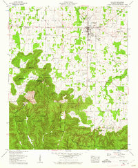
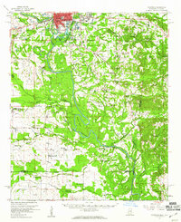
(242)- 1960 Map of Pensacola
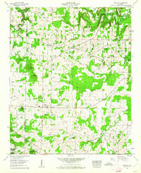
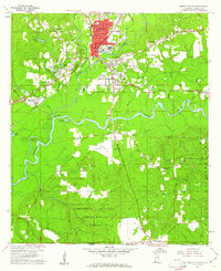
 1960 Pensacola1960 Print · USGSThe Florida Panhandle and Alabama's eastern shore are shown during a period of rapid military and coastal growth. Genealogists and historians can trace the mid-century footprints of Warrington, the Pensacola NAS (Chevalier), and the Blackwater River timber lands.
 - 1960 Map of Gadsden
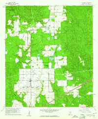
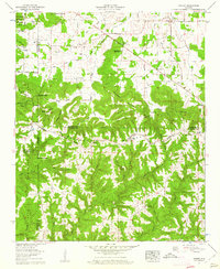
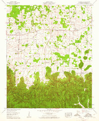
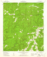
 1960 Gadsden1960 Print · USGSNorthern Alabama in the mid-1950s is defined by the mighty Tennessee River and its massive reservoirs. Trace the development of Huntsville and Redstone Arsenal or explore the vast William B Bankhead National Forest.2 unique versions available
 - 1960 Map of Mobile
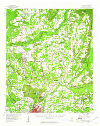
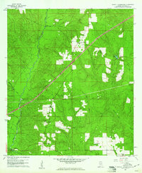
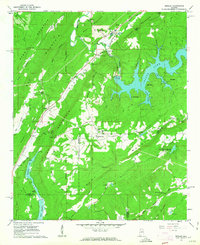
 1960 Mobile1960 Print · USGSThe Gulf Coast at the dawn of the sixties shows a landscape of busy ports, military airbases, and barrier islands. Trace the rail lines of the Louisville & Nashville through BILOXI and Pascagoula or find family history in towns like Bayou La Batre and Poplarville.
 - 1960 Map of Tallahassee
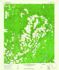
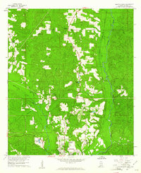
 1960 Tallahassee1960 Print · USGSThe Florida Panhandle and southern Georgia are captured here in the mid-twentieth century, showing a region defined by its rivers and military installations. Genealogists and historians can trace the growth of Tallahassee or locate coastal landmarks like the St Marks Lighthouse and Tyndall Air Force Base.
 - 1960 Map of Danville, 1961 Print
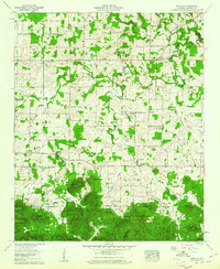
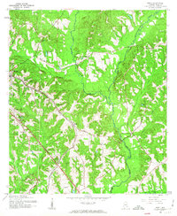
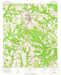
 1960 Danville1961 Print · USGSIn the early sixties, the border of Lawrence and Morgan Counties remained a landscape of timber and tobacco farms. Researchers can trace ancestral roots at Harmony Grove Cemetery or locate old landmarks like the Midway School and Danville Airport.3 unique versions available
 - 1960 Map of Bee Branch, 1961 Print
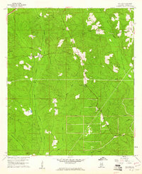
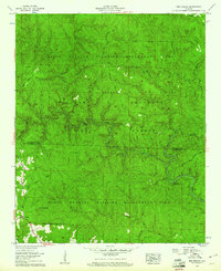 1960 Bee Branch1961 Print · USGSThe Lawrence and Winston county line runs through these deep forest drainages at the dawn of the 1960s. Researchers can trace family sites near Rabbittown, locate the Adkins Cem, and follow the winding Sipsey River past Wolfpen Cyn.4 unique versions available
 - 1960 Map of Grayson, 1961 Print
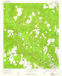
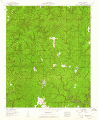 1960 Grayson1961 Print · USGSThe Bankhead National Forest in the early sixties is a landscape of high divides and remote timber management. Genealogists can trace family burial sites like McLemore Cem and Shiloh Cem or locate the settlement of Grayson.3 unique versions available
 - 1960 Map of Atmore, 1961 Print
 1960 Atmore1961 Print · USGSAtmore sits at a busy railroad junction on the Alabama-Florida line during a period of significant civic and agricultural growth. Researchers can trace the development of local neighborhoods and rural hubs like Canoe and Martinville, alongside landmarks such as Oak Hill Cemetery and the State Prison Farm.3 unique versions available
 - 1960 Map of Brewton South, 1961 Print
 1960 Brewton South1961 Print · USGSBrewton and East Brewton thrive at the meeting of the Conecuh River and Murder Creek during this mid-century period. Genealogists and historians can trace family ties at Fort Crawford Cem, visit Neal Sch, or locate old industries like the Sand and Gravel Pits.2 unique versions available
 - 1960 Map of Huxford, 1961 Print
 1960 Huxford1961 Print · USGSEscambia County's timber and rail landscape is captured here in the early sixties, showing the vital line of the St Louis - San Francisco Railroad. Genealogists can locate family landmarks like Sardis Ch, Miller Cem, and the massive Atmore State Prison Farm.4 unique versions available
 - 1960 Map of Caledonia, 1961 Print
 1960 Caledonia1961 Print · USGSThe Mississippi-Alabama borderlands in the early sixties reveal a landscape of growing military bases and traditional river commerce. Trace family roots through rural landmarks like Anderson Grove Sch, Waverly Ferry, and the rail lines serving Steens.2 unique versions available
 - 1960 Map of Pollard, 1961 Print
 1960 Pollard1961 Print · USGSThe Alabama-Florida borderlands come to life in the early 1960s, showing the intersection of the Conecuh River and the LOUISVILLE AND NASHVILLE railroad. Researchers can locate family landmarks like Hollywood Cem, McCall Sch, and the Catawba Springs Ch.3 unique versions available
 - 1960 Map of Massey, 1961 Print
 1960 Massey1961 Print · USGSNorthern Alabama hill country in the early sixties is shown here in detail as it transitions into the William B Bankhead National Forest. Genealogists can trace family names through landmarks like Penn Cem, Andrews Chapel, and the community of Battleground.4 unique versions available
 - 1960 Map of Moulton, 1961 Print
 1960 Moulton1961 Print · USGSMoulton and the surrounding valley floor are captured here in the early 1960s, just as the area balanced agricultural life with growing municipal services. Genealogists can trace family names through dozens of sites like Heflin Cem, Muck City, and Pleasant Ridge Ch.3 unique versions available
 - 1960 Map of Brewton North, 1961 Print
 1960 Brewton North1961 Print · USGSThe area around Brewton in the early sixties was a landscape of creek-side settlements and growing educational institutions along the rail line. Researchers can trace the footprints of the Southern Normal Sch, Appleton, and rural landmarks like Zion Hill Cem.3 unique versions available
 - 1960 Map of Barnett Crossroads, 1961 Print
 1960 Barnett Crossroads1961 Print · USGSEscambia County's rural landscape is captured here in the early sixties, showing the crossroads communities and creek bottoms of south Alabama. Genealogists can trace family names at Magnolia Cem, New Bethlehem Ch, and the Maschmeyer Lookout Tower.3 unique versions available
 - 1960 Map of Oakville, 1961 Print
 1960 Oakville1961 Print · USGSLawrence County farming life and protected timberlands meet in the 1960s at the edge of the William B Bankhead National Forest. Genealogists can trace family names at Aldridge Grove or locate the Indian mound near Oakville.3 unique versions available
 - 1960 Map of Landersville, 1961 Print
 1960 Landersville1961 Print · USGSLawrence County during the early 1960s was a landscape of fertile valleys and wooded ridges where the Moulton Valley meets the Bankhead National Forest. Genealogists and historians can trace the community life of settlements like Landersville through local landmarks such as Old Town Creek Ch and the Mt Hope Sch.3 unique versions available
 - 1960 Map of Wallace, 1961 Print
 1960 Wallace1961 Print · USGSNorth of the Florida line in the early 1960s, this area of Escambia County centers on the Louisville and Nashville rail corridor. Genealogists and historians can trace family-named sites like Hanberry Cem, Appleton, and Pleasant Hill Ch.3 unique versions available
 - 1960 Map of Flomaton, 1961 Print
 1960 Flomaton1961 Print · USGSThe Alabama-Florida borderlands near the turn of the 1960s were shaped by the Escambia River and the vital rail junctions at Flomaton. Researchers can trace rural genealogy and industry through sites like Moyeville, Hammac Cem, and the extensive Old Railroad Grade.2 unique versions available
 - 1960 Map of Upshaw, 1961 Print
 1960 Upshaw1961 Print · USGSNorth Alabama forest lands meet the Tennessee Valley in the early sixties. Genealogists and researchers can locate rural landmarks like Upshaw, the Basham Lookout Tower, and Penn Sch among the wooded hills.3 unique versions available
 - 1960 Map of Columbus, 1961 Print
 1960 Columbus1961 Print · USGSThe Tombigbee River valley at the start of the 1960s shows a landscape of river-bend farms and rural communities centered around family churches and schools. Researchers can trace historic river crossings like the Nashville Ferry or locate ancestral sites at St Mathis Cem and Plum Grove Sch.2 unique versions available
 - 1960 Map of Remlap, 1963 Print
 1960 Remlap1963 Print · USGSCentral Alabama's ridges and valleys are meticulously detailed in the early 1960s, showing the intersection of rural life and early industrial expansion. Trace family history at Pleasant Mount Ch or explore the geography of Remlap and Inland Reservoir.6 unique versions available
 - 1960 Map of Ewell, 1963 Print
 1960 Ewell1963 Print · USGSThe Dale County countryside outside Ozark was undergoing significant postwar development in the early sixties. Researchers can trace the path of the Atlantic Coast Line through rural Ewell or find family landmarks like Chalk Head Ch and Johnsons Pond.2 unique versions available
 - 1960 Map of Brundidge, 1963 Print
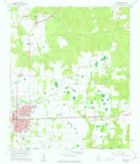
 1960 Brundidge1963 Print · USGSBrundidge and its surrounding rural landscapes are captured here during a period of steady growth and transition in the early sixties. Genealogists and local historians can trace family locations near landmarks like County High Sch, Hamilton Crossroads, and rural pulpits such as New Zion Ch.2 unique versions available
Showing maps 1-25 of 242
Top cities of Alabama
- Huntsville historical maps
- Birmingham historical maps
- Montgomery historical maps
- Mobile historical maps
- Tuscaloosa historical maps
- Hoover historical maps
See more
Top counties of Alabama
- Jefferson County historical maps
- Mobile County historical maps
- Madison County historical maps
- Baldwin County historical maps
- Montgomery County historical maps
- Tuscaloosa County historical maps
See more
Frequently asked questions
- What are the different types of historical maps available for Alabama?
- What is the oldest map of Alabama?
- Where can I purchase historical maps of Alabama for my home or office?
- Where can I download high-res historical maps of Alabama?
- Are there historical topographic maps available for Alabama?
- Is there historical aerial imagery available for Alabama?
- Where are historical maps of Alabama sourced from?