1970s Maps of Alabama
Explore 451 historic maps of Alabama from the 1970s. These maps offer a rare glimpse into what life looked like during the 1970s — showing old roads, neighborhoods, homes, and landmarks that have changed or disappeared over time.
Whether you're researching your family's past, planning a metal detecting trip, or studying how Alabama's landscape evolved across the 1970s, these high-resolution maps are a powerful tool for exploring the history of this region.
- Focus on a specific era: All maps on this page are from the 1970s, giving you a focused view of this time period.
- See what’s changed: Compare century-old streets, trails, and buildings to today's modern landscape using overlays and satellite layers.
- Research with precision: Use these maps for genealogy, historical research, land use analysis, or educational projects.
- View, download, or print: Maps are fully viewable online in high resolution, and can be downloaded or printed for your own records.
Start exploring Alabama's history through authentic maps from the 1970s. This is your window into the past.
Alabama maps
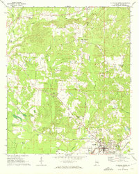
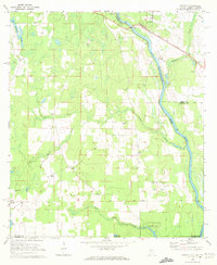
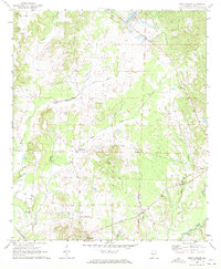
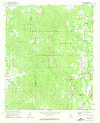
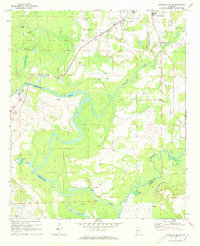
(451)- 1970 Map of Lillian, 1971 Print
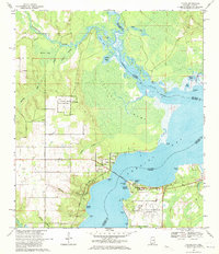 1970 Lillian1971 Print · USGSThe Alabama-Florida state line comes alive in the early seventies, showcasing a coastal landscape defined by naval aviation and deep-rooted heritage. Genealogists and historians can trace Lillian landmarks like St Josephs Ch and the Old Spanish Cem or locate the sprawling Bronson Field.4 unique versions available
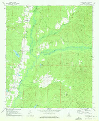
 - 1970 Map of Perdido Bay, 1971 Print
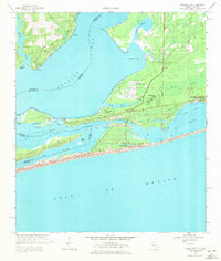 1970 Perdido Bay1971 Print · USGSPerdido Bay and the surrounding coastal reaches of Florida and Alabama are shown here during the early seventies. Researchers can trace the development of beachside communities like Seaglades and Gulf Beach or locate early marinas such as Holiday Harbor Marina.4 unique versions available
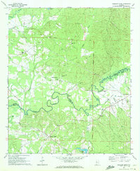
 - 1970 Map of Kirk, 1972 Print
 1970 Kirk1972 Print · USGSPickens County hill country and the Sipsey River bottomlands appear here as they were in the early 1970s, before modern changes. Genealogists and historians can trace the Old Railroad Grade and find rural sites like Speeds Water Mill, Souls Chapel, and Piney Grove Cem.2 unique versions available
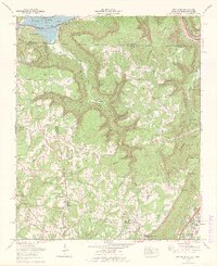
 - 1970 Map of Gordon, 1972 Print
 1970 Gordon1972 Print · USGSIn the early 1970s, the river border between Alabama and Georgia balanced traditional river landings with emerging industrial infrastructure. Researchers can trace family roots through sites like St Pauls Ch and Carver Sch, or locate the Seaboard Coast Line rail corridor.3 unique versions available
 - 1970 Map of Aliceville North, 1972 Print
 1970 Aliceville North1972 Print · USGSThe town of Aliceville and its rural surroundings in Pickens County are documented here during the early 1970s. Local researchers can locate family-named landmarks and institutions like Kirksey High Sch, Franconia Cem, and the Pilgrim Rest Ch.2 unique versions available
 - 1970 Map of Columbia NE, 1972 Print
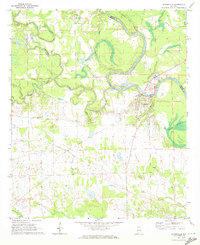
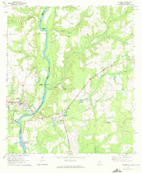
 1970 Columbia NE1972 Print · USGSThe Chattahoochee River forms the border between Alabama and Georgia in this early 1970s view of the rural river valley. Researchers can trace historic river access at Gilbert Landing or locate local family landmarks like Bellevue Cem Ch and Haleburg.
 - 1970 Map of Haleburg, 1972 Print
 1970 Haleburg1972 Print · USGSEastern Henry County in the early seventies remained a landscape of quiet rural hamlets and creek-side settlements. Genealogists and local historians can locate many family landmarks, from Hardwickburg and Balkum to country churches like Piney Grove Ch and Balkum Chapel.2 unique versions available
 - 1970 Map of Romulus, 1972 Print
 1970 Romulus1972 Print · USGSThe Sipsey River bottomlands in the early seventies reveal a rural landscape where Pickens, Greene, and Tuscaloosa Counties meet. Genealogists can trace family footprints at Pate Cem, Jena, and the crossroads of Romulus.2 unique versions available
 - 1970 Map of Mantua, 1972 Print
 1970 Mantua1972 Print · USGSGreene and Pickens counties are shown here as they appeared in the early seventies, centered on the Sipsey River. Genealogists can trace family roots through local landmarks like Mantua, Benevola, and several rural churches including Mt Zion Ch.2 unique versions available
 - 1970 Map of Saffold, 1972 Print
 1970 Saffold1972 Print · USGSThe tri-state border of Alabama, Georgia, and Florida comes alive in the early seventies as a landscape of riverine swamps and rural hamlets. Genealogists can locate family landmarks like Pilgrims Rest Ch or trace the old rail stops at Alaga and Saffold.2 unique versions available
 - 1970 Map of Cunningham, 1972 Print
 1970 Cunningham1972 Print · USGSPickens County comes into focus in the early seventies, centered on the Alabama and Northern rail line and the wetlands of Lubbub Creek. Genealogists and historians can locate old landmarks like Mt Sinai Ch, Dillburg, and the Drive-in Theater.2 unique versions available
 - 1970 Map of Pleasant Ridge, 1972 Print
 1970 Pleasant Ridge1972 Print · USGSPickens and Greene Counties remained deeply rooted in their rural traditions during the 1970s, as small settlements and family churches dotted the Sipsey River basin. Genealogists and historians can trace old homesteads and landmarks like Wilder Quarters, Richardson Bridge, and the Old Railroad Grade.2 unique versions available
 - 1970 Map of New Home, 1972 Print
 1970 New Home1972 Print · USGSThe tri-state border of Georgia, Alabama, and Tennessee comes alive in the early seventies as the Tennessee River valley meets the coal-rich ridges. Genealogists and historians can trace family roots at Reeves Cem or Stephens Cem, and locate landmarks like Nickajack Cave and Cole City.2 unique versions available
 - 1970 Map of West Greene, 1972 Print
 1970 West Greene1972 Print · USGSGreene County, Alabama, is shown here in the early 1970s as a landscape of small rural settlements and historic rail corridors. Genealogists can trace family names and community centers via the Brickyard Cem, St Johns Ch, and the Old Railroad Grade.
 - 1970 Map of Sigma, 1972 Print
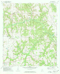 1970 Sigma1972 Print · USGSHouston and Henry County during the early seventies show a landscape of rural crossroads and family settlements. Genealogists can trace local heritage through the Old Pleasant Plains Cem, Sardis Ch, and the Central of Georgia rail line.
 - 1970 Map of Boligee, 1972 Print
 1970 Boligee1972 Print · USGSGreene County near the river during the early seventies shows a landscape of small settlements and rail corridors. Genealogists can trace family landmarks like Lizzieville, the County Training School, and Boatright Cem near the Tombigbee River.3 unique versions available
 - 1970 Map of Gainesville, 1972 Print
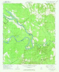
 1970 Gainesville1972 Print · USGSGainesville and the surrounding riverlands of Sumter and Greene Counties are captured here in the early seventies as the Tombigbee continues its slow meander through the deep south. Genealogists and historians can trace community roots through numerous country churches like New Bethel Ch or locate the Old Cem and Old Railroad Grade near the river.2 unique versions available
 - 1970 Map of Ralph, 1972 Print
 1970 Ralph1972 Print · USGSThe borderlands of Greene and Tuscaloosa Counties are mapped here in the early seventies as new infrastructure began to reach these rural communities. Genealogists and local historians can locate several family-centric landmarks, from Wesley Chapel and Mt Carmel Ch to the Old Shiloh Cem.2 unique versions available
 - 1970 Map of Columbia, 1972 Print
 1970 Columbia1972 Print · USGSThe Chattahoochee River corridor at the start of the 1970s shows a landscape of river-based industry and rural community life. Genealogists and historians can locate family landmarks like Grier Cem, Freeman Chapel, and the George W Andrews Lock and Dam.2 unique versions available
 - 1970 Map of West Pensacola, 1972 Print
 1970 West Pensacola1972 Print · USGSCoastal Florida is shown in the era of naval expansion and suburban growth between Perdido and Pensacola Bays. Genealogists and researchers can trace family landmarks like Spring Hill Ch, old schools such as Myrtle Grove Sch, and the grounds of Saufley Field.2 unique versions available
 - 1970 Map of Grangeburg, 1972 Print
 1970 Grangeburg1972 Print · USGSThe Alabama-Florida state line comes alive in the early seventies, showing a rural landscape of creek-side settlements and crossroads. Genealogists and local historians can trace family ties through Bazemores Mill Lake, Harmon Sch, and Williams Chapel.2 unique versions available
 - 1970 Map of Aliceville South, 1973 Print
 1970 Aliceville South1973 Print · USGSPickens County at the start of the 1970s is shown as a fertile riverine landscape where the St. Louis-San Francisco railroad met the Tombigbee River. Researchers can locate old community hubs like Cochrane and Vienna, alongside family-named landmarks such as McCaa Cem and Trantham Cem.3 unique versions available
 - 1970 Map of Delta, 1973 Print
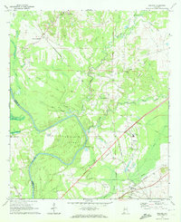
 1970 Delta1973 Print · USGSThe upland forests and creek valleys of rural Clay County are captured here in the early 1970s. Genealogists can trace family landmarks like Ragan Chapel Cem and Pleasant Hill Cem near the settlements of Delta and Needmore.2 unique versions available
 - 1970 Map of Englewood, 1973 Print
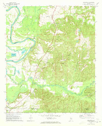 1970 Englewood1973 Print · USGSThe Black Warrior River valley and the Talladega National Forest meet in this 1970s survey of the Alabama borderlands. Researchers can trace rural lineages through numerous country churches like Zion Hope Ch or locate the ancient mounds at Mound State Mon.4 unique versions available
 - 1970 Map of Myrtlewood North, 1973 Print
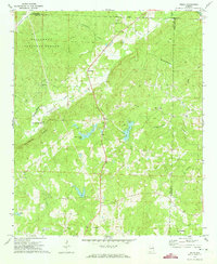
 1970 Myrtlewood North1973 Print · USGSMarengo County and its neighbors meet along the winding river bends of the Tombigbee in the late sixties. Genealogists and local historians can trace family locations near Myrtlewood, Hill Top, and country churches like New Macedonia Ch.
Showing maps 1-25 of 451
Top cities of Alabama
- Huntsville historical maps
- Birmingham historical maps
- Montgomery historical maps
- Mobile historical maps
- Tuscaloosa historical maps
- Hoover historical maps
See more
Top counties of Alabama
- Jefferson County historical maps
- Mobile County historical maps
- Madison County historical maps
- Baldwin County historical maps
- Montgomery County historical maps
- Tuscaloosa County historical maps
See more
Frequently asked questions
- What are the different types of historical maps available for Alabama?
- What is the oldest map of Alabama?
- Where can I purchase historical maps of Alabama for my home or office?
- Where can I download high-res historical maps of Alabama?
- Are there historical topographic maps available for Alabama?
- Is there historical aerial imagery available for Alabama?
- Where are historical maps of Alabama sourced from?