1980s Maps of Alabama
Explore 220 historic maps of Alabama from the 1980s. These maps offer a rare glimpse into what life looked like during the 1980s — showing old roads, neighborhoods, homes, and landmarks that have changed or disappeared over time.
Whether you're researching your family's past, planning a metal detecting trip, or studying how Alabama's landscape evolved across the 1980s, these high-resolution maps are a powerful tool for exploring the history of this region.
- Focus on a specific era: All maps on this page are from the 1980s, giving you a focused view of this time period.
- See what’s changed: Compare century-old streets, trails, and buildings to today's modern landscape using overlays and satellite layers.
- Research with precision: Use these maps for genealogy, historical research, land use analysis, or educational projects.
- View, download, or print: Maps are fully viewable online in high resolution, and can be downloaded or printed for your own records.
Start exploring Alabama's history through authentic maps from the 1980s. This is your window into the past.
Alabama maps
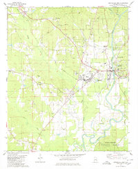
(220)- 1980 Map of Bay Minette North
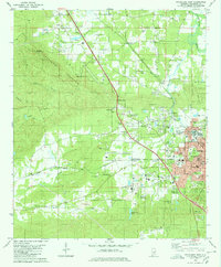
 1980 Bay Minette North1980 Print · USGSBay Minette and Stockton are captured during a period of steady growth in 1980, centered around the Louisville and Nashville rail line. Genealogists can locate family landmarks like Stockton Memorial Cem and Greater St John Ch.
 - 1980 Map of Union
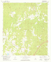 1980 Union1980 Print · USGSGreene County, Alabama, is shown in the late 1970s as a landscape of small rural settlements and family landmarks. Researchers can locate dozens of country churches and burial sites like Birdine Hill Ch, Eatman Sch, and Spencer Cem among the winding bends of Trussells Creek.
 - 1980 Map of Casemore
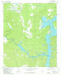
 1980 Casemore1980 Print · USGSHale County's fertile Black Belt region is captured here in the 1980s, defined by the winding Black Warrior River and a dense network of rural communities. Researchers can trace local heritage through numerous landmarks like St Andrews Ch, Lock 5, and the old settlement of Prairieville.4 unique versions available
 - 1980 Map of Alabaster
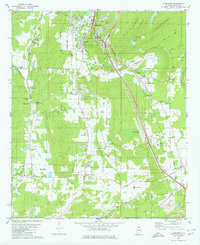 1980 Alabaster1980 Print · USGSShelby County at the start of the 1980s reveals a landscape of limestone mining and growing rural settlements along the rail lines. Researchers can trace family sites like Benton Cem, small communities at Elliotsville, and the Flying X Ranch Landing Strip.3 unique versions available
 - 1980 Map of Magnolia Springs
 1980 Magnolia Springs1980 Print · USGSCoastal Baldwin County is captured here in the late seventies, showing the tidal reach of Weeks Bay and the riverfront community of Magnolia Springs. Genealogists can locate family landmarks like Brook Cedron Cem, Clay City, and the Fish River Ch.3 unique versions available
 - 1980 Map of Payne Lake
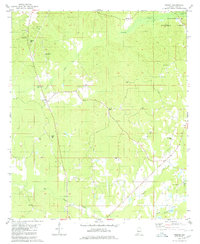
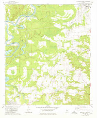
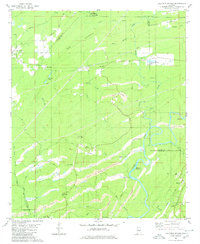
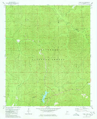 1980 Payne Lake1980 Print · USGSDeep in the Alabama woodlands during the 1980s, this area showcases the intersection of forest management and public recreation. Trace local history at Pine Flat Ch, the Old Railroad Grade, and the shores of Payne Lake.2 unique versions available
 - 1980 Map of Orange Beach
 1980 Orange Beach1980 Print · USGSCoastal Alabama was entering a new era of development in the late seventies, centered on the waterways of Baldwin County. Local historians can trace the early layouts of Orange Beach, the residential expansion on Ono Island, and landmarks like Lay Cem or the U S Naval Res Wolf Field.2 unique versions available
 - 1980 Map of Mc Calla
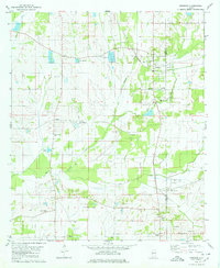
 1980 Mc Calla1980 Print · USGSThe industrial corridor southwest of Birmingham appears in the 1980s as a complex landscape of coal mining and ridge-and-valley settlements. Genealogists and local historians can trace family roots through McCalla, North Johns, and several landmarks like Ligon Cem and the McAdory High Sch.2 unique versions available
 - 1980 Map of Centreville East
 1980 Centreville East1980 Print · USGSBibb County at the end of the 1970s shows the growth of Centreville alongside the quiet reaches of the Talladega National Forest. Genealogists and local historians can locate the Cahaba Academy, ancestral burial grounds like Crockett McKinney Cem, and old rail stops on the Illinois Central Gulf.2 unique versions available
 - 1980 Map of Sylacauga West
 1980 Sylacauga West1980 Print · USGSThe marble industrial corridor west of Sylacauga comes alive in the late 1970s, showing a landscape shaped by stone quarries and rail lines. Genealogists and local historians can trace family-named landmarks like Allen Cem, St Andrews Ch, and the high ridges of Kahatchee Mountain.
 - 1980 Map of Shelby
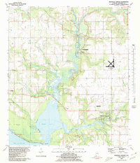
 1980 Shelby1980 Print · USGSShelby and the surrounding lakefront are captured here in the early eighties as the town and the Coosa River landscape evolved. Local researchers can trace family landmarks like Brasher Cem and Bay Spring Ch or the winding path of Waxahatchee Creek.2 unique versions available
 - 1980 Map of Ingram
 1980 Ingram1980 Print · USGSHale County's rural communities are meticulously documented in the late 1970s, showcasing a landscape of timber stands and historic congregations. Researchers can trace family roots at Puritt Spring Ch Cem, Holley Cem, and Rameys Chapel.2 unique versions available
 - 1980 Map of Newbern
 1980 Newbern1980 Print · USGSHale County, Alabama, is captured here in the mid-seventies, showing a landscape shaped by the SOUTHERN railroad and the waters of Big Prairie Creek. Genealogists can trace local roots through landmarks like Hatch Cem, Sunshine Sch, and Mars Hill Ch.
 - 1980 Map of St. Andrews Bay
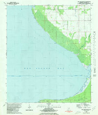
 1980 St. Andrews Bay1980 Print · USGSThe Alabama coastline along the Fort Morgan peninsula is captured here in the late 1970s, showcasing the thin strip of land between Mobile Bay and the Gulf. Genealogists and local historians can locate early coastal settlements like Weeks and Edith.
 - 1980 Map of Bon Secour Bay
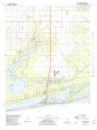
 1980 Bon Secour Bay1980 Print · USGSCoastal Baldwin County is captured here in the late seventies, showing the vital maritime corridor where the Intracoastal Waterway meets the bay. Genealogists and local historians can locate Gasque, Shellbank Ch, and Miller Memorial Cem along the southern shore.2 unique versions available
 - 1980 Map of Little Point Clear
 1980 Little Point Clear1980 Print · USGSThe Alabama Gulf Coast's maritime character is preserved here during the early 1980s, focusing on the waters where the bay meets the sound. Trace the path of the Intracoastal Waterway past Little Point Clear and the shallow Tidal Flat of Saxon Bay.
 - 1980 Map of Gulf Shores
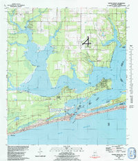
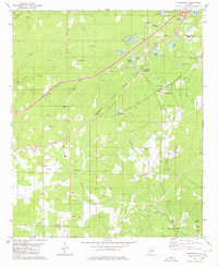
 1980 Gulf Shores1980 Print · USGSGulf Shores and the Baldwin County coast are captured here in 1980, showcasing a landscape of maritime industry and early tourism. Trace the development of the Intracoastal Waterway and locate local landmarks like Swift Sch and Jack Edwards Airport.2 unique versions available
 - 1980 Map of Moundville West
 1980 Moundville West1980 Print · USGSThe Black Warrior River and Southern Railway define this Hale County landscape during the late twentieth century. Genealogists can trace family names at Taylor Chapel, Havana Cem, and small settlements like Powers and Guinea.
 - 1980 Map of Sawyerville
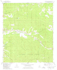
 1980 Sawyerville1980 Print · USGSHale County settlement and transport patterns are captured here in the 1970s, from the rail hub of Akron to the rural roads of Sawyerville. Genealogists can trace family landmarks like Mays Cem, Hill Zion Ch, and several scattered Gravel Pits along Big Brush Creek.
 - 1980 Map of Abernant
 1980 Abernant1980 Print · USGSThe coal-mining and lakeside communities of Tuscaloosa County are shown here in the mid-1970s. Trace the industrial landscape of the Shannon Mine and Yolande alongside the developing Million Dollar Lake Estates.
 - 1980 Map of Centreville West
 1980 Centreville West1980 Print · USGSBibb County, Alabama, is shown in the late 1970s as the rail and river corridors continued to shape the local landscape. Researchers can trace family history through sites like Weldon Cem, Mt Tabor Ch, and the outlying settlement of Harrisburg.2 unique versions available
 - 1980 Map of Halfmile Shoals
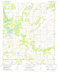
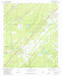
 1980 Halfmile Shoals1980 Print · USGSThe Cahaba River corridor in the early eighties reveals a landscape shaped by coal mining and rural heritage at the junction of four counties. Researchers can trace historic settlements like Belle Ellen and Marvel, or locate landmarks such as McKensey Cem and Tannehill State Park.2 unique versions available
 - 1980 Map of Woodstock
 1980 Woodstock1980 Print · USGSThe Bibb and Tuscaloosa county line in the late seventies is a landscape defined by heavy rail transit and deep-rooted rural communities. Genealogists and historians can trace family sites like Shuttlesworth Cem, Union Cumberland Ch, and the old Old Grade roadbed.2 unique versions available
 - 1980 Map of Columbiana
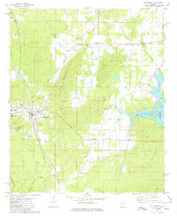 1980 Columbiana1980 Print · USGSShelby County’s seat and its surrounding rural crossroads are frozen in time during the late twentieth century. Genealogists and local researchers can trace family lines through Pine Lawn Gardens, Bethel Ch, and the old settlement at Nelson.
 - 1980 Map of Oakmulgee
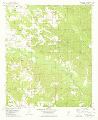
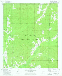 1980 Oakmulgee1980 Print · USGSThe Talladega National Forest in the early 1980s reveals a secluded landscape of timber and creeks along the Perry County line. Local historians can trace family locations near Bethlehem Cemetery, Oakmulgee, and several country churches like Mt Olive Ch.2 unique versions available
Showing maps 1-25 of 220
Top cities of Alabama
- Huntsville historical maps
- Birmingham historical maps
- Montgomery historical maps
- Mobile historical maps
- Tuscaloosa historical maps
- Hoover historical maps
See more
Top counties of Alabama
- Jefferson County historical maps
- Mobile County historical maps
- Madison County historical maps
- Baldwin County historical maps
- Montgomery County historical maps
- Tuscaloosa County historical maps
See more
Frequently asked questions
- What are the different types of historical maps available for Alabama?
- What is the oldest map of Alabama?
- Where can I purchase historical maps of Alabama for my home or office?
- Where can I download high-res historical maps of Alabama?
- Are there historical topographic maps available for Alabama?
- Is there historical aerial imagery available for Alabama?
- Where are historical maps of Alabama sourced from?