1990s Maps of Alabama
Explore 31 historic maps of Alabama from the 1990s. These maps offer a rare glimpse into what life looked like during the 1990s — showing old roads, neighborhoods, homes, and landmarks that have changed or disappeared over time.
Whether you're researching your family's past, planning a metal detecting trip, or studying how Alabama's landscape evolved across the 1990s, these high-resolution maps are a powerful tool for exploring the history of this region.
- Focus on a specific era: All maps on this page are from the 1990s, giving you a focused view of this time period.
- See what’s changed: Compare century-old streets, trails, and buildings to today's modern landscape using overlays and satellite layers.
- Research with precision: Use these maps for genealogy, historical research, land use analysis, or educational projects.
- View, download, or print: Maps are fully viewable online in high resolution, and can be downloaded or printed for your own records.
Start exploring Alabama's history through authentic maps from the 1990s. This is your window into the past.
Alabama maps
(31)- 1990 Map of Demopolis
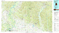 1990 Demopolis1990 Print · USGSWest-central Alabama's river corridors and educational centers are mapped here in the late twentieth century. Genealogists and local historians can trace old family sites near Oak Grove Ch, the historic Marion Military Institute, or the landings at Finchal Ferry.
 - 1993 Map of Adamsville, 1998 Print
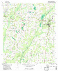
 1993 Adamsville1998 Print · USGSJefferson County's industrial and residential corridors are captured here in the 1990s, revealing the lasting footprint of the area's rail and mining history. Genealogists and historians can trace family roots through landmarks like Mulga Mine, Crumley Chapel, and the Union Grove Cem.
 - 1994 Map of Perdido Bay
 1994 Perdido Bay1994 Print · USGSCoastal Florida and Alabama meet at Perdido Bay in the mid-nineties, showing a landscape of growing beach communities and protected seashores. Trace local landmarks like the Holiday Harbor Marina, the residential blocks of Gulf Beach, and the wild expanses of Rabbit Island.
 - 1994 Map of Mobile
 1994 Mobile1994 Print · USGSMobile and its sprawling bay are captured in the mid-nineties as the industrial port and coastal wilderness found a modern balance. Genealogists and historians can trace rail lines like the Illinois Central Gulf RR and find landmarks such as Bonnie Chapel and Hollingers Island.
 - 1994 Map of Corinth
 1994 Corinth1994 Print · USGSNortheast Mississippi and the Tennessee borderlands are captured in the mid-1990s as the region's modern industrial and recreational landscape took shape. Genealogists and historians can trace rail-to-river connections through Corinth, the old courthouse at Jacinto, and the route of the Natchez Trace Parkway.
 - 1994 Map of Dyas, 1998 Print
 1994 Dyas1998 Print · USGSBaldwin County at the Florida border in the mid-1990s shows a landscape of creek-side settlements and rural crossroads. Genealogists and local historians can trace the Old Pensacola Road or locate the Cain Cem and Horseneck Ch.
 - 1994 Map of Izagora, 1998 Print
 1994 Izagora1998 Print · USGSThe Alabama-Florida state line comes alive in the late twentieth century as it crosses the winding Choctawhatchee River. Genealogists and local historians can trace legacy sites like Curry Ferry, Smith Crossroads, and the Cedar Grove Ch.
 - 1994 Map of Orange Beach, 1998 Print
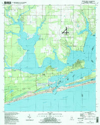 1994 Orange Beach1998 Print · USGSThe Alabama coast in the mid-nineties shows the intricate meeting of bayou and beach before modern development peaked. Researchers can trace the legacy of coastal settlements like Josephine, locate the Lay Cem, and explore the 1994 layout of Gulf State Park.
 - 1994 Map of Gateswood, 1998 Print
 1994 Gateswood1998 Print · USGSBaldwin County's river-cut timberlands are documented here in the mid-nineties, showing the rural communities near the Florida border. Trace local history at Gateswood or locate family sites like Hamilton Cem and the Bellefontaine Sch.
 - 1994 Map of Graceville, 1998 Print
 1994 Graceville1998 Print · USGSGraceville and the Alabama state line are captured in the late twentieth century, showing a rural landscape defined by rail crossings and cypress bays. Genealogists can locate family landmarks like Murphy Hill, Collins Mill, and country churches such as Damascus Ch.
 - 1994 Map of Fidelis, 1998 Print
 1994 Fidelis1998 Print · USGSThe Florida-Alabama state line and the western reaches of the state forest define this landscape in the mid-1990s. Genealogists can locate several rural landmarks including Old Fidelis Cem, Golden Memorial Ch, and the settlement of Berrydale.
 - 1994 Map of Dogwood Creek, 1998 Print
 1994 Dogwood Creek1998 Print · USGSCoastal Alabama's timberlands and river bottoms are captured here in the mid-1990s just as the landscape remained deeply rural. Genealogists and historians can trace family locations near Pine Grove, High Pine Cem, and the historic Wiggins Still.2 unique versions available
 - 1994 Map of Enon, 1998 Print
 1994 Enon1998 Print · USGSThe Florida-Alabama border along the Perdido River is captured here in the mid-1990s. Trace the rural landscape near Enon to find local landmarks like Holly Grove Cem and the La Floresta Perdida Airport.2 unique versions available
 - 1994 Map of Sills, 1998 Print
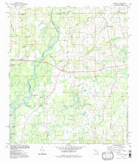
 1994 Sills1998 Print · USGSJackson County and the Alabama borderlands are captured here in the 1990s, showing a landscape defined by the Chipola River. Researchers can trace rural lineages through local landmarks like Holyneck Ch, Moulten Cem, and the historic settlement at Sills.
 - 1994 Map of Lillian, 1999 Print
 1994 Lillian1999 Print · USGSThe Alabama-Florida border comes alive in the mid-nineties as the Perdido River flows into the bay near Lillian. Researchers can trace local heritage at the Old Spanish Cem or explore the military footprint of Pensacola NAS OLF Bronson.
 - 1994 Map of Barrineau Park, 1999 Print
 1994 Barrineau Park1999 Print · USGSThe Florida-Alabama borderlands along the Perdido River remained a landscape of rural churches and creek-side settlements in the mid-nineties. Genealogists can trace family landmarks like St Elizabeth Ch, Tenile, and the Barrineau Park Sch.2 unique versions available
 - 1994 Map of West Pensacola, 1999 Print
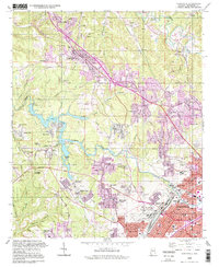
 1994 West Pensacola1999 Print · USGSWestern Escambia County comes into focus in the mid-1990s, showing the deep integration of military bases and suburban development. Genealogists and historians can trace the growth of Myrtle Grove and Warrington near Saufley Field and the shore of Perdido Bay.
 - 1997 Map of Clopton
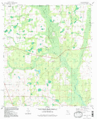
 1997 Clopton1997 Print · USGSSoutheast Alabama at the close of the twentieth century reveals a landscape of river-fed hamlets and rural schoolhouses. Researchers can map family roots near Lawrenceville and Clopton, or trace the legacy of sites like the County Training School and Murphy Station.
 - 1997 Map of Hurricane, 2000 Print
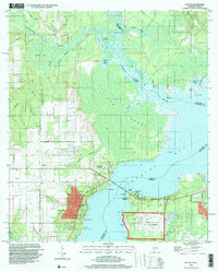
 1997 Hurricane2000 Print · USGSThe Mobile-Tensaw Delta is captured here as the millennium approached, showing a complex waterscape of bayous and historic landings. Researchers can trace the Civil War Trenches near Magnolia Ch or locate old sites like Sizemore Landing and Blakely Sch.
 - 1997 Map of Helena, 2001 Print
 1997 Helena2001 Print · USGSThe Shelby County hills in the late nineties show a landscape of rapid growth along the Cababa River corridor. Researchers can trace the development of Helena and Pelham alongside local landmarks like Mars Hill Ch and the Scottrock Quarry.
 - 1997 Map of Birmingham North, 2001 Print
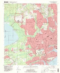
 1997 Birmingham North2001 Print · USGSBirmingham and its northern industrial suburbs are captured here in the late nineties, showcasing a dense network of rail yards and neighborhoods. Researchers can trace historic sites like Rickwood Field, Oak Hill Cemetery, and the campus of Birmingham Southern College.
 - 1997 Map of Paint Rock, 2001 Print
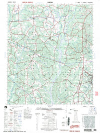
 1997 Paint Rock2001 Print · USGSThe Paint Rock River valley in the late twentieth century remains a landscape of deep hollows and family-named ridges. Genealogists can trace rural roots through a dozen local burial grounds including Rousseau Cem and the historic Conyers-Rosenwald School.
 - 1997 Map of Birmingham South, 2001 Print
 1997 Birmingham South2001 Print · USGSBirmingham's southern suburbs were expanding rapidly toward the Cahaba River during the late nineties. Genealogists and local historians can trace legacy landmarks like Elmwood Cemetery, the Spaulding Mine, and old neighborhood schools like Hemphill Sch.
 - 1998 Map of Hodges, 2000 Print
 1998 Hodges2000 Print · USGSThe rural borderlands of Franklin and Marion counties are captured here in the late twentieth century, centered on the railroad town of Hodges. Researchers can trace family history through sites like Old Lion Cemetery, Mt Zion Church, and the Illinois Central Railroad line.
 - 1998 Map of Irondale, 2001 Print
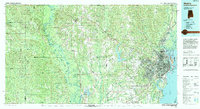
 1998 Irondale2001 Print · USGSThe eastern Birmingham suburbs and the Irondale corridor are shown here in the late nineties as industrial landscapes began to meet sprawling residential growth. Genealogists and local historians can trace family plots in Forest Hill Cemetery or locate landmarks like the Alabama Industrial School for Boys and Gate City.
Showing maps 1-25 of 31
Top cities of Alabama
- Huntsville historical maps
- Birmingham historical maps
- Montgomery historical maps
- Mobile historical maps
- Tuscaloosa historical maps
- Hoover historical maps
See more
Top counties of Alabama
- Jefferson County historical maps
- Mobile County historical maps
- Madison County historical maps
- Baldwin County historical maps
- Montgomery County historical maps
- Tuscaloosa County historical maps
See more
Frequently asked questions
- What are the different types of historical maps available for Alabama?
- What is the oldest map of Alabama?
- Where can I purchase historical maps of Alabama for my home or office?
- Where can I download high-res historical maps of Alabama?
- Are there historical topographic maps available for Alabama?
- Is there historical aerial imagery available for Alabama?
- Where are historical maps of Alabama sourced from?