1940s Maps of Pinal County, Arizona
Explore 42 historic maps of Pinal County from the 1940s. These maps offer a rare glimpse into what life looked like during the 1940s — showing old roads, neighborhoods, homes, and landmarks that have changed or disappeared over time.
Whether you're researching your family's past, planning a metal detecting trip, or studying how Pinal County's landscape evolved across the 1940s, these high-resolution maps are a powerful tool for exploring the history of this region.
- Focus on a specific era: All maps on this page are from the 1940s, giving you a focused view of this time period.
- See what’s changed: Compare century-old streets, trails, and buildings to today's modern landscape using overlays and satellite layers.
- Research with precision: Use these maps for genealogy, historical research, land use analysis, or educational projects.
- View, download, or print: Maps are fully viewable online in high resolution, and can be downloaded or printed for your own records.
Start exploring Pinal County's history through authentic maps from the 1940s. This is your window into the past.
Pinal County, AZ maps
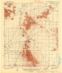
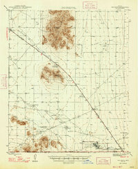
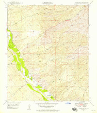
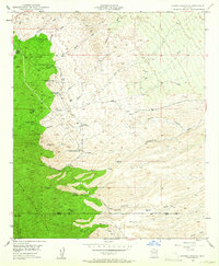
(42)- 1941 Map of Vekol Mountains
 1941 Vekol Mountains1941 Print · USGSMining activity and tribal settlements characterize this desert region in the late 1930s. Genealogists and historians can trace indigenous communities at Sif Vaya and Kohatk alongside early mineral prospects like the Vekol Mine and Reward Mine.
 - 1942 Map of Silver Reef Mountains
 1942 Silver Reef Mountains1942 Print · USGSPinal County's desert mining and indigenous heritage are recorded here in the early 1940s, just as these remote districts were being systematically surveyed. Genealogists and historians can trace the locations of traditional settlements like Vaiva Vo and Kohatk alongside numerous mining claims including the Silver Reef Mine and Jackrabbit Mine.2 unique versions available
 - 1942 Map of Vekol Mountains
 1942 Vekol Mountains1942 Print · USGSThe high desert of southern Arizona comes into focus during the late 1930s as a hub for mineral exploration and tribal settlement. Miners and genealogists can trace the locations of the Vekol Mine, Copperosity Mine, and the settlement of Sif Vaya.
 - 1943 Map of Galiuro Mts
 1943 Galiuro Mts1943 Print · USGSThe high desert of the Galiuro Mountains comes into focus in the late 1930s, showing a rugged landscape defined by cattle ranching and mining. You can trace the locations of family holdings like Mercer Ranch and Daley Ranch or search for remote mine sites like the Bunker Hill Mine.2 unique versions available
 - 1943 Map of Klondyke
 1943 Klondyke1943 Print · USGSGraham County’s high desert mining and forest landscape is captured here during the 1940s. Genealogists and researchers can trace the vicinity of the Klondyke settlement, the Aravaipa Sch, and numerous local workings like the Grand Reef Mine.2 unique versions available
 - 1945 Map of Inspiration, 1947 Print
 1945 Inspiration1947 Print · USGSThe copper-rich country around Miami and Inspiration is captured here just after the war. Researchers can trace the industrial footprint of the Castle Dome Mine, Carlota Mine, and the Inspiration Main Shafts alongside local landmarks like Indian Ruins.6 unique versions available
 - 1946 Map of Antelope Peak, 1955 Print
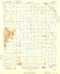
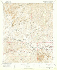
 1946 Antelope Peak1955 Print · USGSThe high desert of Pinal County in the late 1940s is captured here, showing the intersection of tribal lands and the open basin. Researchers can trace early routes like Route 84 past prominent landmarks like Antelope Peak, Table Top, and the watering holes of Hidden Valley.3 unique versions available
 - 1947 Map of Red Rock
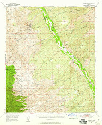
 1947 Red Rock1947 Print · USGSSouthern Arizona’s desert floor and jagged peaks come into focus just after the war, showing a landscape shaped by military aviation and cattle ranching. Genealogists and historians can locate the Old Sasco Ruins, the Sasco Cem, and local landmarks like Thompson Dairy.2 unique versions available
 - 1947 Map of Inspiration
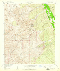
 1947 Inspiration1947 Print · USGSGila County copper country comes alive in the mid-1940s, showing a high-desert landscape of industrial mines and remote ranching. Genealogists and historians can trace the Inspiration Main Shafts, the Southern Pacific Line, and family sites like Horrel Ranch.
 - 1947 Map of Eloy, 1959 Print
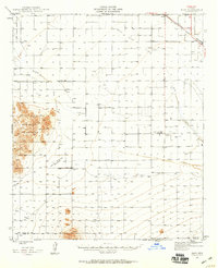 1947 Eloy1959 Print · USGSThe Pinal County desert just after the war shows a landscape of rail transit and early agricultural irrigation. Trace the development of Eloy and Picacho along the Southern Pacific Railroad or locate the Sawtooth Sch and Friendly Corners.2 unique versions available
 - 1948 Map of Pinal Ranch
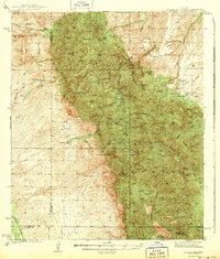
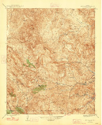
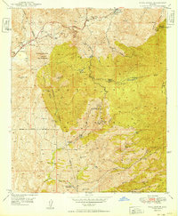
 1948 Pinal Ranch1948 Print · USGSThe Pinal Mountains and Crook National Forest are captured here in the late 1940s, showing a landscape defined by ranching and mining. Trace family-owned landmarks like Pinal Ranch and Henderson Ranch, or locate old workings at the American Mine and Samsel Mines.3 unique versions available
 - 1948 Map of Antelope Peak
 1948 Antelope Peak1948 Print · USGSThe high desert south of Phoenix comes alive in the late 1940s, showing the dramatic rise of Antelope Peak and Table Top above the valley floor. Researchers can trace the early borders of the Maricopa Indian Reservation and locate isolated desert Well sites and the winding Vekol Wash.2 unique versions available
 - 1948 Map of Eloy
 1948 Eloy1948 Print · USGSMid-century Pinal County comes into focus as a developing agricultural and rail hub centered on the Southern Pacific line. You can trace early irrigation works and rural landmarks like the Sawtooth Sch, the Friendly Corners settlement, and the U S Dept of Agric Farm Labor Camp.
 - 1948 Map of Superior, 1953 Print
 1948 Superior1953 Print · USGSSuperior was a thriving copper mining hub in the late 1940s, anchored by massive industrial works and a specialized rail network. Researchers can trace the legacy of the Magma Copper Co, locate the historic Silver King Mine, and find old stops like Hewitt Sta.3 unique versions available
 - 1948 Map of Superior, 1955 Print
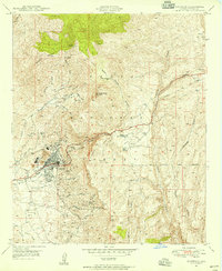 1948 Superior1955 Print · USGSIn the copper-rich corridor of Pinal County after the war, this survey captures the industrial pulse of Superior and its mining district. Genealogists and historians can trace the Magma Arizona RR, local schools, and dozens of mining sites from the Belmont Mine to the Silver King Mine.3 unique versions available
 - 1948 Map of Iron Mountain, 1957 Print
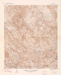
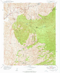
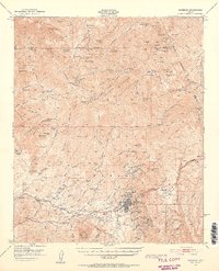
 1948 Iron Mountain1957 Print · USGSCentral Arizona's high desert peaks and canyons appear here in the late 1940s as a landscape of remote ranches and ancient sites. Researchers can locate the Reevis Grave, the Cliff Dwellings, and the old mill site at Rogers Troughs (Old Mill).5 unique versions available
 - 1948 Map of Clark Ranch, 1958 Print
 1948 Clark Ranch1958 Print · USGSSettlement along the San Pedro River in the late 1940s centers on the ranching life and early industry of Pinal County. Researchers can locate the Clark Ranch and Clark School, as well as an old Smelter and several thermal wells.2 unique versions available
 - 1948 Map of Haunted Canyon, 1958 Print
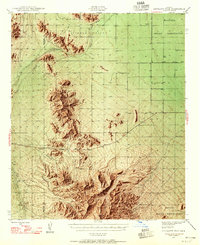
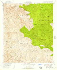
 1948 Haunted Canyon1958 Print · USGSThe Tonto National Forest backcountry is mapped here in the late 1940s, documenting a landscape of remote cattle ranges and named springs. Researchers can locate isolated homesteads like Miles Ranch and trace the rugged drainages of Haunted Canyon and Powers Gulch.4 unique versions available
 - 1948 Map of Mammoth, 1959 Print
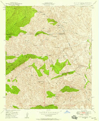
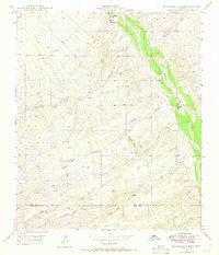
 1948 Mammoth1959 Print · USGSThe San Pedro River valley and the surrounding Pinal County foothills appear in detail just as the local copper industry was modernizing. Researchers can trace the layout of mining hubs like Tiger and Mammoth, alongside historic spreads such as American Flag Ranch and 3 C Ranch.2 unique versions available
 - 1948 Map of Mammoth, 1960 Print
 1948 Mammoth1960 Print · USGSMid-century mining in Pinal County is at its peak here, centered on the company town of Tiger and the riverfront village of Mammoth. Researchers can trace old shafts and industrial sites like the San Manuel Copper Mine, Pearl Mine, and Mohawk Mine.3 unique versions available
 - 1948 Map of Campo Bonito, 1961 Print
 1948 Campo Bonito1961 Print · USGSThe eastern Catalina foothills were a busy junction of mining and ranching just after the war. Researchers can trace the layout of historic operations like the Southern Belle Mine and Old Maudina Mine, or locate early homesteads including Kannally Ranch and American Flag Ranch.5 unique versions available
 - 1948 Map of Picketpost Mtn, 1961 Print
 1948 Picketpost Mtn1961 Print · USGSThe Pinal County landscape at the end of the 1940s reveals a rugged territory defined by the Magma Arizona Railroad. Researchers can trace the Old Pinal Townsite, the Thompson Arboretum, and early infrastructure near Gonzales Pass.4 unique versions available
 - 1948 Map of Peppersauce Wash, 1965 Print
 1948 Peppersauce Wash1965 Print · USGSThe San Pedro River valley and the rugged Black Hills of southern Arizona are captured here in the late 1940s. Genealogists and historians can trace desert water sources and early industry through sites like the Black Hills Mine, Sacaton Ranch, and a rare Artesian Well.3 unique versions available
 - 1949 Map of Pinal Ranch
 1949 Pinal Ranch1949 Print · USGSThe Gila and Pinal County borderlands in the late 1940s reveal a landscape of remote mountain ranching and mining activity. Genealogists and historians can trace family-named sites like Ellis Ranch or the Sixty Six Ranch and locate the Bellevue (Old Site).
 - 1949 Map of Clark Ranch
 1949 Clark Ranch1949 Print · USGSPinal County ranching and mining life comes into focus in the late 1940s as the high desert meets the San Pedro valley. Researchers can locate the Clark Ranch homestead and Clark School, or trace the path of Bunker Hill Road near the Smelter.2 unique versions available
Showing maps 1-25 of 42
Top cities of Pinal County
- San Tan Valley historical maps
- Maricopa historical maps
- Casa Grande historical maps
- Apache Junction historical maps
- Florence historical maps
- Eloy historical maps
See more
Frequently asked questions
- What are the different types of historical maps available for Pinal County?
- What is the oldest map of Pinal County?
- Where can I purchase historical maps of Pinal County for my home or office?
- Where can I download high-res historical maps of Pinal County?
- Are there historical topographic maps available for Pinal County?
- Is there historical aerial imagery available for Pinal County?
- Where are historical maps of Pinal County sourced from?