Old Maps of Pinal County, Arizona for Academic Research
Study the evolution of Pinal County with 709 high-resolution historic maps. Whether you're teaching, researching, or modeling changes in land use, these maps provide essential visual documentation of urban, environmental, and geographic change.
- Analyze long-term change: Track patterns in development, transportation, and natural features.
- Ideal for environmental or urban studies: Support academic projects with primary historical map data.
- Use in the classroom or lab: Educators and researchers rely on these maps to bring historical context to life.
These maps are a powerful tool for teaching, research, and visualizing how Pinal County has changed over the decades.
Pinal County, AZ maps
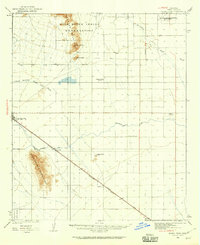
(709)- 1900 Map of Florence, 1956 Print
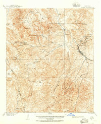
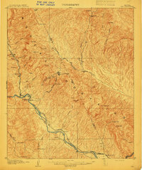
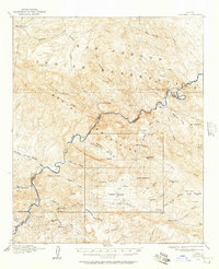
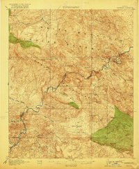
 1900 Florence1956 Print · USGSArizona's mining and ranching frontiers are mapped here at the dawn of the century as the Gila River valley begins its growth. Researchers can trace historic family holdings like Arnett Ranch and early industrial camps at Silver King or the Silver Bell Mine.
 - 1901 Map of Globe, 1955 Print
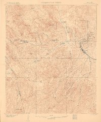
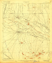
 1901 Globe1955 Print · USGSThe Arizona copper belt and the mining town of Globe appear here at the turn of the century during a period of intense industrial expansion. Genealogists and historians can trace early family-held outposts like Horrell's Ranch and major operations including the Old Dominion Mine.2 unique versions available
 - 1902 Map of Globe
 1902 Globe1902 Print · USGSThe mining district of Globe is captured here at the height of its early copper boom. Genealogists and historians can trace the workings of the Old Dominion Mine and Black Warrior, or locate family sites like Pinal Ranch.3 unique versions available
 - 1902 Map of Florence
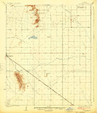
 1902 Florence1902 Print · USGSFlorence and the Gila River valley are captured here at the turn of the century during the peak of early Arizona mining and ranching. Researchers can locate vanished settlements and family sites like Silver King, Adamsville, and the Silver Bell Mine.5 unique versions available
 - 1904 Map of Desert Well, 1958 Print
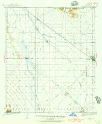
 1904 Desert Well1958 Print · USGSArizona's Salt River Valley comes to life in the early 1900s as a landscape of irrigation canals and desert outposts. Local historians can trace the early footprint of Higley, locate the specific Desert Well, and follow the path of the Santa Fe Prescott and Phoenix RR.
 - 1906 Map of Desert Well
 1906 Desert Well1906 Print · USGSArizona's Salt River valley was transitioning from open range to an irrigated landscape in the years after the turn of the century. Trace the early routes of the Santa Fe Prescott and Phoenix RR and locate pioneer outposts like Buchanan's Ranch and the Desert Well.3 unique versions available
 - 1907 Map of Sacaton
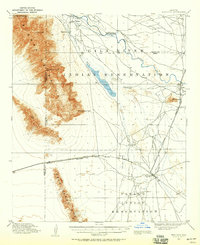
 1907 Sacaton1907 Print · USGSThe Gila River Valley comes alive in this survey from the early 1900s, showing the early infrastructure of the Gila River Indian Reservation. Trace the legacy of desert ranching at Andrada's Ranch or find the early site of Blackwater Chapel.4 unique versions available
 - 1910 Map of Ray
 1910 Ray1910 Print · USGSArizona's copper country and Gila River basin are captured here at a peak of early industrial expansion. Genealogy researchers can locate early homesteads like Uncle Dan's Ranch and Winkelman's Ranch, alongside the massive Ray Mine and the Phoenix and Eastern R. R. corridor.3 unique versions available
 - 1911 Map of Winkelman, 1957 Print
 1911 Winkelman1957 Print · USGSThe Pinal and Pima County line comes alive in the 1910s, showing a landscape of mining camps and early ranching. Genealogists and historians can trace the foundations of Mammoth and find long-lost sites like the Finch School, Campo Bonito, and the MAMMOTH MINE.
 - 1912 Map of Phoenix, 1955 Print
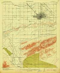
 1912 Phoenix1955 Print · USGSEarly 1900s Phoenix is depicted as an emerging agricultural and rail hub defined by its extensive canal system and desert surroundings. Genealogists and local researchers can trace early homesteads and community centers like Alhambra, St Johns Chapel, and the County Poor Farm.
 - 1913 Map of Winkelman
 1913 Winkelman1913 Print · USGSThe confluence of the Gila and San Pedro rivers in the 1910s reveals a landscape of mining camps and remote ranching outposts. Trace the early industrial footprint of the Mammoth Mine and Oracle or find family landmarks like Finch School and Biddicks Cabin.4 unique versions available
 - 1913 Map of Maricopa, 1958 Print
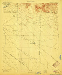
 1913 Maricopa1958 Print · USGSArizona's desert interior comes to life in this early twentieth-century survey of the Gila River Valley. Researchers can trace the shifting rail lines through Maricopa and locate the historic site of Maricopa Wells (Abandoned) or Pima Village.
 - 1914 Map of Gila Butte
 1914 Gila Butte1914 Print · USGSThe Gila River valley in the early twentieth century shows a landscape defined by desert trading posts and the rise of managed irrigation. Researchers can locate family roots and early commerce at the Sweetwater Store Indian Trading Post, Snaketown, and the Casa Blanca Indian School.
 - 1914 Map of Phoenix
 1914 Phoenix1914 Print · USGSPhoenix and its surrounding valley are documented here at a pivotal moment of irrigation-driven growth before the mid-century boom. Genealogists and historians can locate early landmarks like the State Hospital, Maricopa Village, and numerous rural schoolhouses such as Isaac School and Fowler School.4 unique versions available
 - 1915 Map of Maricopa
 1915 Maricopa1915 Print · USGSThe Gila River Valley and its early twentieth-century reservations are captured here as the railroad began to redefine Arizona's desert hubs. Genealogists and historians can trace old stops like Maricopa Wells (Abandoned), the rail junction at Maricopa, and the peaks of the Sierra Estrella.2 unique versions available
 - 1915 Map of Christmas, 1957 Print
 1915 Christmas1957 Print · USGSThe Gila River canyon and Mescal Mountains are shown here during the peak of early Arizona mining and ranching. Genealogists and historians can trace the foundations of the Christmas settlement, the Arizona Eastern rail line, and remote sites like Mings Ranch or the Lower Coal Field Mine.2 unique versions available
 - 1917 Map of Gila Butte
 1917 Gila Butte1917 Print · USGSThe Pinal County desert comes into focus during the early twentieth century as irrigation and rail lines began to reshape the Gila River valley. Genealogists and historians can locate early trading hubs like the North Line Trading Post and tribal landmarks including Snaketown and the Casa Blanca Indian School.2 unique versions available
 - 1917 Map of Christmas
 1917 Christmas1917 Print · USGSMining camps and desert ranching take center stage in this Gila County survey conducted just after the turn of the century. Genealogists and historians can trace the early footprint of Christmas and the various mineral works of the region, from the Lee Mine to the Old Mill.3 unique versions available
 - 1922 Map of Red Rock No 2
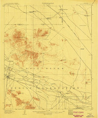
 1922 Red Rock No 21922 Print · USGSPinal County at the dawn of statehood reveals a desert landscape being transformed by irrigation and early highways. Researchers can trace the development of the Picacho Reservoir and early rural landmarks like the Kenilworth School.
 - 1922 Map of Casa Grande, 1956 Print
 1922 Casa Grande1956 Print · USGSPinal County in the early twenties shows a landscape shaped by tribal lands and the railroad. Genealogists and historians can trace the early layout of Casa Grande, the rail siding at Nunez, and the village of Chuichu.2 unique versions available
 - 1922 Map of Signal Peak, 1959 Print
 1922 Signal Peak1959 Print · USGSPinal County's desert corridor is captured in the early 1920s as the railroad and new canals began to transform the arid landscape. Genealogists and historians can trace the early footprints of Casa Grande, Arizola, and the American Boy Mine.2 unique versions available
 - 1924 Map of Signal Peak
 1924 Signal Peak1924 Print · USGSPinal County in the early twenties shows a landscape of desert peaks and growing rail hubs along the Southern Pacific Railroad. Trace the early development of Casa Grande and Eloy near the American Boy Mine and rural Selma School.3 unique versions available
 - 1924 Map of Casa Grande
 1924 Casa Grande1924 Print · USGSThe Santa Cruz River valley in the early 1920s shows the convergence of rail travel and early desert irrigation. Genealogists and historians can trace the rail sidings of Bon and Nunez or locate the village of Chiu Chuischu within the Papago Indian Reservation.
 - 1934 Map of Newman Peak
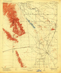
 1934 Newman Peak1934 Print · USGSThe Pinal and Pima County line area is captured here in the mid-1930s, showing a desert landscape shaped by mining and the railroad. Researchers can trace the Southern Pacific line through Redrock or locate the Sasco Mine and 96 Ranch.
 - 1938 Map of Galiuro Mts
 1938 Galiuro Mts1938 Print · USGSThe high desert of Graham and Pinal Counties comes alive in this pre-war survey of the Galiuro Mountains. Local history researchers can trace old ranching boundaries and mining claims like Sixteen To One Mine, Y L Ranch, and the Gerónimo Camp outpost.5 unique versions available
Showing maps 1-25 of 709
Top cities of Pinal County
- San Tan Valley historical maps
- Maricopa historical maps
- Casa Grande historical maps
- Apache Junction historical maps
- Florence historical maps
- Eloy historical maps
See more
Frequently asked questions
- What are the different types of historical maps available for Pinal County?
- What is the oldest map of Pinal County?
- Where can I purchase historical maps of Pinal County for my home or office?
- Where can I download high-res historical maps of Pinal County?
- Are there historical topographic maps available for Pinal County?
- Is there historical aerial imagery available for Pinal County?
- Where are historical maps of Pinal County sourced from?