1950s Maps of Inyo County, California
Explore 89 historic maps of Inyo County from the 1950s. These maps offer a rare glimpse into what life looked like during the 1950s — showing old roads, neighborhoods, homes, and landmarks that have changed or disappeared over time.
Whether you're researching your family's past, planning a metal detecting trip, or studying how Inyo County's landscape evolved across the 1950s, these high-resolution maps are a powerful tool for exploring the history of this region.
- Focus on a specific era: All maps on this page are from the 1950s, giving you a focused view of this time period.
- See what’s changed: Compare century-old streets, trails, and buildings to today's modern landscape using overlays and satellite layers.
- Research with precision: Use these maps for genealogy, historical research, land use analysis, or educational projects.
- View, download, or print: Maps are fully viewable online in high resolution, and can be downloaded or printed for your own records.
Start exploring Inyo County's history through authentic maps from the 1950s. This is your window into the past.
Inyo County, CA maps
(89)- 1950 Map of Trona
 1950 Trona1950 Print · USGSThe Mojave Desert mining economy of 1950 is on full display here, centered on the industrial hub of Trona. Genealogists and historians can trace the Trona Railway to remote workings like the Gold Bottom Mine and Ophir Mine.
 - 1950 Map of Manly Peak
 1950 Manly Peak1950 Print · USGSThe Panamint Range and Death Valley borderlands are captured here in the mid-twentieth century during a period of transition for local mining. Researchers can trace old mountain routes and industrial remains at Myers Ranch, the Lotus Mine, and Mengel Pass.2 unique versions available
 - 1950 Map of Wingate Wash, 1952 Print
 1950 Wingate Wash1952 Print · USGSDeath Valley and the Panamint Range are captured in the early 1950s when mining and remote ranching still dotted these arid canyons. Trace historical activity at Indian Ranch or the Queen of Sheba Mine, and follow the path of Wingate Wash through the desert floor.4 unique versions available
 - 1950 Map of Big Pine, 1952 Print
 1950 Big Pine1952 Print · USGSBig Pine and the Owens Valley are captured here in the early fifties, showing the vital intersection of the Southern Pacific railroad and local irrigation. Researchers can trace the legacy of the Big Pine Rancheria, the County Farm, and the high-altitude route of the John Muir Trail.5 unique versions available
 - 1950 Map of Confidence Hills, 1952 Print
 1950 Confidence Hills1952 Print · USGSThe southern reaches of Death Valley are captured here in the early fifties, showing a remote landscape of mining ruins and desert passes. Researchers can trace historic industrial sites like Ashford Mill (Ruins) and the Desert Hound Mine or locate vital water sources such as Bradbury Well.3 unique versions available
 - 1950 Map of Darwin, 1956 Print
 1950 Darwin1956 Print · USGSMining operations dominated the landscape around Darwin during the post-war era of the early fifties. Genealogists and industrial historians can trace active sites like the Darwin Mines and Sierra Talc Mine alongside local landmarks like the Darwin Hosp and Cem.3 unique versions available
 - 1950 Map of Tecopa, 1958 Print
 1950 Tecopa1958 Print · USGSThe desert landscape of southeastern California is captured here at mid-century, just as the local mining economy and transportation networks were shifting. Researchers can locate remote industrial sites like the Noonday Mine or trace the historic path of the Old Spanish Trail through the hills.3 unique versions available
 - 1950 Map of New York Butte, 1958 Print
 1950 New York Butte1958 Print · USGSHigh in the Inyo Mountains during the mid-century, this survey documents a landscape of deep-canyon mining and early rail infrastructure. Trace the Southern Pacific line along Owens Lake or locate remote sites like Beveridge and the Black Warrior Mine.3 unique versions available
 - 1950 Map of Ubehebe Peak, 1960 Print
 1950 Ubehebe Peak1960 Print · USGSInyo County's high desert mining and geological oddities are captured here at mid-century. Metal detectorists and historians can trace the locations of the Ubehebe Mine, the Lippincott Lead Mine, and remote water sources like Lee Pump.3 unique versions available
 - 1951 Map of Mt. Tom
 1951 Mt. Tom1951 Print · USGSInyo County mining reached its peak in the early fifties as tungsten and vanadium extraction transformed the eastern Sierra slopes. Researchers can trace the era's industrial footprint through the Pine Creek Mine, Tungsten Hills, and the company town at Rovana.2 unique versions available
 - 1951 Map of New York Butte
 1951 New York Butte1951 Print · USGSThe high peaks of the Inyo Mountains dominate this 1950s survey of one of California's most vertical mining landscapes. Genealogists and industrial historians can trace the remote Cerro Gordo Mine, the historic settlement of Swansea, and the complex tramway systems used to transport ore.
 - 1951 Map of Tecopa
 1951 Tecopa1951 Print · USGSThe California desert near the Nevada border in the early fifties reveals a landscape of mining and historic transit routes. Genealogists and historians can trace the Old Spanish Trail and locate remote operations like the Columbia Mine and Mine Camp.
 - 1951 Map of Manly Peak
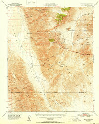 1951 Manly Peak1951 Print · USGSThe Panamint Range and Death Valley frontier are captured here in the early fifties, showing a landscape of mining remnants and isolated ranches. Trace the legacy of desert pioneers at Meyers Ranch, Lotus Mine, and the quiet Grave at Mengel Pass.
 - 1951 Map of Mt. Goddard
 1951 Mt. Goddard1951 Print · USGSHigh Sierra wilderness and the crest of the Sierra Nevada are captured here in the early fifties, documenting a vast landscape of granite peaks and glacial lakes. Researchers can trace historic mineral sites like the Cardinal Mine and Sally Peterson Mine or locate high-country crossings at Muir Pass.2 unique versions available
 - 1951 Map of Darwin
 1951 Darwin1951 Print · USGSThe mining district of Inyo County reached a mid-century peak in the early fifties, centered on the bustling town of Darwin. Genealogists and historians can trace industrial footprints at the Darwin Mines, Santa Rosa Mines, and the local cemetery.
 - 1951 Map of Ubehebe Peak
 1951 Ubehebe Peak1951 Print · USGSThe high desert of Inyo County is captured here in the early fifties, documenting a landscape of remote mines and dry playas. Researchers can locate specific industrial sites like the Lippincott Lead Mine and Lost Burro Mine, or trace water sources at Big Dodd Spr.2 unique versions available
 - 1951 Map of Bishop
 1951 Bishop1951 Print · USGSOwens Valley thrives as an agricultural and mining center in the early fifties, mapped just before local shifts in water and rail. Trace the Southern Pacific line past Laws or locate the Southern Belle Mine and Keough Hot Springs.
 - 1951 Map of Funeral Peak, 1952 Print
 1951 Funeral Peak1952 Print · USGSThe Black Mountains and Greenwater Range dominate this mid-century survey of the California desert during the early years of the national monument. Researchers can trace the remnants of early mining activity and pioneer camps at Furnace (Site), Greenwater (Site), and several unnamed Mines.4 unique versions available
 - 1951 Map of Eagle Mtn, 1952 Print
 1951 Eagle Mtn1952 Print · USGSThe Inyo County desert is documented here in the early fifties, showing the transition from active mining to a landscape of relics. Researchers can trace the path of the Old Traction Road, find the Lila C Mine (Site), and locate the small settlement of Evelyn along the Amargosa River.3 unique versions available
 - 1951 Map of Panamint Butte, 1952 Print
 1951 Panamint Butte1952 Print · USGSInyo County’s high desert landscape comes into focus during the early fifties, documenting the remote mining and transit routes of the eastern Sierra region. Researchers can trace the Nadeau Trail, locate the Big Four Mine, and follow the historic Eichbaum Toll Road through the valley.3 unique versions available
 - 1951 Map of Maturango Peak, 1952 Print
 1951 Maturango Peak1952 Print · USGSThe mining landscape of Inyo County is captured here in the early fifties as active claims and historic ruins defined the desert basins. Trace the routes of old haul roads like the Nadeau Trail to remote workings at the Modoc Mine and Anthony Mill Ruins.3 unique versions available
 - 1951 Map of Marble Canyon, 1952 Print
 1951 Marble Canyon1952 Print · USGSThe high Panamint range and deep valley depressions of Inyo County appear in great detail just after the war. Researchers can locate remote mining sites like Ubehebe Talc Mine, ancient Petroglyphs, and vital water sources including Goldbelt Spring.3 unique versions available
 - 1951 Map of Keeler, 1952 Print
 1951 Keeler1952 Print · USGSOwens Lake and the Inyo Mountains are captured here in the early fifties during a period of intense mineral extraction. Trace the industrial footprint of the Southern Pacific at Keeler or locate the Sierra Talc Mine and Dirty Socks (Hot Spring).4 unique versions available
 - 1951 Map of Shoshone, 1952 Print
 1951 Shoshone1952 Print · USGSEastern California's mining corridor is captured here in the early fifties, where the desert landscape meets the high peaks of the Black Mountains. Local historians can trace the paths of a Dismantled Railroad and locate dozens of namesake claims including the Wonder Mine and Paddys Pride Mine.3 unique versions available
 - 1951 Map of Haiwee Reservoir, 1952 Print
 1951 Haiwee Reservoir1952 Print · USGSInyo County in the early fifties is defined here by the engineering of the Los Angeles City Aqueduct and the mining claims of the high flats. Genealogists and historians can locate family sites like Tunawee Ranch or trace the early paths to Coso Hot Springs and the Beebe Mine.4 unique versions available
Showing maps 1-25 of 89
Top cities of Inyo County
- Bishop historical maps
- West Bishop historical maps
- Lone Pine historical maps
- Big Pine historical maps
- Independence historical maps
- Wilkerson historical maps
See more
Frequently asked questions
- What are the different types of historical maps available for Inyo County?
- What is the oldest map of Inyo County?
- Where can I purchase historical maps of Inyo County for my home or office?
- Where can I download high-res historical maps of Inyo County?
- Are there historical topographic maps available for Inyo County?
- Is there historical aerial imagery available for Inyo County?
- Where are historical maps of Inyo County sourced from?