1950s Maps of Monterey County, California
Explore 43 historic maps of Monterey County from the 1950s. These maps offer a rare glimpse into what life looked like during the 1950s — showing old roads, neighborhoods, homes, and landmarks that have changed or disappeared over time.
Whether you're researching your family's past, planning a metal detecting trip, or studying how Monterey County's landscape evolved across the 1950s, these high-resolution maps are a powerful tool for exploring the history of this region.
- Focus on a specific era: All maps on this page are from the 1950s, giving you a focused view of this time period.
- See what’s changed: Compare century-old streets, trails, and buildings to today's modern landscape using overlays and satellite layers.
- Research with precision: Use these maps for genealogy, historical research, land use analysis, or educational projects.
- View, download, or print: Maps are fully viewable online in high resolution, and can be downloaded or printed for your own records.
Start exploring Monterey County's history through authentic maps from the 1950s. This is your window into the past.
Monterey County, CA maps
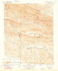
(43)- 1950 Map of Reef Ridge
 1950 Reef Ridge1950 Print · USGSThe northern Kettleman Plain and Diablo Range transition into a landscape of remote ranching and early industry during the 1930s. Genealogists and historians can locate the Ernest Kreyenhagen Ranch, the Avenal Canyon Mine, and the Union Oil Co Pumping Sta.
 - 1950 Map of The Dark Hole
 1950 The Dark Hole1950 Print · USGSThe remote interior where Fresno, Monterey, and Kings counties meet is captured here in the mid-twentieth century, showcasing a landscape of high ridges and isolated cabins. Genealogists and historians can locate specific sites like Kings Mine, Twentysix Camp, and Pinoso House (Ruins).
 - 1953 Map of The Dark Hole, 1957 Print
 1953 The Dark Hole1957 Print · USGSHigh in the California Coast Ranges during the 1950s, this area shows a landscape of remote ranching outposts and rugged ridges. Genealogists and historians can locate specific family sites like Taylor Ranch, Moore Cabin, and the remnants of Pinoso House.
 - 1953 Map of Garza Peak, 1957 Print
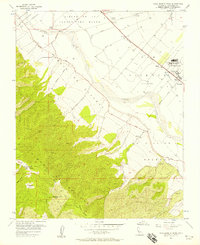
 1953 Garza Peak1957 Print · USGSThe rugged ranch lands of Kings County are captured here in the early 1950s as oil exploration and traditional cattle operations coexisted. You can trace family holdings like Kreyenhagen Ranch and locate early industrial sites such as the Avenal Canyon Mine and Dawson Mine.3 unique versions available
 - 1954 Map of Watsonville West, 1955 Print
 1954 Watsonville West1955 Print · USGSCoastal Santa Cruz County thrived as an agricultural and rail center in the mid-1950s, bridging the gap between the Pajaro River and the Monterey Bay bluffs. Genealogists and local historians can trace the growth of Watsonville and Freedom, locating family-named landmarks like the Monte Vista Christian Sch and the McQuiddy Sch.6 unique versions available
 - 1954 Map of Moss Landing, 1955 Print
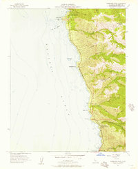
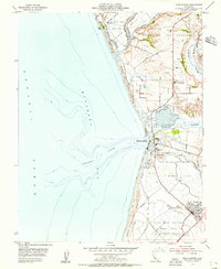 1954 Moss Landing1955 Print · USGSThe Monterey Bay coastline in the mid-fifties is a study in tidal wetlands and maritime industry centered on the deep waters of Monterey Canyon. Genealogists and local historians can locate the Castroville Moss Ldg Cem, the Moss Landing Union School, and the early layout of Castroville.7 unique versions available
 - 1954 Map of Prunedale, 1956 Print
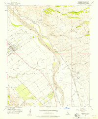
 1954 Prunedale1956 Print · USGSMonterey County's coastal wetlands and canyons are captured here in the mid-1950s, showing the early footprints of rural settlements. Researchers can trace land grant boundaries and local landmarks like Elkhorn Slough, the Southern Pacific line, and Prunedale.6 unique versions available
 - 1955 Map of Santa Cruz
 1955 Santa Cruz1955 Print · USGSCoastal Monterey Bay and the fertile Salinas Valley are captured here during the post-war expansion of the mid-fifties. Researchers can trace the era's rail-and-road network via the Southern Pacific lines and find landmarks like Fort Ord or the Lonoak School.
 - 1955 Map of Hollister, 1956 Print
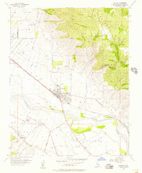
 1955 Hollister1956 Print · USGSHollister and the surrounding San Benito valley floor are captured here in the mid-fifties, just as the local community was expanding. Researchers can trace the Southern Pacific rail lines, the old San Benito County H S and Jr College, and early mountain roads through the San Andreas Rift Zone.5 unique versions available
 - 1955 Map of Watsonville East, 1956 Print
 1955 Watsonville East1956 Print · USGSThe fertile Pajaro Valley and southern Santa Cruz Mountains are seen here in the mid-fifties, centered on a vital agricultural and rail corridor. Genealogists and local historians can trace family sites near Johnston Corner, the Pajaro Valley Memorial Park, and the Southern Pacific hub at Watsonville Junction.6 unique versions available
 - 1955 Map of San Juan Bautista, 1956 Print
 1955 San Juan Bautista1956 Print · USGSSan Juan Bautista at the height of the mid-fifties is captured here along the shifting San Andreas Rift Zone. Researchers can trace the layout of the Mission, local school sites like Lagunita Sch, and the industry of the massive Cement Plant.5 unique versions available
 - 1955 Map of Gonzales, 1957 Print
 1955 Gonzales1957 Print · USGSThe Salinas Valley agricultural landscape and the foothills of the Gabilan Range are shown here during the mid-fifties. Genealogists and researchers can trace property lines through large land grants like Zanjones or locate the Southern Pacific stops at Gonzales and Penvir.4 unique versions available
 - 1955 Map of Soledad, 1957 Print
 1955 Soledad1957 Print · USGSThe Salinas River valley in the mid-1950s reveals a landscape of growing towns and institutional landmarks. Researchers can trace the layout of Soledad, locate the Mission Soledad, and explore local school sites like Mission Union School.4 unique versions available
 - 1955 Map of Hollister, 1960 Print
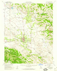 1955 Hollister1960 Print · USGSSan Benito County in the mid-fifties is captured here during a time of agricultural prominence and steady town growth. Genealogists and local historians can trace the foundations of Hollister while locating rural landmarks like San Justo Sch and the Indart Ranch.2 unique versions available
 - 1956 Map of Lopez Point
 1956 Lopez Point1956 Print · USGSThe Monterey coast in the mid-fifties presents a steep landscape of protected forests and isolated landings. Researchers can trace the early infrastructure of Lucia, locate the site of Rockland Landing, and explore the canyon routes of Big Creek.4 unique versions available
 - 1956 Map of New Idria
 1956 New Idria1956 Print · USGSThe Diablo Range's remote mining country is captured here in the mid-fifties, centered on the settlement of New Idria. Genealogists and historians can trace the industrial footprint of the San Carlos Mine, Alpine Mine, and the Jade Mill.3 unique versions available
 - 1956 Map of Palo Escrito Peak
 1956 Palo Escrito Peak1956 Print · USGSMonterey County’s Salinas Valley transitions from fertile river bottoms to high peaks during the mid-fifties. Researchers can locate the Soledad State Prison, trace the Southern Pacific rail line through Molus, and find the Gonzales Cemetery.5 unique versions available
 - 1956 Map of Carmel Valley, 1957 Print
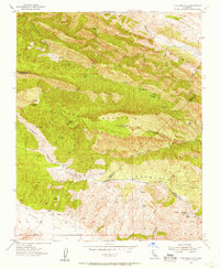
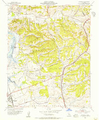
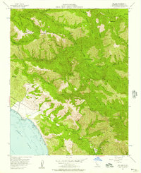
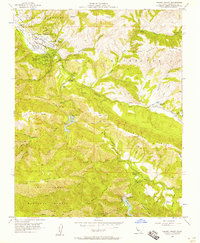 1956 Carmel Valley1957 Print · USGSMid-century Monterey County life centers on the river valley as it transitions into the forest highlands. Genealogists and local historians can trace family-named sites and rural institutions like Holman Ranch, Robles Del Rio, and the Tularcitos School.7 unique versions available
 - 1956 Map of Chews Ridge, 1957 Print
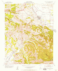
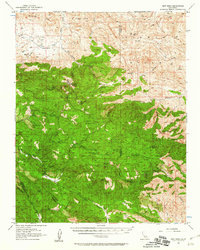
 1956 Chews Ridge1957 Print · USGSMonterey County's rugged backcountry comes into focus during the mid-fifties, showing a remote landscape of high ridges and canyon camps. Researchers can trace ranching history at the Bell Ranch or locate isolated landmarks like Nason Cabin and China Camp.5 unique versions available
 - 1956 Map of Partington Ridge, 1957 Print
 1956 Partington Ridge1957 Print · USGSThe Monterey coast in the mid-fifties shows a remote landscape of steep ridges and protected waters before extensive modern development. Researchers can trace historic sites like Andersen Landing, Timber Top, and the camps along the Big Sur River.5 unique versions available
 - 1956 Map of Big Sur, 1957 Print
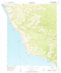
 1956 Big Sur1957 Print · USGSThe Central Coast in the mid-1950s reveals a wild landscape of canyons and forest camps just as recreation began to flourish. Researchers can trace the early boundaries of Pfeiffer Big Sur State Park or locate backcountry spots like Comings Cabin and Jackson Camp.7 unique versions available
 - 1956 Map of Soberanes Point, 1957 Print
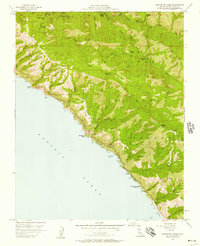
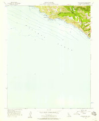
 1956 Soberanes Point1957 Print · USGSAlong the Monterey coast in the mid-fifties, this survey shows the winding road and deep canyons south of Carmel. Genealogists can locate Notleys Landing, the Palo Colorado School, and the vast Palo Corona Ranch.5 unique versions available
 - 1956 Map of Point Sur, 1957 Print
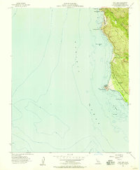 1956 Point Sur1957 Print · USGSThe Monterey coast in the mid-1950s highlights a rugged landscape defined by the intersection of early industry and coastal navigation. Researchers can trace the ruins of Bixby Landing, the status of the Sur School, and the iconic Bixby Bridge.5 unique versions available
 - 1956 Map of Pfeiffer Point, 1957 Print
 1956 Pfeiffer Point1957 Print · USGSThe Monterey coast comes into focus during the mid-fifties, just as the regional park system was establishing its footprint. Researchers can trace the early development of Pfeiffer Big Sur State Park and locate the historic Pfeiffer Sch and the community at Posts.5 unique versions available
 - 1956 Map of Greenfield, 1957 Print
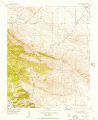
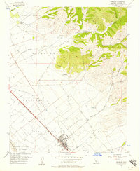
 1956 Greenfield1957 Print · USGSMid-century Monterey County comes into focus as the agricultural grid around Greenfield expands along the Salinas River. Genealogists and historians can trace rail stops at Coburn and Metz or locate family plots in the Greenfield Cemetery.4 unique versions available
Showing maps 1-25 of 43
Top cities of Monterey County
- Salinas historical maps
- Monterey historical maps
- Marina historical maps
- Prunedale historical maps
- Pacific Grove historical maps
- Greenfield historical maps
See more
Frequently asked questions
- What are the different types of historical maps available for Monterey County?
- What is the oldest map of Monterey County?
- Where can I purchase historical maps of Monterey County for my home or office?
- Where can I download high-res historical maps of Monterey County?
- Are there historical topographic maps available for Monterey County?
- Is there historical aerial imagery available for Monterey County?
- Where are historical maps of Monterey County sourced from?