1960s Maps of Monterey County, California
Explore 31 historic maps of Monterey County from the 1960s. These maps offer a rare glimpse into what life looked like during the 1960s — showing old roads, neighborhoods, homes, and landmarks that have changed or disappeared over time.
Whether you're researching your family's past, planning a metal detecting trip, or studying how Monterey County's landscape evolved across the 1960s, these high-resolution maps are a powerful tool for exploring the history of this region.
- Focus on a specific era: All maps on this page are from the 1960s, giving you a focused view of this time period.
- See what’s changed: Compare century-old streets, trails, and buildings to today's modern landscape using overlays and satellite layers.
- Research with precision: Use these maps for genealogy, historical research, land use analysis, or educational projects.
- View, download, or print: Maps are fully viewable online in high resolution, and can be downloaded or printed for your own records.
Start exploring Monterey County's history through authentic maps from the 1960s. This is your window into the past.
Monterey County, CA maps
(31)- 1961 Map of Cholame Valley, 1962 Print
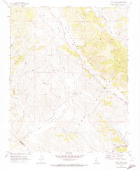
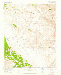 1961 Cholame Valley1962 Print · USGSThe Monterey and San Luis Obispo county borders come together in the early 1960s across this ranching landscape. Genealogists and historians can locate remote landmarks like the Cholame Ranch, identify water sources at Kerr Lake, and trace the terrain of Turkey Flat.3 unique versions available
 - 1961 Map of Parkfield, 1962 Print
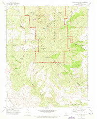
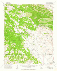 1961 Parkfield1962 Print · USGSParkfield and the Cholame Valley are captured here in the early sixties, a time of isolated ranching and mineral exploration along the San Andreas fault line. Researchers can trace family history through the Parkfield Cemetery or locate old operations like the Patriquin Mine and White Mine.2 unique versions available
 - 1961 Map of The Dark Hole, 1962 Print
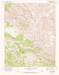
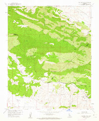 1961 The Dark Hole1962 Print · USGSThe remote High Desert borderlands of Central California come alive in the early sixties, showing a landscape of mining claims and rugged cattle ranching. Genealogists and historians can trace family outposts like Taylor Ranch or search for the sites of Kings Mine and the Riley Cabin.4 unique versions available
 - 1961 Map of Cholame Hills, 1962 Print
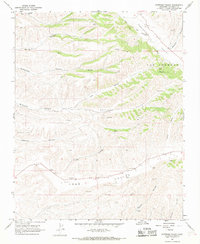
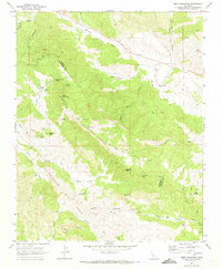
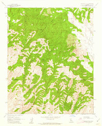 1961 Cholame Hills1962 Print · USGSThe California Coast Ranges come into focus in the early sixties as they straddle the Monterey and San Luis Obispo line. Genealogists and local historians can trace isolated outposts like Cottonwood Camp and remote water sources including Square Corral Spring and Covington Lake.3 unique versions available
 - 1961 Map of Parkfield, 1962 Print
 1961 Parkfield1962 Print · USGSThe ranching and mining country of the California Coast Ranges comes into focus during the early sixties near the Monterey-Fresno border. Genealogists and historians can locate the Parkfield settlement, the local Cem, and sites like the Patriquin Mine or Hog Ranch.3 unique versions available
 - 1961 Map of Bradley, 1968 Print
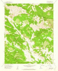
 1961 Bradley1968 Print · USGSMonterey County in the early sixties is a landscape defined by the intersection of military training grounds, oil extraction, and ranching life. Researchers can trace the path of the Southern Pacific Railroad through Bradley or locate family sites near Pleyto and Hames Valley Hall.2 unique versions available
 - 1961 Map of Junipero Serra, 1968 Print
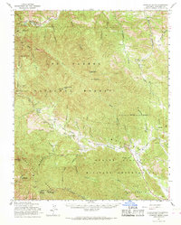 1961 Junipero Serra1968 Print · USGSThe Santa Lucia Range in the early 1960s reveals a mix of remote wilderness, private ranching, and strategic military lands. Researchers can locate family landmarks such as Leigh Ranch and Herbert Ranch or trace early forest service outposts like Santa Lucia Ranger Sta.2 unique versions available
 - 1961 Map of Cape San Martin, 1968 Print
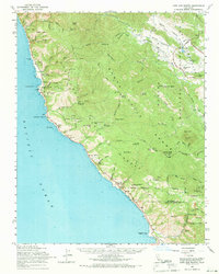 1961 Cape San Martin1968 Print · USGSThe Big Sur coast and Santa Lucia Range are shown here in the early sixties, before the full development of modern tourism. Researchers can trace remote coastal settlements like Plaskett and Gorda, find the Pacific Valley Sch, and locate the Polar Star Mine.2 unique versions available
 - 1961 Map of King City, 1968 Print
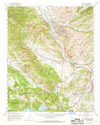
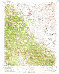 1961 King City1968 Print · USGSThe Salinas River valley in the early 1960s shows a landscape of rail-connected agriculture and expanding military installations. Genealogists and historians can trace the Southern Pacific line through King City down to San Lucas, or locate family landmarks in Quinado Canyon and the Hunter Liggett Military Reservation.
 - 1961 Map of Bryson, 1968 Print
 1961 Bryson1968 Print · USGSCoastal range foothills and river valleys of Monterey County come into focus in the 1960s as military and rural life intersect. Genealogists can trace the locales of Jolon, Lockwood, and Bryson, alongside institutions like the San Antonio Union Sch and Pleyto Sch.
 - 1961 Map of San Miguel, 1968 Print
 1961 San Miguel1968 Print · USGSThe Salinas River valley and the expansive Camp Roberts Military Reservation are documented here in the early sixties. Genealogists can trace family names and sites like the Imusdale Cem, Indian Valley Sch, and the rail stop at McKay.
 - 1962 Map of Cape San Martin
 1962 Cape San Martin1962 Print · USGSThe Big Sur coast meets the high ridges of the Santa Lucia Range in the early sixties. Trace the rugged terrain from Gorda to the Polar Star Mine, or locate historic sites like San Miguelito Ranch and Dutra Flats Camp.
 - 1965 Map of Santa Cruz, 1968 Print
 1965 Santa Cruz1968 Print · USGSThe Central Coast and San Joaquin Valley meet here during the mid-sixties, capturing the growth of agricultural and coastal hubs. Trace the historic Southern Pacific RR lines and locate sites like the Presidio of Monterey or Pinnacles National Monument.
 - 1967 Map of Monarch Peak, 1968 Print
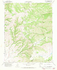
 1967 Monarch Peak1968 Print · USGSThe California Coast Ranges are captured here in the late sixties, showcasing the tectonic landscape of the San Andreas Rift Zone. Researchers can trace old transportation routes and landmarks like Peachtree Road and the Mustang Fire Control Station.3 unique versions available
 - 1967 Map of Nattrass Valley, 1968 Print
 1967 Nattrass Valley1968 Print · USGSThe ranchlands of Monterey County are captured here in the late sixties, showing the isolated canyon systems of the Gabilan foothills. Researchers can trace the rural landscape through family-named landmarks like Randall, the Eade No 1 site, and a remote Cem in Long Valley.2 unique versions available
 - 1967 Map of San Ardo, 1968 Print
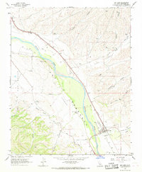 1967 San Ardo1968 Print · USGSThe Salinas River valley in Monterey County comes into focus during the late 1960s, documenting the rail and agricultural hub of San Ardo. Researchers can trace the Southern Pacific line and find localized landmarks like the Cem, Grain Elevators Storage Bins, and an Airway Beacon.4 unique versions available
 - 1967 Map of Pancho Rico Valley, 1968 Print
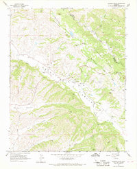
 1967 Pancho Rico Valley1968 Print · USGSCoastal Monterey County is captured in the late sixties as a landscape of remote canyons and ranching outposts. Researchers can trace land use through family-named landmarks like Dutch Henry Canyon, search for early Oil Wells near Lanigan, and locate water sources like Iron Springs.2 unique versions available
 - 1968 Map of Mount Johnson, 1971 Print
 1968 Mount Johnson1971 Print · USGSEastern Monterey County is shown here in the late sixties, where the high ridges of the Gabilan Range meet ranching corridors. Researchers can trace historic boundaries like Rincon de la Puente del Monte or follow the path of La Gloria Road toward Gloria Lake.3 unique versions available
 - 1968 Map of Paicines, 1971 Print
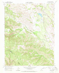 1968 Paicines1971 Print · USGSSan Benito County ranching and geology are on full display in the late sixties as the San Benito River flows past Paicines. Researchers can locate rural landmarks like Willow Grove Sch, the Paicines Ranch, and trace the path of the San Andreas Rift Zone.2 unique versions available
 - 1968 Map of Bickmore Canyon, 1971 Print
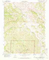 1968 Bickmore Canyon1971 Print · USGSThe San Andreas fault line cuts directly through San Benito County in the late sixties, defining a landscape of isolated ranches and wilderness. Researchers can trace the heritage of Melendy Ranch, find the Willow Creek Cem, and explore the rugged northern boundary of Pinnacles National Monument.6 unique versions available
 - 1968 Map of Mt. Harlan, 1971 Print
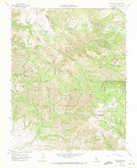 1968 Mt. Harlan1971 Print · USGSThe high ridges of the Gabilan Range come into focus in the late sixties, showing the rugged divide between San Benito and Monterey counties. Researchers can trace remote sites like Thompson Cabin, the historic Encinal y Buena Esperanza grant line, and old quarries near Mt Harlan.2 unique versions available
 - 1969 Map of Topo Valley, 1973 Print
 1969 Topo Valley1973 Print · USGSSan Benito and Monterey counties are captured in the late sixties at the intersection of geology and ranching life. Genealogists and historians can trace family land at Sans Ranch, locate the remote Murphy Flat, or study the San Andreas Rift Zone.2 unique versions available
 - 1969 Map of North Chalone Peak, 1973 Print
 1969 North Chalone Peak1973 Print · USGSThe high volcanic peaks of the Gabilan Range define this 1960s study of the Central Coast interior. Local historians can trace the early footprint of Pinnacles National Monument, from the Visitor Center to landmarks like Machete Ridge and South Chalone Peak.2 unique versions available
 - 1969 Map of Curry Mountain, 1973 Print
 1969 Curry Mountain1973 Print · USGSThe rugged boundary between Fresno and Monterey counties comes into focus in the late 1960s, showing a land of oil exploration and high-country ranching. Researchers can trace historic routes like the Warthan Grade to find remote landmarks such as Dias Cabin, Jacalitos Ranch, and Merrill Pools.2 unique versions available
 - 1969 Map of Smith Mountain, 1973 Print
 1969 Smith Mountain1973 Print · USGSThe Monterey and Fresno County line in the late sixties reveals a landscape defined by the San Andreas Rift Zone. Researchers can trace old family sites near Warthan Cem and industrial history at the Stone Canyon Mine.2 unique versions available
Showing maps 1-25 of 31
Top cities of Monterey County
- Salinas historical maps
- Monterey historical maps
- Marina historical maps
- Prunedale historical maps
- Pacific Grove historical maps
- Greenfield historical maps
See more
Frequently asked questions
- What are the different types of historical maps available for Monterey County?
- What is the oldest map of Monterey County?
- Where can I purchase historical maps of Monterey County for my home or office?
- Where can I download high-res historical maps of Monterey County?
- Are there historical topographic maps available for Monterey County?
- Is there historical aerial imagery available for Monterey County?
- Where are historical maps of Monterey County sourced from?