1990s Maps of Monterey County, California
Explore 28 historic maps of Monterey County from the 1990s. These maps offer a rare glimpse into what life looked like during the 1990s — showing old roads, neighborhoods, homes, and landmarks that have changed or disappeared over time.
Whether you're researching your family's past, planning a metal detecting trip, or studying how Monterey County's landscape evolved across the 1990s, these high-resolution maps are a powerful tool for exploring the history of this region.
- Focus on a specific era: All maps on this page are from the 1990s, giving you a focused view of this time period.
- See what’s changed: Compare century-old streets, trails, and buildings to today's modern landscape using overlays and satellite layers.
- Research with precision: Use these maps for genealogy, historical research, land use analysis, or educational projects.
- View, download, or print: Maps are fully viewable online in high resolution, and can be downloaded or printed for your own records.
Start exploring Monterey County's history through authentic maps from the 1990s. This is your window into the past.
Monterey County, CA maps
(28)- 1994 Map of Tent Hills
 1994 Tent Hills1994 Print · USGSThe high borderlands of the California Coast Ranges come into focus in the early nineties, where Kings, Monterey, and Kern counties meet. Genealogists and historians can locate remote landmarks like Cottonwood Pass, the Johnson Peak summit, and a secluded Cem.2 unique versions available
 - 1994 Map of Garza Peak
 1994 Garza Peak1994 Print · USGSThe high ridges and basins of Kings County are captured here in the early nineties as the region transitioned between traditional ranching and modern infrastructure. Researchers can locate the Avenal State Prison, trace the path of Canoas Creek, or find remote landmarks like the Dawson Mine and The Turtle Hole.
 - 1995 Map of Watsonville West, 1998 Print
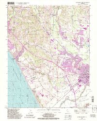 1995 Watsonville West1998 Print · USGSThe Pajaro Valley and the Monterey Bay coastline come alive in the late twentieth century as agriculture and coastal settlements expand. Genealogists and historians can trace family-named sites like Day Valley Cem, Corralitos, and Monte Vista Christian Sch.2 unique versions available
 - 1995 Map of Hollister, 1998 Print
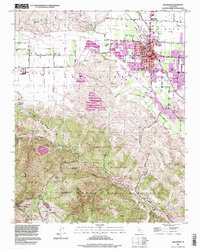 1995 Hollister1998 Print · USGSHollister and the surrounding San Juan Valley are captured here in the mid-nineties as the city expanded toward the Gabilan Range. Local historians can trace established landmarks like the IOOF Cem and San Benito Joint Union High Sch alongside the striking topography of the San Andreas Rift Zone.
 - 1995 Map of Watsonville East, 1998 Print
 1995 Watsonville East1998 Print · USGSCoastal agriculture and mountainous terrain meet in the Pajaro Valley during the mid-nineties. Researchers can trace the Southern Pacific rail corridor through Watsonville Junction or locate family sites at Pajaro Valley Memorial Park and Johnston Corner.2 unique versions available
 - 1995 Map of North Chalone Peak, 1999 Print
 1995 North Chalone Peak1999 Print · USGSThe Monterey and San Benito county line crosses these high peaks of the Gabilan Range in the mid-nineties. Trace the trails and landmarks of Pinnacles National Monument, from Machete Ridge to the high lookout at North Chalone Peak.
 - 1995 Map of Partington Ridge, 2000 Print
 1995 Partington Ridge2000 Print · USGSThe Big Sur coast and the steep Santa Lucia interior are captured here in the mid-nineties. Trace the rugged backcountry trails and coastal landmarks from Julia Pfeiffer Burns State Park to remote spots like Sykes Campsite and Anderson Peak.
 - 1995 Map of Alder Peak, 2000 Print
 1995 Alder Peak2000 Print · USGSMonterey County’s upland interior is shown in the mid-1990s as a landscape of military reservations and wilderness. Researchers can trace land grants like the San Miguelito Grant and find landmarks like San Miguelito Ranch and Alder Peak.
 - 1995 Map of Soberanes Point, 2000 Print
 1995 Soberanes Point2000 Print · USGSThe Monterey coast in the late twentieth century reveals a landscape of steep canyons and legendary offshore rocks. Local historians can trace family-named sites and landmarks like Notleys Landing, Palo Colorado School, and the remote Palo Corona Ranch.
 - 1995 Map of Lopez Point, 2000 Print
 1995 Lopez Point2000 Print · USGSThe Monterey coast in the mid-nineties remains a dramatic meeting of mountain and sea, dominated by protected wilderness and the winding path of the Coast Road. Researchers can locate the settlement of Lucia, the historic Rockland Landing, and remote landmarks like Slates Hot Springs.
 - 1995 Map of Burnett Peak, 2000 Print
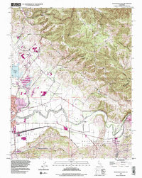
 1995 Burnett Peak2000 Print · USGSThe Monterey and San Luis Obispo county line meets in the mid-1990s within this stretch of the Santa Lucia Range. Researchers can trace the complex borders of Fort Hunter Liggett and historic ranch grants near Burnett Peak and the Nacimiento River.
 - 1995 Map of Zigzag Creek, 2000 Print
 1995 Zigzag Creek2000 Print · USGSThe Ventana Wilderness of the mid-nineties is shown here in detail, focusing on the backcountry around the Santa Lucia Range. Hikers and historians can trace the network of trails and camps including Tassajara Hot Springs, the Marble Peak Trail, and Deer Pasture.
 - 1995 Map of Chews Ridge, 2000 Print
 1995 Chews Ridge2000 Print · USGSMonterey County ranch lands and wilderness areas are captured in the mid-nineties, showing a remote landscape of high ridges and private holdings. Researchers can trace historic mountain sites like Rancho Palo Escrito, Jamesburg, and the Mira Observatory along the spine of Chew's Ridge.
 - 1995 Map of Cone Peak, 2000 Print
 1995 Cone Peak2000 Print · USGSThe Santa Lucia Range in the mid-1990s reveals a landscape of high-elevation lookouts and historic ranching outposts. Researchers can trace the boundaries of the Milpitas Grant or locate remote sites like The Indian Ranch and the Cone Peak Lookout.
 - 1995 Map of Sycamore Flat, 2000 Print
 1995 Sycamore Flat2000 Print · USGSMonterey’s rugged interior remains largely undeveloped in the mid-nineties, centering on the wild canyons of the Arroyo Seco. Local historians can locate specific family outposts like Fritch Ranch, Millers Ranch, and the remote Hermits Cabin.
 - 1995 Map of Ventana Cones, 2000 Print
 1995 Ventana Cones2000 Print · USGSThe Santa Lucia Range and Ventana Wilderness are documented here in the mid-nineties, showing a landscape of high peaks and river canyons. Hikers and historians can trace routes like the Miller Canyon Trail to the Ventana Double Cone Lookout or the Pine Valley Campsite.
 - 1995 Map of Big Sur, 2000 Print
 1995 Big Sur2000 Print · USGSThe Monterey coast in the mid-1990s is captured here, showing the intersection of wilderness and early state park development. Trace the historic Old Coast Road and locate remote landmarks like the Pico Blanco Boy Scout Camp and Tin House Campsite.
 - 1995 Map of Reliz Canyon, 2000 Print
 1995 Reliz Canyon2000 Print · USGSMonterey County's backcountry appears in the mid-1990s as a rugged expanse of federal forest and military lands. Genealogists and researchers can trace ranching footprints at Herbert Ranch and Leigh Ranch or find the remote ruins near Reliz Canyon.
 - 1995 Map of Carmel Valley, 2000 Print
 1995 Carmel Valley2000 Print · USGSThe Carmel River valley in the mid-1990s exhibits a unique blend of valley settlements and wild forest interior. Researchers can trace the development of Robles Del Rio and locate landmarks like Holman Ranch, the San Clemente Dam, and the Tularcitos Guard Station.
 - 1995 Map of Villa Creek, 2000 Print
 1995 Villa Creek2000 Print · USGSThe Monterey coastline near the mid-nineties is characterized by protected wilderness and the winding path of the Cabrillo Highway. Researchers can locate remote trail waypoints like the Buckeye Campsite and trace the bounds of the California Sea Otter State Game Refuge.
 - 1995 Map of Burro Mountain, 2000 Print
 1995 Burro Mountain2000 Print · USGSThe Big Sur coastline met the rugged Santa Lucia Range in the mid-nineties, showing a landscape of wilderness trails and remote ranches. Researchers can locate the Polar Star Mine, the Baldwin Ranch, and numerous backcountry sites like Estrella Campsite.
 - 1995 Map of Junipero Serra Peak, 2000 Print
 1995 Junipero Serra Peak2000 Print · USGSIn the heart of Monterey County during the mid-nineties, this survey captures the high ridges and deep canyons of the Santa Lucia Range. Researchers can trace the path of Indians Road and locate remote landmarks like the Pinyon Peak Lookout and Last Chance Camp.
 - 1995 Map of Pfeiffer Point, 2000 Print
 1995 Pfeiffer Point2000 Print · USGSThe Big Sur coast in the mid-nineties shows a landscape defined by conservation and topography. Genealogists and hikers can trace the Big Sur River past Posts to the Big Sur State Park and Pfeiffer Beach Day Use areas.
 - 1995 Map of Cape San Martin, 2000 Print
 1995 Cape San Martin2000 Print · USGSThe Monterey coast in the mid-nineties shows a landscape of dramatic wilderness and small seaside outposts. Trace the coastal Highway 1 through Gorda and Plaskett, or locate family landmarks like Pacific Valley Station and the Prewitt Ridge Campsite.
 - 1995 Map of Mount Carmel, 2000 Print
 1995 Mount Carmel2000 Print · USGSThe Santa Lucia Range in the mid-1990s reveals a landscape defined by historic land grants and protected wilderness. Local historians can trace the boundaries of the San Francisquito Grant or locate remote landmarks like the White Rock Gun Club and Sid Ormsbee Lookout.
Showing maps 1-25 of 28
Top cities of Monterey County
- Salinas historical maps
- Monterey historical maps
- Marina historical maps
- Prunedale historical maps
- Pacific Grove historical maps
- Greenfield historical maps
See more
Frequently asked questions
- What are the different types of historical maps available for Monterey County?
- What is the oldest map of Monterey County?
- Where can I purchase historical maps of Monterey County for my home or office?
- Where can I download high-res historical maps of Monterey County?
- Are there historical topographic maps available for Monterey County?
- Is there historical aerial imagery available for Monterey County?
- Where are historical maps of Monterey County sourced from?