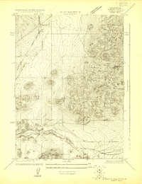
1900s (20th Century) Maps of Siskiyou County, California
Explore 334 historic maps of Siskiyou County from the 1900s (20th Century). These maps offer a rare glimpse into what life looked like during the 1900s — showing old roads, neighborhoods, homes, and landmarks that have changed or disappeared over time.
Whether you're researching your family's past, planning a metal detecting trip, or studying how Siskiyou County's landscape evolved across the 1900s, these high-resolution maps are a powerful tool for exploring the history of this region.
- Focus on a specific era: All maps on this page are from the 1900s, giving you a focused view of this time period.
- See what’s changed: Compare century-old streets, trails, and buildings to today's modern landscape using overlays and satellite layers.
- Research with precision: Use these maps for genealogy, historical research, land use analysis, or educational projects.
- View, download, or print: Maps are fully viewable online in high resolution, and can be downloaded or printed for your own records.
Start exploring Siskiyou County's history through authentic maps from the 1900s. This is your window into the past.
Siskiyou County, CA maps
(334)- 1908 Map of Grants Pass
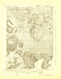
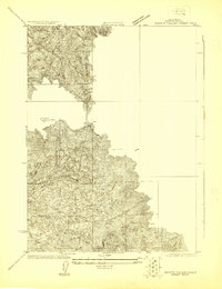
 1908 Grants Pass1908 Print · USGSThe Rogue River valley and Siskiyou Mountains are shown here during a peak era of mineral extraction and rail expansion. Researchers can trace historic claims like the Granite Hill Mine or find early settlements such as Woodville and Wilderville before modern development altered the landscape.5 unique versions available
 - 1913 Map of Weaverville
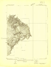
 1913 Weaverville1913 Print · USGSTrinity and Shasta counties appear here during a peak era of mountain mining and ranching before the mid-century reservoirs were built. Genealogists can trace early homesteads and industrial sites like Whiskytown, Minersville, and the Gladstone Mine.6 unique versions available
 - 1914 Map of Seiad, 1957 Print
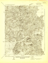
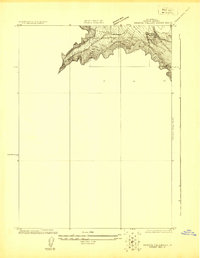
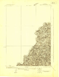
 1914 Seiad1957 Print · USGSSiskiyou County's rugged borderlands are documented here just before the First World War, showing a landscape of remote mines and river settlements. Genealogists and historians can trace family outposts like Johnsons Dairy, old schoolhouses, and active mining works such as the Blue Ledge Mine.
 - 1917 Map of Kerby, 1927 Print
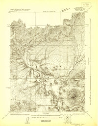
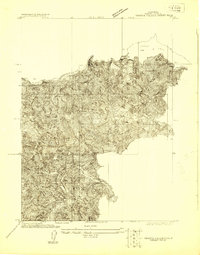
 1917 Kerby1927 Print · USGSSouthern Oregon's mining and timber country is documented here during the early twentieth century, showing the Illinois River basin at its industrial peak. Genealogists can trace family homesteads and local institutions through Kerby, Selma, and rural schools like Spence School.3 unique versions available
 - 1918 Map of Kerby
 1918 Kerby1918 Print · USGSJosephine County in the years before the Great War was a center of mountain mining and early forestry. Genealogists and historians can trace the pioneer footprints of Waldo, Kerby, and Takilma, alongside remote operations like the Queen of Bronze Mine and Eureka Mine.2 unique versions available
 - 1921 Map of Shasta Valley Sheet No 7
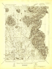
 1921 Shasta Valley Sheet No 71921 Print · USGSShasta Valley was undergoing significant irrigation planning in the early 1920s as ranching families established themselves in Siskiyou County. You can trace early water sources and landholdings like Dukes Ranch, Big Springs, and the Little Shasta River.
 - 1921 Map of Shasta Valley Sheet No 11
 1921 Shasta Valley Sheet No 111921 Print · USGSSiskiyou County irrigation and reclamation efforts were in full swing during the early twenties as engineers mapped this volcanic landscape. Researchers can trace the early rural footprint of the valley near Table Rock School and the prominent Bluff.
 - 1921 Map of Shasta Valley Sheet No 1
 1921 Shasta Valley Sheet No 11921 Print · USGSShasta Valley at the dawn of the 1920s reveals a landscape defined by the iron rails and early automobile routes of Siskiyou County. Trace the development of Gazelle along the Southern Pacific (Shasta Route) and the historic Pacific Highway.
 - 1921 Map of Shasta Valley Sheet No 6
 1921 Shasta Valley Sheet No 61921 Print · USGSIn the Siskiyou hills during the early 1920s, this survey reveals a unique landscape of volcanic hummocks and scattered ranching. Researchers can locate the original Big Springs School and trace the early course of the Shasta River through the Little Shasta Valley.
 - 1921 Map of Shasta Valley Sheet No 2
 1921 Shasta Valley Sheet No 21921 Print · USGSSiskiyou County irrigation and transportation are evolving in the early 1920s as rail and highway routes converge near the valley floor. Researchers can trace the path of the Old Yreka Mining Ditch or locate early rural education sites like Excelsior School and Vineland School.
 - 1922 Map of Shasta Valley Sheet No 10
 1922 Shasta Valley Sheet No 101922 Print · USGSSiskiyou County's volcanic terrain and early 1920s development are captured here during a period of significant irrigation and power planning. Genealogists and historians can locate the Shasta View School and trace the original path of the Pacific Branch railroad.
 - 1922 Map of Shasta Valley Sheet No 10 E
 1922 Shasta Valley Sheet No 10 E1922 Print · USGSSiskiyou County's volcanic landscape is captured here in the early 1920s during a pivotal era of land reclamation. Researchers can trace the subterranean orientation of The Caves and the significant landmark of Yellow Butte.
 - 1922 Map of Preston Peak
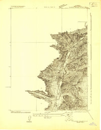
 1922 Preston Peak1922 Print · USGSThe California-Oregon borderlands are mapped here just before the era of modern highway expansion, showing a network of remote river bars and mountain ranches. Trace the locations of early outposts like Gasquet Adams Sta, the Cleopatra Mine, and Terwer School.5 unique versions available
 - 1922 Map of Shasta Valley Sheet No 12
 1922 Shasta Valley Sheet No 121922 Print · USGSSiskiyou County irrigation and reclamation efforts are captured in the early 1920s during a detailed survey of the Shasta Valley. Researchers can trace the course of Little Shasta and locate landmarks like Black Rock and Solomons Temple.
 - 1922 Map of Shasta Valley Sheet No 4
 1922 Shasta Valley Sheet No 41922 Print · USGSSiskiyou County's high-desert landscape appears in great detail in the early 1920s as irrigation and power projects began to reshape the valley. Genealogists and local historians can pinpoint the exact sites of the Dwinell School, Delphic School, and the rail junction at Montague.
 - 1922 Map of Shasta Valley Sheet No 13
 1922 Shasta Valley Sheet No 131922 Print · USGSSiskiyou County's high ridges and early irrigation district surveys are detailed in this early 1920s topography. Genealogists and researchers can locate a rural School and follow the route of an early Power Line near Bogus Mtn..
 - 1922 Map of Shasta Valley Sheet No 1 S
 1922 Shasta Valley Sheet No 1 S1922 Print · USGSSiskiyou County irrigation and transport come into focus in the early 1920s as the Klamath-Shasta Valley project took shape. Trace the path of the Pacific Highway and the Southern Pacific Railroad (Shasta Route) near Independence School.
 - 1922 Map of Shasta Valley Sheet No 16
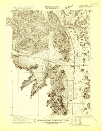
 1922 Shasta Valley Sheet No 161922 Print · USGSThe northern Klamath River corridor comes into focus in the early twenties as hydroelectric and irrigation projects transformed the valley. Researchers can trace the shoreline of Copco Lake and locate the Copco Dam and a local School.
 - 1922 Map of Shasta Valley Sheet No 3
 1922 Shasta Valley Sheet No 31922 Print · USGSYreka and the western Shasta Valley are shown in detail during the early 1920s as the local irrigation network was being established. Researchers can locate specific structures and civic sites like Greenhorn School, the town Cem, and the winding Yreka Ditch.
 - 1922 Map of Shasta Valley Sheet No 15
 1922 Shasta Valley Sheet No 151922 Print · USGSNorthern California river canyons were being meticulously documented in the early 1920s for irrigation development. You can trace the elevation shifts along the Klamath River and locate precise survey markers like BM 2113.
 - 1922 Map of Shasta Valley Sheet No 14
 1922 Shasta Valley Sheet No 141922 Print · USGSSiskiyou County's high country and the Klamath River are captured here in the early twenties as the Pacific Highway was beginning to shape local travel. Genealogists and local historians can locate rural landmarks such as Snowden School, Ager School, and the Cal-Ore Power Co site.
 - 1922 Map of Shasta Valley Sheet No 9
 1922 Shasta Valley Sheet No 91922 Print · USGSSiskiyou County irrigation and reclamation efforts come into focus in the early 1920s as engineers surveyed this corner of the valley. Researchers can trace the precise terrain and drainage near Weed and locate the historic Moffit Mill in its original setting.
 - 1922 Map of Shasta Valley Sheet No 3 S
 1922 Shasta Valley Sheet No 3 S1922 Print · USGSIn the early 1920s, the irrigation and water networks of Siskiyou County were undergoing significant engineering. Researchers can trace the path of the Yreka Ditch alongside Yreka Creek and locate early benchmarks like BM 2838.
 - 1922 Map of Seiad
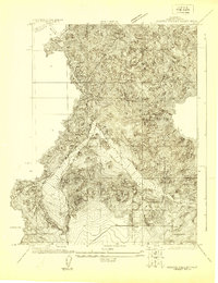
 1922 Seiad1922 Print · USGSSiskiyou County's rugged mining and timber country is captured here during the early twentieth century. Researchers can trace historic river crossings like Gordons Ferry, remote schools such as Nolton School, and active gold operations including the Siskiyou Mine.4 unique versions available
 - 1922 Map of Shasta Valley Sheet No 5
 1922 Shasta Valley Sheet No 51922 Print · USGSNorthern California rail and river corridors appear in fine detail during the early twenties. Genealogists and historians can trace the Southern Pacific line through Snowden and the banks of the Little Shasta River.
Showing maps 1-25 of 334
Top cities of Siskiyou County
- Yreka historical maps
- Mount Shasta historical maps
- Weed historical maps
- Dunsmuir historical maps
- Montague historical maps
- Tulelake historical maps
See more
Frequently asked questions
- What are the different types of historical maps available for Siskiyou County?
- What is the oldest map of Siskiyou County?
- Where can I purchase historical maps of Siskiyou County for my home or office?
- Where can I download high-res historical maps of Siskiyou County?
- Are there historical topographic maps available for Siskiyou County?
- Is there historical aerial imagery available for Siskiyou County?
- Where are historical maps of Siskiyou County sourced from?