Old Maps of Siskiyou County, California for Metal Detecting
Plan your next treasure hunt with 1,020 historic maps of Siskiyou County. Find old homesites, ghost towns, trails, and gathering spots that may be lost to time — perfect for identifying promising metal detecting locations.
- Locate forgotten sites: Uncover places like long-lost settlements, abandoned rail lines, or gathering spots.
- Plan better hunts: Use map overlays combined with LiDAR or satellite views to narrow in on historically rich areas.
- Made for detectorists: Thousands of hobbyists use these maps to discover relics, coins, and hidden history.
Use these historic maps to boost your research and find new opportunities beneath the surface of Siskiyou County.
Siskiyou County, CA maps
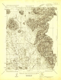
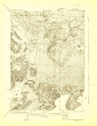
(1,020)- 1886 Map of Modoc Lava Bed
 1886 Modoc Lava Bed1886 Print · USGSNortheastern California is surveyed here in the years following the Modoc War, showing the volcanic terrain of the Modoc Lava Bed and early river settlements. Trace pioneer history through Modoc Rifle Pits, a Ferry on the Pit River, and old outposts like Bieber and Lookout.
 - 1886 Map of Shasta
 1886 Shasta1886 Print · USGSUpper California in the mid-1880s is captured here during the height of the mining era and the early days of mountain tourism. Genealogists can locate family holdings near Yreka, trace river crossings like the ferry at Oaks Bar, or find early resorts at Upper Soda Spring.3 unique versions available
 - 1889 Map of Klamath
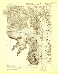
 1889 Klamath1889 Print · USGSSouthern Oregon in the late nineteenth century is a land of vast marshes and emerging frontier towns like Linkville. Historians can trace early government outposts at Ft. Klamath and Yainax Agency or locate family-named sites like Applegate Spr. and Olene.
 - 1890 Map of Red Bluff
 1890 Red Bluff1890 Print · USGSNorthern California in the late nineteenth century was a hub of river-and-rail activity where the Central Pacific Railroad met the rugged Klamath Mountains. Researchers can trace old ferry crossings like Ball's Ferry, locate the U.S. Fishery, or find early mining camps and stations such as Minersville and Buck Horn Station.
 - 1891 Map of Ashland
 1891 Ashland1891 Print · USGSSouthern Oregon's Rogue River Valley was undergoing rapid transformation in the late nineteenth century as rail lines connected its emerging towns. Genealogists and historians can trace early property and settlement patterns near Jacksonville, Medford, and the pristine Crater Lake basin.
 - 1892 Map of Modoc Lava-Bed
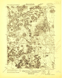
 1892 Modoc Lava-Bed1892 Print · USGSNortheastern California's volcanic terrain is meticulously charted in the 1890s, before modern irrigation altered the great northern basins. Genealogists and historians can locate early outposts like Burgettville, the Modoc Rifle Pit, and the high-altitude Ice Cave.7 unique versions available
 - 1893 Map of Ashland
 1893 Ashland1893 Print · USGSSouthern Oregon in the late nineteenth century was a region of rapid change as the Oregon and California R. R. linked the valley floor. Researchers can trace the early footprints of Jacksonville, Medford, and Ashland, or locate landmarks like Crater Lake and Mt Pitt.6 unique versions available
 - 1894 Map of Klamath
 1894 Klamath1894 Print · USGSSouthern Oregon's high desert and lake country are captured in the 1880s, revealing a landscape of remote agencies and early frontier outposts. Genealogists and historians can trace the foundations of Linkville or locate the Yainax Agency and Ft. Klamath.6 unique versions available
 - 1894 Map of Red Bluff, 1896 Print
 1894 Red Bluff1896 Print · USGSNorthern California's mining and river-trading frontier comes alive in this survey of the late nineteenth century. Genealogists and historians can trace the growth of rail hubs like Redding or locate early river crossings and industrial sites such as Jelley's Ferry and the Copper Mine.6 unique versions available
 - 1894 Map of Shasta, 1903 Print
 1894 Shasta1903 Print · USGSNorthern California at the turn of the century reveals a landscape defined by the shadow of Mt Shasta and a booming mining economy. Genealogists can trace family roots through pioneer settlements like Yreka, Fort Jones, and the Callahan Ranch as the frontier transitioned into a network of established ranching and timber hubs.8 unique versions available
 - 1897 Map of Ashland, 1937 Print
 1897 Ashland1937 Print · USGSSouthern Oregon's Rogue River Valley is captured here in the late nineteenth century as the railroad began to transform local commerce. Trace the early footprints of Jacksonville and Medford, or locate remote landmarks like Wizard Island and the high peaks of the Rogue River National Forest.
 - 1908 Map of Grants Pass
 1908 Grants Pass1908 Print · USGSThe Rogue River valley and Siskiyou Mountains are shown here during a peak era of mineral extraction and rail expansion. Researchers can trace historic claims like the Granite Hill Mine or find early settlements such as Woodville and Wilderville before modern development altered the landscape.5 unique versions available
 - 1913 Map of Weaverville
 1913 Weaverville1913 Print · USGSTrinity and Shasta counties appear here during a peak era of mountain mining and ranching before the mid-century reservoirs were built. Genealogists can trace early homesteads and industrial sites like Whiskytown, Minersville, and the Gladstone Mine.6 unique versions available
 - 1914 Map of Seiad, 1957 Print
 1914 Seiad1957 Print · USGSSiskiyou County's rugged borderlands are documented here just before the First World War, showing a landscape of remote mines and river settlements. Genealogists and historians can trace family outposts like Johnsons Dairy, old schoolhouses, and active mining works such as the Blue Ledge Mine.
 - 1917 Map of Kerby, 1927 Print
 1917 Kerby1927 Print · USGSSouthern Oregon's mining and timber country is documented here during the early twentieth century, showing the Illinois River basin at its industrial peak. Genealogists can trace family homesteads and local institutions through Kerby, Selma, and rural schools like Spence School.3 unique versions available
 - 1918 Map of Kerby
 1918 Kerby1918 Print · USGSJosephine County in the years before the Great War was a center of mountain mining and early forestry. Genealogists and historians can trace the pioneer footprints of Waldo, Kerby, and Takilma, alongside remote operations like the Queen of Bronze Mine and Eureka Mine.2 unique versions available
 - 1921 Map of Shasta Valley Sheet No 7
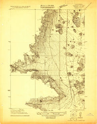
 1921 Shasta Valley Sheet No 71921 Print · USGSShasta Valley was undergoing significant irrigation planning in the early 1920s as ranching families established themselves in Siskiyou County. You can trace early water sources and landholdings like Dukes Ranch, Big Springs, and the Little Shasta River.
 - 1921 Map of Shasta Valley Sheet No 11
 1921 Shasta Valley Sheet No 111921 Print · USGSSiskiyou County irrigation and reclamation efforts were in full swing during the early twenties as engineers mapped this volcanic landscape. Researchers can trace the early rural footprint of the valley near Table Rock School and the prominent Bluff.
 - 1921 Map of Shasta Valley Sheet No 1
 1921 Shasta Valley Sheet No 11921 Print · USGSShasta Valley at the dawn of the 1920s reveals a landscape defined by the iron rails and early automobile routes of Siskiyou County. Trace the development of Gazelle along the Southern Pacific (Shasta Route) and the historic Pacific Highway.
 - 1921 Map of Shasta Valley Sheet No 6
 1921 Shasta Valley Sheet No 61921 Print · USGSIn the Siskiyou hills during the early 1920s, this survey reveals a unique landscape of volcanic hummocks and scattered ranching. Researchers can locate the original Big Springs School and trace the early course of the Shasta River through the Little Shasta Valley.
 - 1921 Map of Shasta Valley Sheet No 2
 1921 Shasta Valley Sheet No 21921 Print · USGSSiskiyou County irrigation and transportation are evolving in the early 1920s as rail and highway routes converge near the valley floor. Researchers can trace the path of the Old Yreka Mining Ditch or locate early rural education sites like Excelsior School and Vineland School.
 - 1922 Map of Shasta Valley Sheet No 10
 1922 Shasta Valley Sheet No 101922 Print · USGSSiskiyou County's volcanic terrain and early 1920s development are captured here during a period of significant irrigation and power planning. Genealogists and historians can locate the Shasta View School and trace the original path of the Pacific Branch railroad.
 - 1922 Map of Shasta Valley Sheet No 10 E
 1922 Shasta Valley Sheet No 10 E1922 Print · USGSSiskiyou County's volcanic landscape is captured here in the early 1920s during a pivotal era of land reclamation. Researchers can trace the subterranean orientation of The Caves and the significant landmark of Yellow Butte.
 - 1922 Map of Preston Peak
 1922 Preston Peak1922 Print · USGSThe California-Oregon borderlands are mapped here just before the era of modern highway expansion, showing a network of remote river bars and mountain ranches. Trace the locations of early outposts like Gasquet Adams Sta, the Cleopatra Mine, and Terwer School.5 unique versions available
 - 1922 Map of Shasta Valley Sheet No 12
 1922 Shasta Valley Sheet No 121922 Print · USGSSiskiyou County irrigation and reclamation efforts are captured in the early 1920s during a detailed survey of the Shasta Valley. Researchers can trace the course of Little Shasta and locate landmarks like Black Rock and Solomons Temple.
Showing maps 1-25 of 1,020
Top cities of Siskiyou County
- Yreka historical maps
- Mount Shasta historical maps
- Weed historical maps
- Dunsmuir historical maps
- Montague historical maps
- Tulelake historical maps
See more
Frequently asked questions
- What are the different types of historical maps available for Siskiyou County?
- What is the oldest map of Siskiyou County?
- Where can I purchase historical maps of Siskiyou County for my home or office?
- Where can I download high-res historical maps of Siskiyou County?
- Are there historical topographic maps available for Siskiyou County?
- Is there historical aerial imagery available for Siskiyou County?
- Where are historical maps of Siskiyou County sourced from?