1980s Maps of Siskiyou County, California
Explore 123 historic maps of Siskiyou County from the 1980s. These maps offer a rare glimpse into what life looked like during the 1980s — showing old roads, neighborhoods, homes, and landmarks that have changed or disappeared over time.
Whether you're researching your family's past, planning a metal detecting trip, or studying how Siskiyou County's landscape evolved across the 1980s, these high-resolution maps are a powerful tool for exploring the history of this region.
- Focus on a specific era: All maps on this page are from the 1980s, giving you a focused view of this time period.
- See what’s changed: Compare century-old streets, trails, and buildings to today's modern landscape using overlays and satellite layers.
- Research with precision: Use these maps for genealogy, historical research, land use analysis, or educational projects.
- View, download, or print: Maps are fully viewable online in high resolution, and can be downloaded or printed for your own records.
Start exploring Siskiyou County's history through authentic maps from the 1980s. This is your window into the past.
Siskiyou County, CA maps
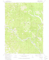
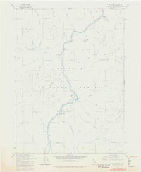
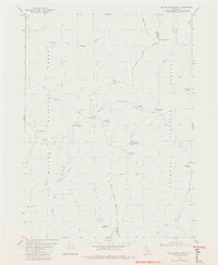
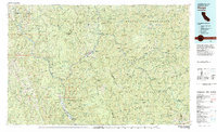
(123)- 1980 Map of Dutch Creek
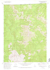
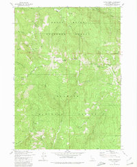 1980 Dutch Creek1980 Print · USGSSiskiyou County's high ridges are captured in the early 1980s as the wilderness was managed for both mining and recreation. Trace local history through Blue Ledge Mine, Knutzen Cabin, and the former Johnsons Dairy.2 unique versions available
 - 1980 Map of Huckleberry Mtn.
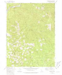
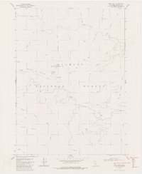
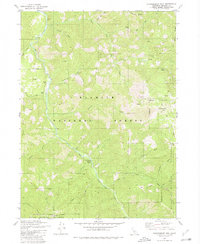 1980 Huckleberry Mtn.1980 Print · USGSSiskiyou County as it appeared in the 1980s is captured here through its remote forest camps and high-elevation ridgelines. Researchers can locate named sites like the settlement at Hoskin., Johnsons Hunting Grounds, and the waters of Sulphur Springs.
 - 1980 Map of Kangaroo Mtn.
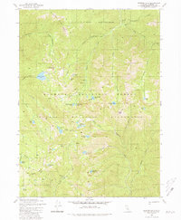
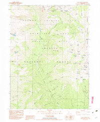
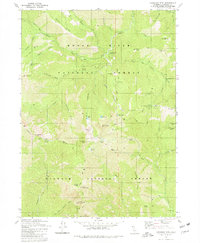 1980 Kangaroo Mtn.1980 Print · USGSThe high Siskiyou Mountains backcountry is captured here in the 1980s, marking the border between two major national forests. Hikers and historians can trace the Pacific Crest National Scenic Trail past remote sites like No-See-Um Camp and Hello Lake.2 unique versions available
 - 1980 Map of Scott Bar
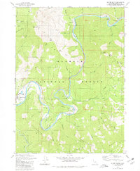
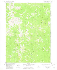
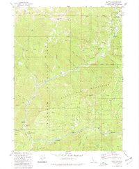 1980 Scott Bar1980 Print · USGSThe Scott River corridor in northern Siskiyou County is shown here in the 1980s, documenting a landscape of mountain forestry and riverside recreation. Genealogists and historians can trace local landmarks like Scott Bar, a riverside Grave, and numerous backcountry sites from Gold Flat to Beauty Flat.
 - 1980 Map of Hamburg
 1980 Hamburg1980 Print · USGSThe Klamath and Scott Rivers meet in the rugged Siskiyou backcountry during the late 1970s. Trace the history of mining and mountain life at Hamburg, Ladd Mine, and the Horse Creek Cemetery.
 - 1980 Map of Slater Butte
 1980 Slater Butte1980 Print · USGSThe Klamath River corridor in Siskiyou County is shown here in the 1980s, documenting a landscape shaped by mining and forestry. Researchers can trace historical gold operations at the China Creek Mine (Site), the Muck a Muck Mine (Site), and the settlement at Happy Camp.
 - 1980 Map of Marble Mountain
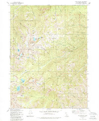
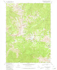 1980 Marble Mountain1980 Print · USGSThe high backcountry of Siskiyou County is captured in the early eighties as a protected wilderness within the Klamath National Forest. Hikers and historians can trace the Pacific Crest National Scenic Trail past remote landmarks like Kings Castle and Shadow Lake.3 unique versions available
 - 1980 Map of Happy Camp, 1981 Print
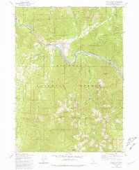
 1980 Happy Camp1981 Print · USGSThe Klamath River corridor near the Oregon border is captured here in the early eighties as it flows past the remote settlement of Happy Camp. Researchers can trace forest access via 4 WD trails to landmarks like the Lookout Tower on Baldy Mtn or the riverside Happy Camp Airport.
 - 1980 Map of Figurehead Mtn, 1981 Print
 1980 Figurehead Mtn1981 Print · USGSThe high Siskiyou backcountry at the turn of the 1980s is captured here, showing where Oregon and California meet among three national forests. Researchers can trace the remote Baileys Cabin (Site), the Mohawk Mine Gulch, and the Bee Flat Trail.2 unique versions available
 - 1980 Map of Ukonom Mountain, 1981 Print
 1980 Ukonom Mountain1981 Print · USGSThe Klamath River corridor and the high backcountry of Siskiyou County are mapped here in the early eighties. Researchers can trace historic mountain routes near Jacobs Ladder, Stanshaw Meadows, and Jims Camp.
 - 1980 Map of Ukonom Lake, 1981 Print
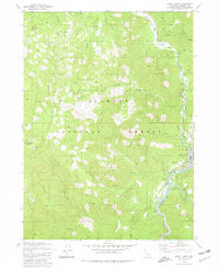
 1980 Ukonom Lake1981 Print · USGSThe Siskiyou high country comes into focus in the early 1980s, centered on the protected reaches of the Klamath National Forest. Researchers can trace historic access points like Pickle Camp and Horse Pocket, and locate remote alpine waters such as Ukonom Lake.2 unique versions available
 - 1980 Map of Seiad Valley, 1981 Print
 1980 Seiad Valley1981 Print · USGSThe Klamath River valley comes into focus during the early eighties, showing the settlement of Seiad Valley and the Pacific Crest National Scenic Trail. Trace family-named landmarks like Grider Creek Ranch or the remote Hoags Camp East Fork Walker Creek.2 unique versions available
 - 1981 Map of Clear Creek
 1981 Clear Creek1981 Print · USGSThe Klamath River corridor in the early 1980s reveals a rugged landscape defined by its mining history and river crossings. Researchers can trace the legacy of resource extraction through sites like the Siskiyou Mine and Buzzard Hill Mine, or locate former river landmarks like Ferry Pt.2 unique versions available
 - 1981 Map of Boulder Peak
 1981 Boulder Peak1981 Print · USGSHigh in the Siskiyou mountains in the early eighties, this wilderness survey shows a landscape of alpine lakes and pack trails. Researchers can trace the original route of the Pacific Crest Scenic Trail past Boulder Peak and through the Marble Mountain Wilderness.2 unique versions available
 - 1981 Map of Chimney Rock
 1981 Chimney Rock1981 Print · USGSHigh in the Siskiyou Mountains during the early eighties, this survey captures the intersection of two national forests and their historical camps. Researchers can trace old sites like Rose Camp (Site), locate the Siskiyou Mine, and map the remote Forks of Blue settlement.
 - 1981 Map of Deadman Point
 1981 Deadman Point1981 Print · USGSIn the early 1980s, the Siskiyou County backcountry was a landscape of deep timber and active mineral claims along the Oregon border. Trace the history of remote mountain extraction through sites like the Classic Hill Mine, Huey Mine, and the West Branch FS Station.3 unique versions available
 - 1981 Map of Grider Valley
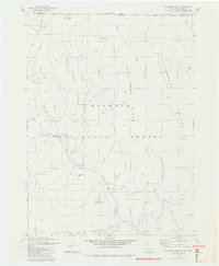
 1981 Grider Valley1981 Print · USGSSiskiyou County's high backcountry is shown in the early eighties as a primitive landscape defined by the Pacific Crest National Scenic Trail. Trace historic routes and remote water sources including the Kelsey Trail, Maple Falls, and Turk Lake.2 unique versions available
 - 1981 Map of Devils Punchbowl, 1982 Print
 1981 Devils Punchbowl1982 Print · USGSThe high backcountry of Del Norte and Siskiyou counties is documented here in the early 1980s at the junction of three National Forests. Backcountry researchers can locate the Prescott Cabin ruins, the high waters of Devils Punchbowl, and the remote Trout Camp.4 unique versions available
 - 1981 Map of Prescott Mountain, 1982 Print
 1981 Prescott Mountain1982 Print · USGSThe Del Norte and Siskiyou county line runs through these national forest lands in the early 1980s. Researchers and hikers can locate remote landmarks such as the Bear Wallows Shelter, Harrington Lake, and the summit of Prescott Mtn.
 - 1982 Map of Broken Rib Mtn
 1982 Broken Rib Mtn1982 Print · USGSThe Oregon-California borderlands are captured here in the early eighties, showcasing a wilderness of high peaks and river forks. Researchers can trace the path of the Randolph Collier Tunnel, find the Camp Chicago (Site), and locate remote points like Stevens Camp.2 unique versions available
 - 1982 Map of Polar Bear Mountain
 1982 Polar Bear Mountain1982 Print · USGSThe high Siskiyou mountains straddle the California-Oregon border in the early 1980s, where national forest boundaries meet. Researchers can locate remote mining sites like Orloff Mine and isolated landmarks such as Porters Camp, Sutcliffe Falls, and Polar Bear Mtn.
 - 1982 Map of Bear Peak
 1982 Bear Peak1982 Print · USGSThe high ridges of the Siskiyou Mountains are captured here in the early 1980s, showcasing a landscape of dense forests and mountain peaks. Researchers can locate remote landmarks such as Bear Peak, the KELSEY RANGE, and Lower Bear Lake.2 unique versions available
 - 1982 Map of Siligo Peak
 1982 Siligo Peak1982 Print · USGSThe Trinity Alps high country is captured here in the early eighties, before modern wilderness designations changed its management. Local historians can trace early mining footprints at the Globe Mine or locate historical seasonal sites like the Longs Cabin (Site) and Portuguese Camp.2 unique versions available
 - 1982 Map of Preston Peak
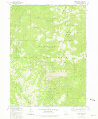
 1982 Preston Peak1982 Print · USGSHigh in the Siskiyou Mountains during the early 1980s, this area of the Klamath National Forest remained a rugged backcountry of ridges and peaks. Researchers can locate remote landmarks like Preston Peak, the isolated Raspberry Lake, and the historic site of an unnamed Mine near Cyclone Gap.
 - 1983 Map of Hoopa
 1983 Hoopa1983 Print · USGSThe Klamath and Trinity Rivers converge in the early eighties at Weitchpec, carving through a landscape of national forests and the Hoopa Indian Reservation. Researchers can trace remote settlements like Orleans and Cecilville or locate landmarks like Tish Tang Creek and English Peak.
Showing maps 1-25 of 123
Top cities of Siskiyou County
- Yreka historical maps
- Mount Shasta historical maps
- Weed historical maps
- Dunsmuir historical maps
- Montague historical maps
- Tulelake historical maps
See more
Frequently asked questions
- What are the different types of historical maps available for Siskiyou County?
- What is the oldest map of Siskiyou County?
- Where can I purchase historical maps of Siskiyou County for my home or office?
- Where can I download high-res historical maps of Siskiyou County?
- Are there historical topographic maps available for Siskiyou County?
- Is there historical aerial imagery available for Siskiyou County?
- Where are historical maps of Siskiyou County sourced from?