1900s (20th Century) Maps of Costilla County, Colorado
Explore 49 historic maps of Costilla County from the 1900s (20th Century). These maps offer a rare glimpse into what life looked like during the 1900s — showing old roads, neighborhoods, homes, and landmarks that have changed or disappeared over time.
Whether you're researching your family's past, planning a metal detecting trip, or studying how Costilla County's landscape evolved across the 1900s, these high-resolution maps are a powerful tool for exploring the history of this region.
- Focus on a specific era: All maps on this page are from the 1900s, giving you a focused view of this time period.
- See what’s changed: Compare century-old streets, trails, and buildings to today's modern landscape using overlays and satellite layers.
- Research with precision: Use these maps for genealogy, historical research, land use analysis, or educational projects.
- View, download, or print: Maps are fully viewable online in high resolution, and can be downloaded or printed for your own records.
Start exploring Costilla County's history through authentic maps from the 1900s. This is your window into the past.
Costilla County, CO maps
(49)- 1954 Map of Raton, 1963 Print
 1954 Raton1963 Print · USGSNorthern New Mexico's high-country and plains are documented here in the early sixties, showing the region's ranching and mining infrastructure. Trace the legacy of the Maxwell Land Grant, locate remote rural sites like Tafoya School, and follow the Atchison Topeka and Santa Fe Railway through the heart of Raton.3 unique versions available
 - 1954 Map of Trinidad, 1963 Print
 1954 Trinidad1963 Print · USGSSouthern Colorado is captured here during the mid-fifties, showing the vital rail-and-river connections between the San Luis Valley and the eastern foothills. Researchers can trace the Denver and Rio Grande Western line and locate rural landmarks like Malachite School and San Luis.2 unique versions available
 - 1955 Map of Trinidad, 1976 Print
 1955 Trinidad1976 Print · USGSSouthern Colorado during the mid-fifties is defined by the high-altitude agriculture of the San Luis Valley and the peaks of the Culebra Range. Genealogists can trace early settlements and rural schoolhouses like Medina Plaza, San Luis, and the Trujillo Creek School.
 - 1958 Map of Raton
 1958 Raton1958 Print · USGSNorthern New Mexico and the Colorado borderlands are mapped here in the late fifties, showcasing a landscape of high peaks and historic land grants. Genealogists and historians can trace families across Picuris Pueblo, find old schoolhouses like Piedra Lumbre School, or follow the Atchison Topeka and Santa Fe rail line.3 unique versions available
 - 1958 Map of Trinidad
 1958 Trinidad1958 Print · USGSSouthern Colorado in the late fifties was a landscape of high-altitude agriculture and coal production, centered on the San Luis Valley. Local historians can trace old community centers like the Malachite School or follow the mining and rail activity near Walsenburg and the Allen Mine.
 - 1959 Map of Trinidad
 1959 Trinidad1959 Print · USGSThe San Luis Valley and the high Sangre de Cristo peaks are documented here in the late fifties, during a period of steady ranching and rail activity. Genealogy researchers can locate family-named landmarks and rural institutions like Trujillo Creek School and the historic San Luis settlement.
 - 1962 Map of Ash Mountain, 1964 Print
 1962 Ash Mountain1964 Print · USGSThe Sangre de Cristo Mountains and the historic Maxwell Land Grant are captured here in the early sixties. Researchers can trace high-altitude ranching and mining history through sites like the Van Lint Mine, Penatlor Ruins, and family-named landmarks like Banning Place.3 unique versions available
 - 1963 Map of Mc Carty Park, 1966 Print
 1963 Mc Carty Park1966 Print · USGSHigh in the Sangre de Cristo range during the early sixties, this map captures the remote transition between mountain peaks and rail corridors. You can trace the Denver and Rio Grande Western railroad line past Codo or locate the remote Mc Carty Cow Camp.5 unique versions available
 - 1963 Map of La Veta Pass, 1966 Print
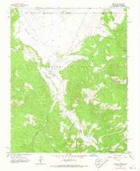
 1963 La Veta Pass1966 Print · USGSThe Sangre de Cristo Mountains in the early sixties reveal a complex web of high-altitude transit through Huerfano and Costilla counties. Researchers can trace the legendary Denver and Rio Grande Western rail line and the historic Wagon Toll Road.7 unique versions available
 - 1963 Map of Costilla, 1967 Print
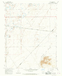
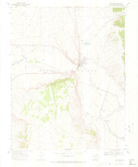
 1963 Costilla1967 Print · USGSThe Colorado-New Mexico borderlands in the early 1960s reveal a landscape defined by traditional irrigation and ranching. Genealogists and historians can trace family-named water systems like Acequia Madre and Cordillera Ditch near the village of Costilla.3 unique versions available
 - 1963 Map of Amalia, 1967 Print
 1963 Amalia1967 Print · USGSTaos County’s high mountain valleys are captured in the early sixties as they transition into the modern era. Genealogists and local historians can trace the community life of the region through landmarks like Santo Niño Ch, Amalia Sch, and the isolated Mine sites near Ballejos Creek.2 unique versions available
 - 1963 Map of Ute Mountain, 1967 Print
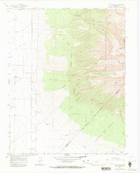
 1963 Ute Mountain1967 Print · USGSThe volcanic heights of the Sangre De Cristo range meet the New Mexico-Colorado border in the early 1960s. Researchers can trace the dramatic Cañon Del Rio Grande, a remote Landing Strip, and the historic Grant Boundary.3 unique versions available
 - 1963 Map of Big Costilla Peak, 1968 Print
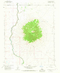
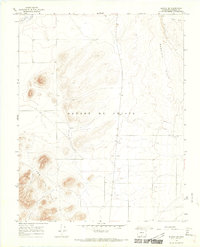
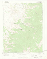
 1963 Big Costilla Peak1968 Print · USGSThe high alpine country of the New Mexico-Colorado border is captured in the early sixties, centered on the towering Big Costilla Peak. Researchers can trace remote mountain locations such as Costilla Lodge, the Seven Lakes, and Costilla Reservoir.3 unique versions available
 - 1965 Map of Blanca, 1968 Print
 1965 Blanca1968 Print · USGSThe San Luis Valley landscape comes into focus during the mid-sixties, centered on the railroad town of Blanca. Researchers can trace irrigation patterns and early transport hubs like the Denver and Rio Grande Western rail line and the Blanca Municipal Airport.3 unique versions available
 - 1965 Map of Baldy, 1968 Print
 1965 Baldy1968 Print · USGSThe San Luis Valley in the mid-1960s is defined here by its wetland conservation and artesian water systems. Researchers can trace the Denver and Rio Grande Western rail line through Baldy or locate the historic Grant Boundary.2 unique versions available
 - 1965 Map of Lasauses, 1968 Print
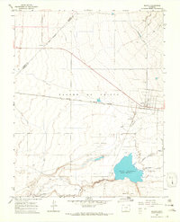
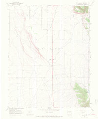
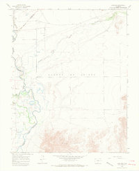 1965 Lasauses1968 Print · USGSThe San Luis Valley in the mid-1960s shows a landscape of high-altitude hydrology where the Rio Grande meets the Conejos River. Genealogists and historians can locate the Lasauses settlement, the Becker Cem, and several flowing wells along the Trinchera Creek.3 unique versions available
 - 1965 Map of Blanca SE, 1968 Print
 1965 Blanca SE1968 Print · USGSCostilla County was a landscape of volcanic ridges and vital irrigation systems in the mid-sixties. Genealogists and researchers can trace the movement of water and power through the Trinchera Canal and find local landmarks like the Substa.3 unique versions available
 - 1965 Map of Twin Peaks, 1968 Print
 1965 Twin Peaks1968 Print · USGSAlamosa and Costilla counties meet along the high ridges of the Sangre de Cristo Range during the mid-sixties. Genealogists and hikers can trace early regional markers like the Pioneer Urraca Cem, the Swab Mine, and remote waters such as Lake Como.3 unique versions available
 - 1967 Map of San Luis, 1970 Print
 1967 San Luis1970 Print · USGSThe Colorado high desert and Sangre de Cristo foothills come into focus in the late sixties, showcasing the historic acequia systems of the Culebra river valley. Trace family roots and land patterns across San Luis, San Pedro, and the San Pedro Cem.4 unique versions available
 - 1967 Map of La Valley, 1970 Print
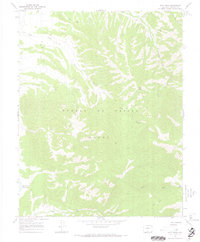
 1967 La Valley1970 Print · USGSThe settlement of La Valley and the vast Sangre De Cristo Grant appear here as they were in the late 1960s. Researchers can trace historical water rights and land use along Vallejos Creek, San Francisco Creek, and the remote Jeep Trail.3 unique versions available
 - 1967 Map of Fort Garland SW, 1970 Print
 1967 Fort Garland SW1970 Print · USGSThe San Luis Valley in the late sixties shows a landscape of expansive land grants and essential irrigation. Trace the water systems of the Trinchera Canal or locate the Escheman Landing Strips and Willow Creek Reservoir.5 unique versions available
 - 1967 Map of Ojito Peak, 1970 Print
 1967 Ojito Peak1970 Print · USGSHigh in the Colorado Rockies during the late sixties, this area shows the rugged character of the Sangre De Cristo Grant. Researchers can trace old mountain routes like the Jeep Trail and locate isolated landmarks like the high-altitude Mine or Big Meadow.4 unique versions available
 - 1967 Map of Mosca Pass, 1970 Print
 1967 Mosca Pass1970 Print · USGSThe Sangre de Cristo high country during the late sixties features a network of pack trails and alpine reservoirs. Trace historical routes through Mosca Pass and locate isolated landmarks like Singing River Ranch and Montez Reservoir.3 unique versions available
 - 1967 Map of Blanca Peak, 1971 Print
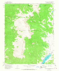
 1967 Blanca Peak1971 Print · USGSHigh in the southern Rockies during the late sixties, this survey captures the towering terrain where three counties meet. Trace high-altitude mining efforts and mountain landmarks like Blanca Peak, Mount Lindsey, and Arrowhead Ranch.7 unique versions available
 - 1967 Map of Trinchera Ranch, 1971 Print
 1967 Trinchera Ranch1971 Print · USGSThe Sangre de Cristo foothills in the late sixties reveal a landscape of early rail history and mountain water management. Genealogists can trace the Denver and Rio Grande corridor and find the Garland City (Site) and a local Cem.3 unique versions available
Showing maps 1-25 of 49
Top cities of Costilla County
Frequently asked questions
- What are the different types of historical maps available for Costilla County?
- What is the oldest map of Costilla County?
- Where can I purchase historical maps of Costilla County for my home or office?
- Where can I download high-res historical maps of Costilla County?
- Are there historical topographic maps available for Costilla County?
- Is there historical aerial imagery available for Costilla County?
- Where are historical maps of Costilla County sourced from?