1900s (20th Century) Maps of Monroe County, Florida
Explore 110 historic maps of Monroe County from the 1900s (20th Century). These maps offer a rare glimpse into what life looked like during the 1900s — showing old roads, neighborhoods, homes, and landmarks that have changed or disappeared over time.
Whether you're researching your family's past, planning a metal detecting trip, or studying how Monroe County's landscape evolved across the 1900s, these high-resolution maps are a powerful tool for exploring the history of this region.
- Focus on a specific era: All maps on this page are from the 1900s, giving you a focused view of this time period.
- See what’s changed: Compare century-old streets, trails, and buildings to today's modern landscape using overlays and satellite layers.
- Research with precision: Use these maps for genealogy, historical research, land use analysis, or educational projects.
- View, download, or print: Maps are fully viewable online in high resolution, and can be downloaded or printed for your own records.
Start exploring Monroe County's history through authentic maps from the 1900s. This is your window into the past.
Monroe County, FL maps
(110)- 1921 Map of Sugar Loaf Key
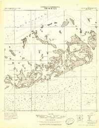 1921 Sugar Loaf Key1921 Print · USGSThe Lower Florida Keys are captured here in the early twentieth century before modern development transformed the island chain. Maritime researchers and genealogists can trace the original shorelines of Sugarloaf Key, Cudjoe Key, and family-named landmarks like Mallorys Key.2 unique versions available
 - 1921 Map of Key West
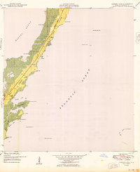
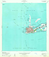
 1921 Key West1921 Print · USGSKey West at the end of the Florida East Coast Railway era is meticulously detailed in this early twentieth-century tactical survey. You can trace the island's coastal defenses at the E. Martello Tower and locate maritime landmarks like the N.W. Bar Light.
 - 1943 Map of Bay Keys
 1943 Bay Keys1943 Print · USGSThe shallow waters north of Key West are captured in the 1940s as a series of navigational channels and mangroves. Maritime researchers can trace early survey markers like Tidal Bm 2 and passages through Bay Keys and Bluefish Channel.
 - 1943 Map of Saddlebunch Keys
 1943 Saddlebunch Keys1943 Print · USGSMonroe County’s island chain is captured during the war years as the modern overseas route was still taking shape. Maritime researchers can trace essential coastal markers like American Shoal Lighthouse and the early layout of Sugaloa Beach.2 unique versions available
 - 1943 Map of Boca Chica
 1943 Boca Chica1943 Print · USGSThe Lower Keys are captured here during the Second World War as modern infrastructure begins to reshape the archipelago. Researchers can trace the development of Boca Chica Airport and early roads connecting Stock Island, Big Coppitt Key, and the Sugar Loaf Club.
 - 1943 Map of Key West
 1943 Key West1943 Print · USGSKey West was a fortified maritime center during the war years, serving as a vital strategic link between the Gulf and the Atlantic. Researchers can locate military landmarks like Fort Taylor and Meacham Field, alongside old harbor features such as Key West Bight and Trumbo Island.3 unique versions available
 - 1943 Map of Snipe Keys
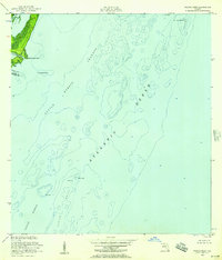
 1943 Snipe Keys1943 Print · USGSMonroe County's maritime landscape appears in high detail during the early 1940s, documenting the intricate network of islands and channels before modern development. Maritime researchers can trace historic landmarks like Old Dan Mangrove, Coon Key, and the navigational reaches of Turkey Basin.2 unique versions available
 - 1943 Map of Sugarloaf Key
 1943 Sugarloaf Key1943 Print · USGSThe Florida Keys during the early 1940s are seen here as infrastructure begins to reshape the maritime landscape. Researchers can locate the settlement at Perky, trace the highway route under construction, and find landmarks at Pirates Cove.3 unique versions available
 - 1943 Map of Cottrell Key, 1952 Print
 1943 Cottrell Key1952 Print · USGSMonroe County's lower islands are captured here during the 1940s, showing the remote coastal landscape as it existed before significant modern development. Maritime researchers can locate early navigational marks like the NW Passage Bn (Old Tower) and trace the natural shorelines of Boca Grande Key and Woman Key.
 - 1947 Map of Garden Cove, 1964 Print
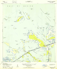
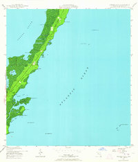 1947 Garden Cove1964 Print · USGSThe upper Florida Keys are captured here in the late 1940s, showing a sparsely populated shoreline before the era of major resort development. Researchers can trace coastal landmarks like Garden Cove, the small settlement at Knowlson, and isolated inland waters such as Lake Surprise.3 unique versions available
 - 1947 Map of Rock Harbor, 1965 Print
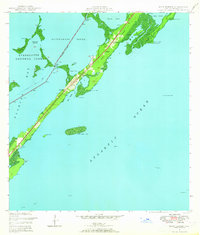 1947 Rock Harbor1965 Print · USGSUpper Key Largo in the late 1940s reveals a string of small island settlements and coastal outposts before the era of major resort expansion. Genealogists and historians can trace the foundations of Rock Harbor, find local landmarks like St Margarets Ch, or locate the specific shorelines of Tarpon Basin and Largo Sound.4 unique versions available
 - 1947 Map of Blackwater Sound, 1967 Print
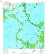 1947 Blackwater Sound1967 Print · USGSThe upper Florida Keys and the southeastern reaches of the Everglades are mapped here just after the war. Researchers can trace the early path of the Overseas Highway across Cross Key and locate early coastal landmarks like Jewfish Creek and Largo Point.3 unique versions available
 - 1949 Map of Blackwater Sound
 1949 Blackwater Sound1949 Print · USGSThe Upper Florida Keys appear here in the late 1940s, showing the early infrastructure of the Overseas Highway. Researchers can trace the original route through Cross Key and locate early coastal sites like Anglers Park and Jewfish Creek.
 - 1949 Map of Rock Harbor
 1949 Rock Harbor1949 Print · USGSUpper Key Largo in the late 1940s shows a landscape of small coastal settlements and crucial navigational markers. Trace the early footprints of Newport, Rock Harbor, and Sawyer alongside local landmarks like St Margarets Ch and the Intracoastal Waterway.2 unique versions available
 - 1949 Map of Garden Cove
 1949 Garden Cove1949 Print · USGSThe northern reaches of the Florida Keys are documented in the late 1940s, showing a landscape defined by small settlements and vital maritime markers. Researchers can trace early property sites like Knowlson and White, or locate coastal features such as Garden Cove and Rattlesnake Key.2 unique versions available
 - 1949 Map of Card Sound
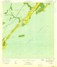
 1949 Card Sound1949 Print · USGSUpper Key Largo and the sounds of Monroe County are shown here in the late 1940s before major modern expansion. Trace the early layout of the Key Largo Club, the settlement of Grayvik, and the natural labyrinth of Crocodile Lake and Angelfish Creek.
 - 1949 Map of Pacific Reef
 1949 Pacific Reef1949 Print · USGSThe Florida Keys and the reef line appear just after the war as a network of critical maritime passages and navigational aids. Maritime historians can trace the deep-water Turtle Harbor Channel and locate the iconic Pacific Reef Lighthouse near Old Rhodes Key.2 unique versions available
 - 1950 Map of Glades
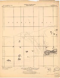
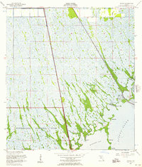
 1950 Glades1950 Print · USGSThe Florida coast at mid-century reveals a landscape defined by the intersection of marsh and sea. Researchers can trace the path of the Old Dixie Highway and locate coastal landmarks like Narrow Point and Manatee Bay.
 - 1956 Map of Card Sound, 1957 Print
 1956 Card Sound1957 Print · USGSMonroe County and the northern tip of Key Largo are captured here in the mid-fifties, showing the early infrastructure of the Upper Keys. Researchers can trace the development of the Ocean Reef Club, the Grayvik settlement, and the remote Landing Field among the mangroves.5 unique versions available
 - 1956 Map of Pacific Reef, 1957 Print
 1956 Pacific Reef1957 Print · USGSThe northern Florida Keys in the mid-fifties reveal a world of coral heads and shallow channels where Dade and Monroe counties meet. Trace the hazardous coastal navigation routes past the Pacific Reef Lighthouse, Turtle Reef, and Old Rhodes Point.2 unique versions available
 - 1956 Map of Glades, 1957 Print
 1956 Glades1957 Print · USGSCoastal Miami-Dade and Monroe Counties are captured in the mid-1950s as a landscape of vast wetlands and developing transit corridors. Researchers can trace the path of the Old Dixie Highway and locate local landmarks like the Quarry and Main Key.4 unique versions available
 - 1956 Map of Miami, 1963 Print
 1956 Miami1963 Print · USGSSouthern Florida experiences post-war expansion in the 1950s, even as the wilderness remains dominant across the southern peninsula. Genealogists and historians can trace suburban growth in Opa-locka and Perrine or locate remote sites like the Tamiami Ranger Station.5 unique versions available
 - 1958 Map of Miami
 1958 Miami1958 Print · USGSSoutheast Florida in the late fifties reveals a coastal boom held in balance with the wild sawgrass and mangroves of Everglades National Park. Trace the paths of the Florida East Coast RR through Homestead or locate the U S Marine Corps Air Station during the height of the Cold War.
 - 1962 Map of Key West
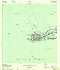
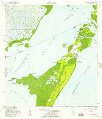
 1962 Key West1962 Print · USGSKey West at the start of the sixties reveals a unique landscape where military readiness and island life converged. Genealogists and historians can trace the evolution of Key West Island through landmarks like Fort Taylor, Meacham Field, and Stock I.
 - 1963 Map of Cottrell Key
 1963 Cottrell Key1963 Print · USGSThe remote Florida Keys west of Key West are captured in the mid-twentieth century as a network of isolated islands and navigational towers. Maritime historians can trace coastal features across Boca Grande Key, Woman Key, and the historic NW Passage Bn (Old Tower).
Showing maps 1-25 of 110
Top cities of Monroe County
- Key West historical maps
- Key Largo historical maps
- Marathon historical maps
- Islamorada historical maps
- Big Pine Key historical maps
- Key Colony Beach historical maps
See more
Frequently asked questions
- What are the different types of historical maps available for Monroe County?
- What is the oldest map of Monroe County?
- Where can I purchase historical maps of Monroe County for my home or office?
- Where can I download high-res historical maps of Monroe County?
- Are there historical topographic maps available for Monroe County?
- Is there historical aerial imagery available for Monroe County?
- Where are historical maps of Monroe County sourced from?