Old Maps of Sheridan County, Kansas for Academic Research
Study the evolution of Sheridan County with 126 high-resolution historic maps. Whether you're teaching, researching, or modeling changes in land use, these maps provide essential visual documentation of urban, environmental, and geographic change.
- Analyze long-term change: Track patterns in development, transportation, and natural features.
- Ideal for environmental or urban studies: Support academic projects with primary historical map data.
- Use in the classroom or lab: Educators and researchers rely on these maps to bring historical context to life.
These maps are a powerful tool for teaching, research, and visualizing how Sheridan County has changed over the decades.
Sheridan County, KS maps
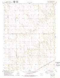
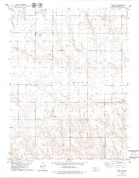
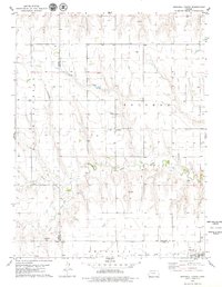
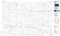
(126)- 1951 Map of Selden, 1952 Print
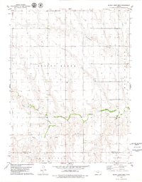
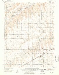 1951 Selden1952 Print · USGSNorthwestern Kansas farmland is depicted here in the early fifties, centered on the railroad hub of Selden. Genealogists can trace a remarkable number of rural landmarks, from Shibboleth Ch to schools like Welsh Sch and North Valley Sch.2 unique versions available
 - 1954 Map of Goodland, 1976 Print
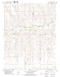
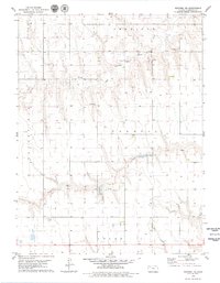
 1954 Goodland1976 Print · USGSNorthwest Kansas comes into focus during the mid-1950s, showing a landscape defined by its vital river forks and thriving rail towns. Researchers can trace the path of the Union Pacific through Colby or locate historic parks like Sheridan Co State Park.
 - 1956 Map of Goodland
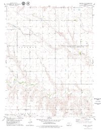
 1956 Goodland1956 Print · USGSThe high plains of Northwest Kansas in the mid-fifties reveal a landscape of river-fed agriculture and expanding rail networks. Genealogists and historians can trace the development of county seats like Goodland and Atwood or locate landmarks such as the Arikaree Breaks.
 - 1957 Map of Goodland
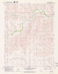
 1957 Goodland1957 Print · USGSNorthwest Kansas in the mid-1950s shows a landscape of high plains agriculture and vital rail junctions. Researchers can trace the river-valley settlements from Goodland to Oberlin and follow the paths of the Union Pacific and Sappa Creek.2 unique versions available
 - 1978 Map of Clayton SW
 1978 Clayton SW1978 Print · USGSNorthwest Kansas in the late seventies is captured here at the junction of four counties. Researchers can trace land use through local markers like the Allison Ch and Roadside Park, while genealogists will find the boundaries of Adell and Allodium helpful for locating family homesteads.
 - 1978 Map of Allison, 1979 Print
 1978 Allison1979 Print · USGSNorthwestern Kansas plains meet the winding North Fork Solomon River in this late-seventies survey of the Decatur and Sheridan county line. Researchers can locate local landmarks like McGraw Ch, Adell Cem, and the industry of the Oil Field.
 - 1978 Map of Selden, 1979 Print
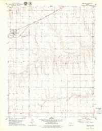
 1978 Selden1979 Print · USGSThe Kansas High Plains are captured here in the late seventies, centered on the railroad town of Selden. Genealogists and local historians can trace the paths of the Chicago Rock Island and Pacific and locate the local Cem and Roadside Park.
 - 1978 Map of Selden SW, 1979 Print
 1978 Selden SW1979 Print · USGSNorthwest Kansas in the late 1970s shows a high-plains landscape defined by section-line roads and the vital waterways of the prairie. Researchers can locate the Hawkeye Cem, the rail siding at Laing, and the route of the Chicago Rock Island and Pacific railroad.
 - 1978 Map of Dresden South, 1979 Print
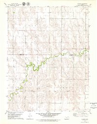
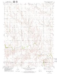
 1978 Dresden South1979 Print · USGSSheridan and Decatur counties are captured here in the late seventies, showing the rural landscape as the railway era persisted. Researchers can locate family sites near Leoville, trace the Chicago Rock Island and Pacific line, or find the Cem and North Fork Solomon River.
 - 1979 Map of Lucerne
 1979 Lucerne1979 Print · USGSThe small community of Lucerne and its surrounding prairie landscape are documented here in the late seventies. Family historians and researchers can trace the course of Bow Creek and locate early Oil Field developments and isolated Wells.
 - 1979 Map of Menlo
 1979 Menlo1979 Print · USGSMenlo and its surrounding High Plains farmland are captured here in the late seventies, centered on the Union Pacific rail line. Researchers can trace local landmarks like the Menlo Cem, the settlement of Nash, and the South Fork Solomon River.
 - 1979 Map of Midway Draw West
 1979 Midway Draw West1979 Print · USGSSheridan and Gove Counties are captured in the late seventies, showing a landscape defined by the winding Saline River and open range. Researchers can trace the industrial footprints of rural Kansas at Gravel Pits, Sandpits, and the agricultural tracts of Grainfield.
 - 1979 Map of Midway Draw East
 1979 Midway Draw East1979 Print · USGSWestern Kansas ranchland and river breaks are captured in the late 1970s along the Sheridan and Gove County line. Researchers can trace the drainage patterns of Midway Draw and Leeds Draw as they feed into the Saline River valley.
 - 1979 Map of Rexford
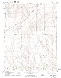
 1979 Rexford1979 Print · USGSRexford sits at a vital rail and highway junction in Northwest Kansas during the late seventies. Researchers can trace the layout of the town and its Rexford center, locate the Rexford Cem, and follow the path of the Chicago Rock Island and Pacific railroad.2 unique versions available
 - 1979 Map of Hoxie
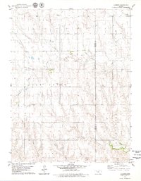
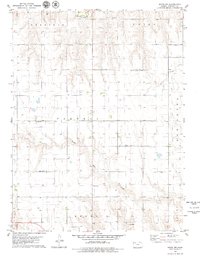
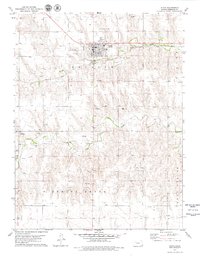 1979 Hoxie1979 Print · USGSHoxie and the surrounding Sheridan County plains are captured here in the late seventies during a period of steady rail and resource activity. Researchers can locate family sites at Hoxie Cemetery or St. Francis Cemetery and trace the Union Pacific line as it cuts through Logan Valley.
 - 1979 Map of Hoxie NE
 1979 Hoxie NE1979 Print · USGSSheridan County's high plains were defined by creek-carved valleys and quiet townships like Union and Adell in the mid-1970s. Trace local family history at the Bow Creek Cem or locate vintage infrastructure like a Sandpit and various Well sites.
 - 1979 Map of Rexford NE
 1979 Rexford NE1979 Print · USGSSheridan County in the late seventies reveals a landscape of high-plains agriculture and river-basin industry. Researchers can trace the path of the North Fork Solomon River and locate specific sites like the central Feedlot and local Sandpits.
 - 1979 Map of Grinnell NE
 1979 Grinnell NE1979 Print · USGSWestern Kansas at the end of the 1970s shows a landscape defined by its waterways and rail access. Genealogists and historians can trace the Union Pacific line as it connects the communities of Grinnell and Grainfield along the county border.2 unique versions available
 - 1979 Map of Tasco
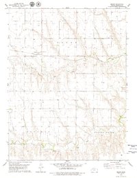
 1979 Tasco1979 Print · USGSThe Sheridan County high plains are captured here in the late seventies, centered on the settlement of Tasco. Researchers can trace the Union Pacific rail corridor and locate rural landmarks like the local Cem and scattered Oil Wells.
 - 1979 Map of Studley
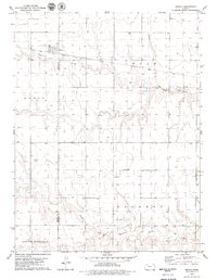
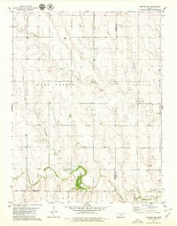
 1979 Studley1979 Print · USGSThe High Plains of Sheridan County are captured here in the late seventies, showing the vital rail and river corridor through Studley. Genealogists and local historians can locate the Mount Pleasant Cem and trace the Union Pacific line as it parallels the South Fork Solomon River.
 - 1979 Map of Grinnell North
 1979 Grinnell North1979 Print · USGSSheridan County agricultural lands and rail corridors are captured here in the late seventies. Genealogists and local historians can trace the foundations of Angelus and Grinnell, or locate rural landmarks like St Johns Cem and the Union Pacific line.
 - 1979 Map of Hoxie NW
 1979 Hoxie NW1979 Print · USGSSheridan County agricultural lands are captured here in the late seventies, showing the organized grid of the High Plains. Genealogists and local historians can locate rural landmarks like Immanuel Ch and follow the paths of the South Fk Solomon River and Bow Creek.
 - 1979 Map of Quinter NW
 1979 Quinter NW1979 Print · USGSThis late-seventies survey of Sheridan County explores the transition from agricultural townships to active energy production areas. Genealogists and researchers can trace the rural landscape through landmarks like Bethel Cem and the Sheridan State Game Management Area along the Saline River.
 - 1979 Map of Seguin
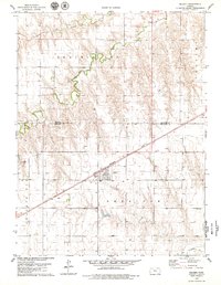
 1979 Seguin1979 Print · USGSThe High Plains of Sheridan County are documented here in the late seventies, centered on the railroad town of Seguin. Genealogists and local historians can trace the Union Pacific rail line, locate St Martins Cem, and see the development of the local Oil Field.
 - 1985 Map of Oakley
 1985 Oakley1985 Print · USGSWestern Kansas at the mid-eighties shows a vast agricultural network tied together by the Union Pacific and KYLE rail lines. Genealogists and researchers can trace family roots through rural communities like Hoxie, Angelus, and St Peter while identifying local Cemeteries and small-scale operations like the Silica Pit.2 unique versions available
Showing maps 1-25 of 126
Top cities of Sheridan County
Frequently asked questions
- What are the different types of historical maps available for Sheridan County?
- What is the oldest map of Sheridan County?
- Where can I purchase historical maps of Sheridan County for my home or office?
- Where can I download high-res historical maps of Sheridan County?
- Are there historical topographic maps available for Sheridan County?
- Is there historical aerial imagery available for Sheridan County?
- Where are historical maps of Sheridan County sourced from?