
Historical Maps of Kansas City, Kansas
What stories do these 109 old maps tell about Kansas City's past? From 1890 to present day, these maps reveal the evolution of streets, neighborhoods, iconic landmarks, and natural features in stunning high-res detail. Whether you're a history enthusiast, genealogist, or professional in education, environmental work, or architecture, these maps are perfect for exploration, research, and discovery.
Discover Kansas City's history through maps:
- Trace Kansas City's growth: Explore earlier and latest maps and editions to uncover how the region changed over time.
- Examine technical details: Each map includes its creators, publishers, scale, dimensions, and full source information.
- Layer maps with modern tools & imagery: Compare historical maps to modern-day with high-resolution satellite imagery and detailed LiDAR layers.
- Sourced from trusted archives: Carefully preserved and digitized by institutions like the United Stated Geological Survey and the US Library of Congress.
- Access in any format: View and explore in high resolution, download for offline use, or order a museum-quality print for yourself or a loved one.
Begin your journey into Kansas City's history with these remarkable must-see maps.
Kansas City, KS maps
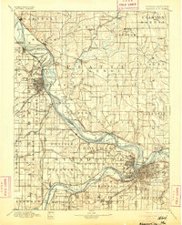
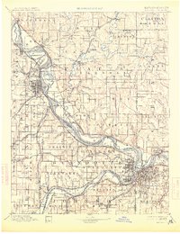
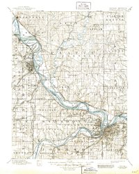
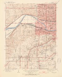
(109)- 1890 Map of Kansas City
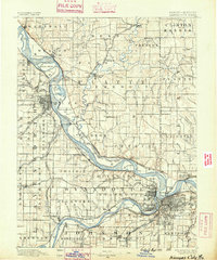 1890 Kansas City1890 Print · USGSCovers Kansas City, including Overland Park, Shawnee, and other nearby areas
 - 1890 Map of Kansas City
 1890 Kansas City1890 Print · USGSCovers Kansas City, including Overland Park, Shawnee, and other nearby areas
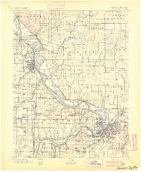
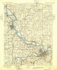
 - 1894 Map of Kansas City
 1894 Kansas City1894 Print · USGSCovers Kansas City, including Overland Park, Shawnee, and other nearby areas
 - 1894 Map of Kansas City
 1894 Kansas City1894 Print · USGSCovers Kansas City, including Overland Park, Shawnee, and other nearby areas
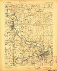
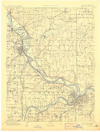
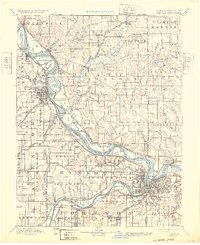
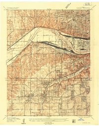
 - 1894 Map of Kansas City, 1900 Print
 1894 Kansas City1900 Print · USGSCovers Kansas City, including Overland Park, Shawnee, and other nearby areas
 - 1894 Map of Kansas City, 1900 Print
 1894 Kansas City1900 Print · USGSCovers Kansas City, including Overland Park, Shawnee, and other nearby areas
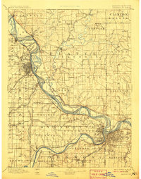
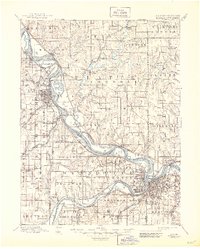
 - 1894 Map of Kansas City, 1905 Print
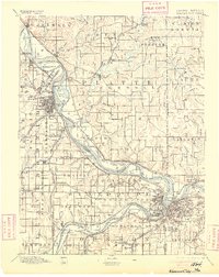 1894 Kansas City1905 Print · USGSCovers Kansas City, including Overland Park, Shawnee, and other nearby areas
 - 1894 Map of Kansas City, 1905 Print
 1894 Kansas City1905 Print · USGSCovers Kansas City, including Overland Park, Shawnee, and other nearby areas
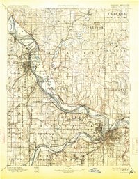
 - 1894 Map of Kansas City, 1908 Print
 1894 Kansas City1908 Print · USGSCovers Kansas City, including Overland Park, Shawnee, and other nearby areas
 - 1894 Map of Kansas City, 1908 Print
 1894 Kansas City1908 Print · USGSCovers Kansas City, including Overland Park, Shawnee, and other nearby areas
 - 1894 Map of Kansas City, 1913 Print
 1894 Kansas City1913 Print · USGSCovers Kansas City, including Overland Park, Shawnee, and other nearby areas
 - 1894 Map of Kansas City, 1913 Print
 1894 Kansas City1913 Print · USGSCovers Kansas City, including Overland Park, Shawnee, and other nearby areas
 - 1894 Map of Kansas City, 1932 Print
 1894 Kansas City1932 Print · USGSCovers Kansas City, including Overland Park, Shawnee, and other nearby areas
 - 1894 Map of Kansas City, 1932 Print
 1894 Kansas City1932 Print · USGSCovers Kansas City, including Overland Park, Shawnee, and other nearby areas
 - 1894 Map of Kansas City, 1945 Print
 1894 Kansas City1945 Print · USGSCovers Kansas City, including Overland Park, Shawnee, and other nearby areas
 - 1894 Map of Kansas City, 1945 Print
 1894 Kansas City1945 Print · USGSCovers Kansas City, including Overland Park, Shawnee, and other nearby areas
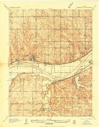
 - 1934 Map of Bonner Springs
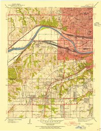
 1934 Bonner Springs1934 Print · USGSCovers Kansas City, including Shawnee, Leavenworth, and other nearby areas
 - 1934 Map of Shawnee
 1934 Shawnee1934 Print · USGSCovers Kansas City, including Overland Park, Shawnee, and other nearby areas
 - 1934 Map of Edwardsville
 1934 Edwardsville1934 Print · USGSCovers Kansas City, including Shawnee, Bonner Springs, and other nearby areas
 - 1934 Map of Wolcott
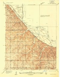 1934 Wolcott1934 Print · USGSCovers Kansas City, including Lansing, Parkville, and other nearby areas
 - 1934 Map of Shawnee, 1954 Print
 1934 Shawnee1954 Print · USGSCovers Kansas City, including Overland Park, Shawnee, and other nearby areas
 - 1934 Map of Shawnee, 1954 Print
 1934 Shawnee1954 Print · USGSCovers Kansas City, including Overland Park, Shawnee, and other nearby areas
 - 1935 Map of Kansas City
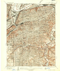 1935 Kansas City1935 Print · USGSCovers Kansas City, including Prairie Village, Roeland Park, and other nearby areas
 - 1935 Map of North Kansas City
 1935 North Kansas City1935 Print · USGSCovers Kansas City, including Gladstone, North Kansas City, and other nearby areas
 - 1935 Map of Kansas City, 1955 Print
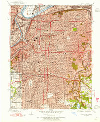 1935 Kansas City1955 Print · USGSCovers Kansas City, including Prairie Village, Roeland Park, and other nearby areas
Showing maps 1-25 of 109
Top neighborhoods in Kansas City
- Fairfax historical maps
- Grays Park historical maps
- Vinewood historical maps
- Maywood historical maps
- Wallula historical maps
- Muncie historical maps
See more
Frequently asked questions
- What are the different types of historical maps available for Kansas City?
- What is the oldest map of Kansas City?
- Where can I purchase historical maps of Kansas City for my home or office?
- Where can I download high-res historical maps of Kansas City?
- Are there historical topographic maps available for Kansas City?
- Is there historical aerial imagery available for Kansas City?
- Where are historical maps of Kansas City sourced from?