1960s Maps of Plaquemines Parish, Louisiana
Explore 18 historic maps of Plaquemines Parish from the 1960s. These maps offer a rare glimpse into what life looked like during the 1960s — showing old roads, neighborhoods, homes, and landmarks that have changed or disappeared over time.
Whether you're researching your family's past, planning a metal detecting trip, or studying how Plaquemines Parish's landscape evolved across the 1960s, these high-resolution maps are a powerful tool for exploring the history of this region.
- Focus on a specific era: All maps on this page are from the 1960s, giving you a focused view of this time period.
- See what’s changed: Compare century-old streets, trails, and buildings to today's modern landscape using overlays and satellite layers.
- Research with precision: Use these maps for genealogy, historical research, land use analysis, or educational projects.
- View, download, or print: Maps are fully viewable online in high resolution, and can be downloaded or printed for your own records.
Start exploring Plaquemines Parish's history through authentic maps from the 1960s. This is your window into the past.
Plaquemines Parish, LA maps
(18)- 1960 Map of Forts, 1961 Print
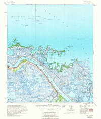 1960 Forts1961 Print · USGSThe lower Mississippi River delta in the early sixties was a landscape defined by the intersection of river settlements and the emerging oil industry. Researchers can trace the riverfront communities of Boothville and Venice, or locate historic sites like Fort St Philip and the Boothville Cem.3 unique versions available
 - 1960 Map of Empire, 1963 Print
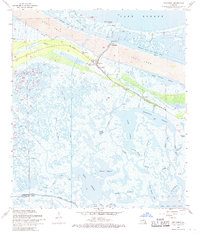
 1960 Empire1963 Print · USGSThe lower Plaquemines Parish delta in the early sixties was a world defined by the river and the oil fields. Genealogists and historians can trace the foundations of communities like Empire and Port Sulphur, locating landmarks such as St Patrick Ch and Nairn PO.2 unique versions available
 - 1961 Map of Breton Sound
 1961 Breton Sound1961 Print · USGSThe Louisiana delta and the outer marshes of Plaquemines Parish are captured here at the start of the 1960s. Researchers can trace the river settlements from Davant to Venice, locate isolated stations like Port Eads, and find old sites such as Fort Jackson.
 - 1962 Map of Barataria, 1966 Print
 1962 Barataria1966 Print · USGSCoastal Jefferson Parish in the early 1960s reveals a unique intersection of delta settlements and a booming petroleum industry. Genealogists and historians can trace local families through recorded sites like Fleming Cem and Lafitte Cem or the industrial footprint of the Lafitte Oil Field.2 unique versions available
 - 1962 Map of Pointe a La Hache, 1966 Print
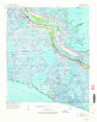
 1962 Pointe a La Hache1966 Print · USGSCoastal Plaquemines Parish reveals a landscape of river-dependent towns and delta marshes in the early sixties. Genealogists can trace family roots through riverside sites like Carlisle P O, Besumar Plantation, and the Seichsnaydre Cem.
 - 1963 Map of New Orleans
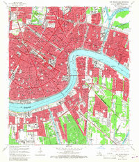
 1963 New Orleans1963 Print · USGSCoastal Louisiana in the mid-twentieth century reveals a complex world of bayou settlements, expanding oil fields, and vital rail networks. Genealogists and historians can trace family roots through river towns like Thibodaux or follow the Southern Pacific line through Franklin and Patterson.4 unique versions available
 - 1964 Map of Black Bay
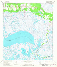
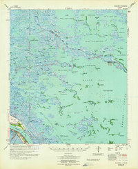 1964 Black Bay1964 Print · USGSCoastal Plaquemines Parish is mapped here in the mid-1960s, showing a landscape defined by tidal bayous and the emerging offshore energy industry. Researchers can find old riverfront landmarks like Bohemia Cem, the Potash District Camp, and the settlement of Happy Jack.2 unique versions available
 - 1964 Map of Pointe a La Hache, 1965 Print
 1964 Pointe a La Hache1965 Print · USGSCoastal Louisiana at the height of the mid-century oil boom centers on the communities flanking the Mississippi River. Genealogists and historians can trace family roots through riverfront landmarks like Beaumar Plantation, Pointe a la Hache, and the St Jude Sch & Ch.
 - 1966 Map of New Orleans
 1966 New Orleans1966 Print · USGSCoastal Louisiana in the mid-1960s reveals a transition from traditional bayou life to an intensive offshore oil and gas economy. Researchers can trace the rail lines of the Southern Pacific RR through Morgan City or locate the Eugene Island Lighthouse among the delta's shifting marshes.
 - 1966 Map of Bertrandville, 1967 Print
 1966 Bertrandville1967 Print · USGSLouisiana's river-and-canal landscape south of New Orleans is captured here during the mid-1960s. Genealogists and historians can trace riverside settlements like Bertrandville and Oakville or locate the sprawling U S Naval Air Station.4 unique versions available
 - 1966 Map of New Orleans East, 1967 Print
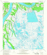
 1966 New Orleans East1967 Print · USGSNew Orleans and its riverfront parishes are captured in the mid-1960s as the city expanded across its historic levees. Researchers can trace family roots through numerous sites like Metairie Cemetery, locate old schools like Behrman High Sch, or explore the industrial waterfront at the New Orleans Army Base.5 unique versions available
 - 1966 Map of Belle Chasse, 1968 Print
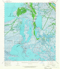
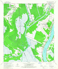
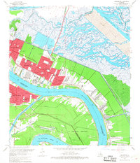
 1966 Belle Chasse1968 Print · USGSThe Mississippi River's shifting path and industrial riverfront dominate the landscape of Plaquemines Parish in the mid-sixties. Genealogists and historians can locate legacy landmarks like Bethlehem Ch, the English Turn Cem, and the Sea Train Terminal near Belle Chasse.6 unique versions available
 - 1967 Map of Delacroix, 1968 Print
 1967 Delacroix1968 Print · USGSCoastal St. Bernard Parish was a landscape of marsh-side settlements and canal networks in the late sixties. Genealogists and researchers can trace local landmarks like True Love Cem, St Bernard High Sch, and the winding Bayou Terre aux Boeufs.4 unique versions available
 - 1967 Map of Chalmette, 1968 Print
 1967 Chalmette1968 Print · USGSCoastal St. Bernard Parish and the New Orleans riverfront are captured during a period of industrial and residential expansion in the late sixties. Trace the historical footprint of Chalmette and find local landmarks like Merrit Cem and Chalmette National Historical Park.7 unique versions available
 - 1967 Map of New Orleans, 1969 Print
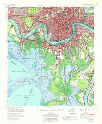 1967 New Orleans1969 Print · USGSGreater New Orleans in the mid-1960s reveals a landscape of massive engineering and urban expansion along the Mississippi River. Genealogists and local historians can trace family roots through the grids of Metairie, Gretna, and Harvey, or locate specific sites like Metairie High Sch and St Vincent de Paul Cem.
 - 1968 Map of Yscloskey, 1969 Print
 1968 Yscloskey1969 Print · USGSSt. Bernard Parish at the end of the 1960s reveals a marshland landscape transformed by the Mississippi River - Gulf Outlet Canal. Researchers can locate coastal sites like Old Fort Beauregard Ruins, Alluvial City, and the winding Bayou la Loutre.3 unique versions available
 - 1969 Map of Yscloskey
 1969 Yscloskey1969 Print · USGSCoastal St. Bernard Parish in the late sixties reveals the dramatic impact of the new ship channel on traditional marsh settlements. Genealogists and historians can trace the foundations of Alluvial City, the Old Fort Beauregard Ruins, and the early footprint of Hopedale.
 - 1969 Map of St. Bernard, 1970 Print
 1969 St. Bernard1970 Print · USGSCoastal St. Bernard Parish comes alive in this late-sixties survey of the riverfront and marshlands during a period of significant industrial and maritime growth. Researchers can trace the development of Chalmette, find family landmarks like St Bernard Memorial Gardens, and explore the winding Southern Railway through Violet and Verret.
End of results
Showing maps 1-18 of 18
Top cities of Plaquemines Parish
Frequently asked questions
- What are the different types of historical maps available for Plaquemines Parish?
- What is the oldest map of Plaquemines Parish?
- Where can I purchase historical maps of Plaquemines Parish for my home or office?
- Where can I download high-res historical maps of Plaquemines Parish?
- Are there historical topographic maps available for Plaquemines Parish?
- Is there historical aerial imagery available for Plaquemines Parish?
- Where are historical maps of Plaquemines Parish sourced from?