1990s Maps of Plaquemines Parish, Louisiana
Explore 34 historic maps of Plaquemines Parish from the 1990s. These maps offer a rare glimpse into what life looked like during the 1990s — showing old roads, neighborhoods, homes, and landmarks that have changed or disappeared over time.
Whether you're researching your family's past, planning a metal detecting trip, or studying how Plaquemines Parish's landscape evolved across the 1990s, these high-resolution maps are a powerful tool for exploring the history of this region.
- Focus on a specific era: All maps on this page are from the 1990s, giving you a focused view of this time period.
- See what’s changed: Compare century-old streets, trails, and buildings to today's modern landscape using overlays and satellite layers.
- Research with precision: Use these maps for genealogy, historical research, land use analysis, or educational projects.
- View, download, or print: Maps are fully viewable online in high resolution, and can be downloaded or printed for your own records.
Start exploring Plaquemines Parish's history through authentic maps from the 1990s. This is your window into the past.
Plaquemines Parish, LA maps
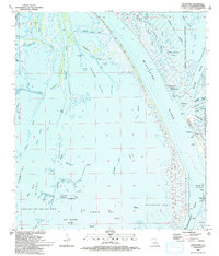
(34)- 1992 Map of Bertrandville
 1992 Bertrandville1992 Print · USGSCoastal Louisiana at the start of the nineties shows a landscape defined by the great river and maritime infrastructure. Trace the river road through Bertrandville and Oakville, or explore the sprawling Alvin Callender Field.2 unique versions available
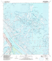
 - 1992 Map of New Orleans East
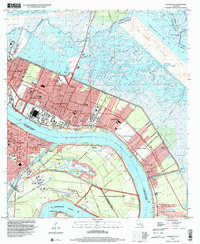
 1992 New Orleans East1992 Print · USGSGreater New Orleans at the start of the nineties reveals a complex urban landscape shaped by the Mississippi River and industrial waterways. Trace neighborhood history through family-named landmarks like McDonoghville and historic sites like Metairie Cemetery or the Vieux Carre.
 - 1993 Map of Pass A Loutre West
 1993 Pass A Loutre West1993 Print · USGSThe Mississippi River Delta reaches into the Gulf during the early nineties, showing a landscape shaped by both conservation and the energy industry. Researchers can trace landforms like Goose Island alongside the Delta Duck Oil Field and Head of Passes.
 - 1993 Map of Pass Du Bois
 1993 Pass Du Bois1993 Print · USGSCoastal Plaquemines Parish appears as a hub of offshore energy during the early nineties, where the delta meets the open sea. Map collectors and researchers can trace the industrial footprint of the West Bay Oil and Gas Field and landmarks like Pass Du Bois.
 - 1993 Map of Breton Islands
 1993 Breton Islands1993 Print · USGSThe Breton Islands remain a critical wildlife sanctuary and industrial zone in the early nineties. Researchers can trace the shifting sands of Breton National Wildlife Refuge alongside an active Oil Field and the Mississippi River Gulf Outlet Canal.
 - 1993 Map of Pilottown
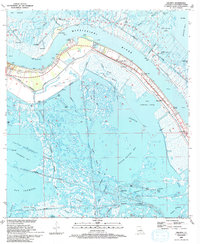
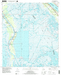
 1993 Pilottown1993 Print · USGSPlaquemines Parish comes alive in the early nineties where the river meets the sea at the historic Pilottown settlement. Researchers can trace the industrial and natural balance of the delta, from the Wildlife Headquarters to the extensive West Bay Oil and Gas Field.2 unique versions available
 - 1993 Map of Venice
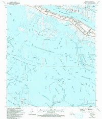
 1993 Venice1993 Print · USGSThe Plaquemines Parish marshlands are captured here in the early nineties, showing where the Mississippi River splits into the Gulf of Mexico. Researchers can trace the industrial footprint of the Oil and Gas Field and find local landmarks like The Jump and Full Gospel Ch.
 - 1993 Map of Triumph, 1994 Print
 1993 Triumph1994 Print · USGSThe lower Mississippi delta in the early nineties reveals a landscape of strategic forts and river-levee settlements. Trace family history near Triumph and Boothville, or locate industrial sites like the Venice Oil Field and Fort Jackson.
 - 1993 Map of Port Sulphur, 1994 Print
 1993 Port Sulphur1994 Print · USGSThe industrial wetlands of the Mississippi Delta are captured here in the early nineties, showing a region dominated by oil production and river commerce. Genealogists and local historians can locate Port Sulphur, St Patrick Cem, and the specialized Freeport Sulphur Co Canal.
 - 1993 Map of Bay Coquette, 1994 Print
 1993 Bay Coquette1994 Print · USGSThe Plaquemines Parish coast in the early nineties reveals a landscape of shifting barrier islands and extensive offshore industry. Trace the industrial footprint of the Oil Field and Pipeline infrastructure near Pelican Island and Bay Coquette.
 - 1993 Map of Coquille Point, 1994 Print
 1993 Coquille Point1994 Print · USGSCoastal Plaquemines Parish is shown here in the early nineties, a landscape defined by the intersection of the Gulf and the oil industry. Researchers can trace the industrial footprint across Breton Sound, locating an oil well, Sable Island, and Battledore Reef.
 - 1993 Map of Bay Batiste, 1994 Print
 1993 Bay Batiste1994 Print · USGSThe Plaquemines Parish coastline in the early nineties reveals a landscape defined by the intersection of marshland and heavy industry. You can trace the massive Freeport Sulphur Co Elevated Pipeline and locate historic extraction sites near Grande Ecaille and Lake Washington.
 - 1993 Map of Buras, 1994 Print
 1993 Buras1994 Print · USGSThe Mississippi Delta's fragile landscape is documented here in the early nineties, showing the town of Buras squeezed between the river levee and the marsh. Researchers can trace local infrastructure from the Buras Boat Harbor to the Cem and High Sch.
 - 1993 Map of Bay Ronquille, 1994 Print
 1993 Bay Ronquille1994 Print · USGSThe Louisiana coast in the early nineties reveals a landscape of heavy industry and shifting tides. Trace the expansion of the Gas Field and maritime navigation at Quatre Bayou Pass or Quatre 2 Light.
 - 1993 Map of Taylor Pass, 1994 Print
 1993 Taylor Pass1994 Print · USGSThe Mississippi River Delta's outer marshes meet the Gulf in the early nineties, revealing a landscape of shifting tides and energy industry infrastructure. Map collectors and researchers can trace the shoreline of Bird Island or locate specific Oil Wells and Platforms throughout Breton Sound.
 - 1993 Map of Barataria Pass, 1994 Print
 1993 Barataria Pass1994 Print · USGSCoastal Jefferson Parish in the early nineties reveals a landscape where maritime history meets the energy industry. Researchers can trace the layout of Grand Isle, locate the Ft Livingston Ruins, and identify the structures within the Queen Bess Island Oil and Gas Field.
 - 1993 Map of Bastian Bay, 1995 Print
 1993 Bastian Bay1995 Print · USGSCoastal Plaquemines Parish is captured here in the early nineties, showing a landscape defined by deltaic marsh and industrial infrastructure. Researchers can trace the extensive network of dredging and drilling including the West Bastian Bay Oil and Gas Field and landmarks like Bastian Island and the Pumping Station.
 - 1994 Map of Lake Athanasio, 1995 Print
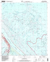
 1994 Lake Athanasio1995 Print · USGSCoastal St. Bernard Parish in the mid-nineties is defined by the intersection of industrial shipping channels and delicate marshland. Researchers can trace the path of the Mississippi River Gulf Outlet past Gardner Island and the remote Half Moon Lake Oil Field.
 - 1994 Map of Yscloskey, 1995 Print
 1994 Yscloskey1995 Print · USGSCoastal St. Bernard Parish in the mid-nineties shows a landscape of fishing villages and industrial canals navigating the Mississippi Delta marsh. Genealogists and historians can trace the foundations of Alluvial City and Yscloskey or locate the historic Old Fort Beauregard Ruins.
 - 1995 Map of Bertrandville, 1999 Print
 1995 Bertrandville1999 Print · USGSCoastal Jefferson and Plaquemines Parishes come alive in this mid-nineties survey of the Mississippi riverfront and its surrounding marshlands. Genealogists and local historians can trace family roots through settlements like Bertrandville or locate St John The Baptist Ch and the Southern Seaplane Base.
 - 1995 Map of Lafitte, 1999 Print
 1995 Lafitte1999 Print · USGSCoastal Jefferson Parish in the mid-nineties shows a landscape defined by the intersection of family heritage and the oil industry. Genealogists can locate several historic burial sites like Little Village Cem and Lafitte Cem or trace the New Orleans and Lower Coast rail line.
 - 1998 Map of New Orleans East, 2000 Print
 1998 New Orleans East2000 Print · USGSNew Orleans and the West Bank are shown at the end of the century, detailing the dense urban fabric and the great bend of the river. Genealogists can trace hundreds of sites including St Louis Cathedral, Metairie Cemetery, and the extensive McDonogh No 26 Sch system.
 - 1998 Map of Chalmette, 2001 Print
 1998 Chalmette2001 Print · USGSCoastal Louisiana at the close of the twentieth century shows a landscape defined by the great river and the expanding footprint of St. Bernard Parish. Genealogists and historians can trace neighborhood growth in Chalmette Vista and Meraux, or locate family sites near St Bernard Memorial Gardens (Cem) and Jackson Barracks.
 - 1998 Map of Venice, 2001 Print
 1998 Venice2001 Print · USGSThe Mississippi Delta's edge comes into focus in the late nineties, where the river meets a maze of marsh and industry. Researchers can trace the levee-protected communities of Venice and Boothville, finding local landmarks like the Full Gospel Ch and The Jump.
 - 1998 Map of Three Bayou Bay, 2001 Print
 1998 Three Bayou Bay2001 Print · USGSCoastal Jefferson Parish in the late twentieth century is a landscape of complex waterways and energy production. Researchers can trace the extensive industrial infrastructure of the Lafitte Oil and Gas Field and landmarks like Cutler and the Texaco Heliport.
Showing maps 1-25 of 34
Top cities of Plaquemines Parish
Frequently asked questions
- What are the different types of historical maps available for Plaquemines Parish?
- What is the oldest map of Plaquemines Parish?
- Where can I purchase historical maps of Plaquemines Parish for my home or office?
- Where can I download high-res historical maps of Plaquemines Parish?
- Are there historical topographic maps available for Plaquemines Parish?
- Is there historical aerial imagery available for Plaquemines Parish?
- Where are historical maps of Plaquemines Parish sourced from?