1970s Maps of Plaquemines Parish, Louisiana
Explore 39 historic maps of Plaquemines Parish from the 1970s. These maps offer a rare glimpse into what life looked like during the 1970s — showing old roads, neighborhoods, homes, and landmarks that have changed or disappeared over time.
Whether you're researching your family's past, planning a metal detecting trip, or studying how Plaquemines Parish's landscape evolved across the 1970s, these high-resolution maps are a powerful tool for exploring the history of this region.
- Focus on a specific era: All maps on this page are from the 1970s, giving you a focused view of this time period.
- See what’s changed: Compare century-old streets, trails, and buildings to today's modern landscape using overlays and satellite layers.
- Research with precision: Use these maps for genealogy, historical research, land use analysis, or educational projects.
- View, download, or print: Maps are fully viewable online in high resolution, and can be downloaded or printed for your own records.
Start exploring Plaquemines Parish's history through authentic maps from the 1970s. This is your window into the past.
Plaquemines Parish, LA maps
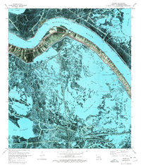
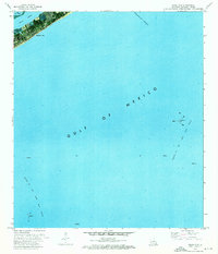
(39)- 1971 Map of Breton Islands SE, 1972 Print
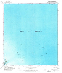 1971 Breton Islands SE1972 Print · USGSThe Plaquemines Parish coast in the early seventies shows a landscape defined by offshore energy and marshy delta terrain. Researchers can trace the industrial footprint of the Block 69 Oil Field and find coastal landmarks like Japan Island and Dead Women Pass.2 unique versions available
 - 1971 Map of Breton Islands, 1972 Print
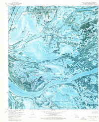
 1971 Breton Islands1972 Print · USGSThe barrier islands and wildlife sanctuary of Plaquemines Parish are captured here during the early 1970s. Researchers can trace the shifting sands of North Point and the industrial footprint of the Oil Field and Mississippi River Gulf Outlet Canal.
 - 1971 Map of Pass Tante Phine, 1974 Print
 1971 Pass Tante Phine1974 Print · USGSCoastal Plaquemines Parish appears in high-detail photography during the early 1970s, showing the heavy hand of energy infrastructure on the delta. Trace the navigation of Tiger Pass and Spanish Pass alongside numerous oil wells and pipelines.3 unique versions available
 - 1971 Map of Main Pass, 1974 Print
 1971 Main Pass1974 Print · USGSThe Plaquemines Parish coast in the early 1970s reveals a complex deltaic environment where conservation and industry coexist. Trace the footprint of the Romere Oil and Gas Field and remote marshes like Contrariete Island and Grants Pond.2 unique versions available
 - 1971 Map of South Pass, 1974 Print
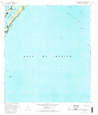
 1971 South Pass1974 Print · USGSThe tip of the Mississippi Delta in the early seventies shows a landscape where industrial infrastructure meets the coastal marsh. Researchers can trace the layout of Port Eads, find the isolated Clubhouse, and locate remote energy sites like the Block 27 Oil Field.2 unique versions available
 - 1971 Map of Taylor Pass, 1974 Print
 1971 Taylor Pass1974 Print · USGSCoastal Plaquemines Parish is captured in the early seventies, showing a landscape of shifting marsh and open water. Researchers can locate offshore Platforms, the narrow waters of Taylor Pass, and the isolated landmark of Bird Island.
 - 1971 Map of Burrwood Bayou West, 1974 Print
 1971 Burrwood Bayou West1974 Print · USGSThe tip of the Mississippi River Delta comes into sharp focus during the early seventies, revealing an environment dominated by offshore extraction. Researchers can locate specific energy infrastructure including an Oil Field, numerous platforms, and the Helicopter Pad near Southwest Pass.
 - 1971 Map of Coquille Point, 1974 Print
 1971 Coquille Point1974 Print · USGSThe Louisiana coast in the early seventies reveals a landscape defined by the intersection of delta marsh and offshore industry. Researchers can trace the development of the Block 33 and 35 Oil Field and locate coastal landmarks like Sable Island and Fort Point.
 - 1971 Map of Dixon Bay, 1974 Print
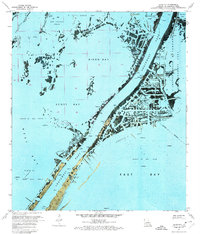 1971 Dixon Bay1974 Print · USGSCoastal Louisiana at the start of the 1970s shows a delta landscape defined by the energy industry and tidal marsh. Genealogists and researchers can trace local landmarks like Bob Taylors Pond, Joseph Bayou, and the Pass A Loutre State Waterfowl Management Area.2 unique versions available
 - 1971 Map of Pass A Loutre West, 1974 Print
 1971 Pass A Loutre West1974 Print · USGSThe Mississippi River delta landscape of the early seventies is shown here in detail before decades of coastal change. You can trace industrial and natural features like the Duck Oil Field, Dead Women Pass, and the Head of Passes Light.2 unique versions available
 - 1971 Map of Garden Island Pass, 1974 Print
 1971 Garden Island Pass1974 Print · USGSThe Mississippi River delta in the early seventies shows a landscape where conservation and industry meet among the marshy passes of Plaquemines Parish. Trace the winding waterways of the Pass A Loutre State Waterfowl Management Area and find industrial markers like the Block 6 Oil Field or the Sludge Pit.
 - 1971 Map of Venice, 1974 Print
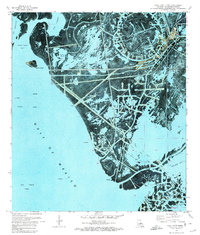
 1971 Venice1974 Print · USGSThe Mississippi Delta's tip reveals a landscape of industrial ambition and coastal marsh in the early 1970s. Trace the working waterfront of Venice and locate family landmarks like Full Gospel Ch or the Boothville Cem alongside the dredging and rigs of Breton Sound.2 unique versions available
 - 1971 Map of Pass A Loutre East, 1974 Print
 1971 Pass A Loutre East1974 Print · USGSThe Mississippi River Delta reveals its intricate, shifting geography in the early 1970s as the river bifurcates toward the sea. Researchers can trace the maritime footprint of two Abandoned Lighthouses and industrial offshore Platforms near Pass A Loutre.
 - 1971 Map of Pilottown, 1974 Print
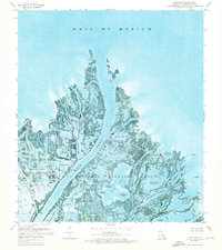
 1971 Pilottown1974 Print · USGSThe Mississippi Delta's remote maritime outposts and marshlands are captured here in the early seventies during a period of heavy industrial and conservation activity. Researchers can trace the pilot operations at Pilottown and explore the sprawling West Bay Oil and Gas Field or the Delta National Wildlife Refuge.2 unique versions available
 - 1971 Map of South of South Pass, 1974 Print
 1971 South of South Pass1974 Print · USGSThe Mississippi River delta meets the sea in the early 1970s, where industry and conservation intersect. Researchers can trace the layout of the Block 27 Oil Field and the protected lands of the Pass A Loutre State Waterfowl Management Area.
 - 1971 Map of Pass Du Bois, 1974 Print
 1971 Pass Du Bois1974 Print · USGSCoastal Plaquemines Parish in the early seventies shows the intense intersection of delta marshland and the offshore energy industry. Trace the reach of the West Bay Oil and Gas Field and remote installations like the Platforms in West Bay.
 - 1971 Map of Triumph, 1974 Print
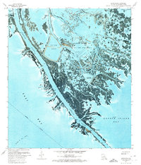
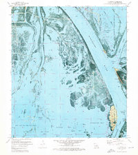
 1971 Triumph1974 Print · USGSThe lower Mississippi delta in the early seventies shows a fragile balance between industrial infrastructure and the shifting Gulf wetlands. Genealogists and historians can locate the riverfront communities of Triumph and Boothville, alongside landmarks like Fort Jackson and the Boothville Cem.2 unique versions available
 - 1971 Map of Burrwood Bayou East, 1974 Print
 1971 Burrwood Bayou East1974 Print · USGSThe Mississippi Delta's industrial fringe comes into focus during the early seventies as oil extraction reshapes the coastline. Researchers can trace the maritime and energy infrastructure of the day, from the Southwest Pass channel to the Oil Well Platform and Sludge Pit near West Bay.2 unique versions available
 - 1973 Map of Lake Laurier, 1976 Print
 1973 Lake Laurier1976 Print · USGSThe Plaquemines Parish delta in the early 1970s reveals a landscape where river industry meets the deep marsh. Genealogists and historians can trace riverside settlements like Bellevue and Deer Range or locate the Deer Range Cem near the Mississippi River levee.2 unique versions available
 - 1973 Map of Wilkinson Bay, 1976 Print
 1973 Wilkinson Bay1976 Print · USGSThe coastal wetlands of Jefferson and Plaquemines Parishes are captured here in the early 1970s, showing a landscape defined by water and oil extraction. Trace the industrial development of the Manila Village Oil Field and the Barataria Waterway alongside coastal features like St Marys Point.2 unique versions available
 - 1973 Map of Grand Isle, 1976 Print
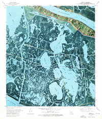
 1973 Grand Isle1976 Print · USGSGrand Isle and the Jefferson Parish coast are captured here in the early seventies, a time when the energy industry transformed the shoreline. Maritime researchers can trace the Barataria Bay Waterway and offshore platforms in the Block 16 Oil and Gas Field.
 - 1973 Map of Buras, 1976 Print
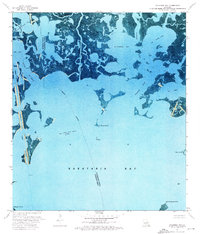
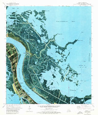
 1973 Buras1976 Print · USGSCoastal Louisiana in the early seventies is captured here, showing the fragile balance of levees and marshland along the Mississippi River. Researchers can trace local waterways like Tortillon Bayou and Scofield Bayou or locate the Buras Boat Harbor and various gas fields.
 - 1973 Map of Barataria Pass, 1976 Print
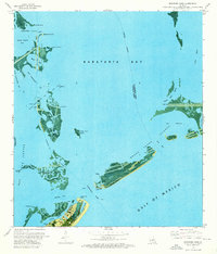 1973 Barataria Pass1976 Print · USGSCoastal Jefferson Parish in the early 1970s reveals a unique intersection of military history and the offshore energy industry. Researchers can locate the Ft Livingston Ruins, trace the developed waterfront of Grand Isle, and identify maritime landmarks like the Queen Bess Island Oil and Gas Field.2 unique versions available
 - 1973 Map of Empire, 1976 Print
 1973 Empire1976 Print · USGSThe Plaquemines Parish coast in the early seventies shows a complex landscape of delta industry and river life. Genealogists and historians can locate markers like Cannon Cem and Point Pleasant Cem or trace the reach of the Cox Bay Oil and Gas Field.3 unique versions available
 - 1973 Map of Happy Jack, 1976 Print
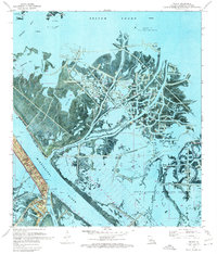
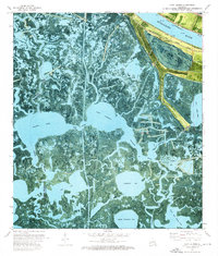
 1973 Happy Jack1976 Print · USGSThe Mississippi River delta in the early 1970s reveals a unique perspective of riverfront settlements amidst the marshlands of Plaquemines Parish. Researchers can trace the developed corridor of Happy Jack and Port Sulphur, contrasting with the wild expanses of American Bay and the Bohemia State Wildlife Management Area.
Showing maps 1-25 of 39
Top cities of Plaquemines Parish
Frequently asked questions
- What are the different types of historical maps available for Plaquemines Parish?
- What is the oldest map of Plaquemines Parish?
- Where can I purchase historical maps of Plaquemines Parish for my home or office?
- Where can I download high-res historical maps of Plaquemines Parish?
- Are there historical topographic maps available for Plaquemines Parish?
- Is there historical aerial imagery available for Plaquemines Parish?
- Where are historical maps of Plaquemines Parish sourced from?