Old Maps of Plaquemines Parish, Louisiana for Academic Research
Study the evolution of Plaquemines Parish with 248 high-resolution historic maps. Whether you're teaching, researching, or modeling changes in land use, these maps provide essential visual documentation of urban, environmental, and geographic change.
- Analyze long-term change: Track patterns in development, transportation, and natural features.
- Ideal for environmental or urban studies: Support academic projects with primary historical map data.
- Use in the classroom or lab: Educators and researchers rely on these maps to bring historical context to life.
These maps are a powerful tool for teaching, research, and visualizing how Plaquemines Parish has changed over the decades.
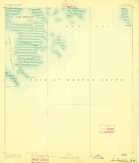
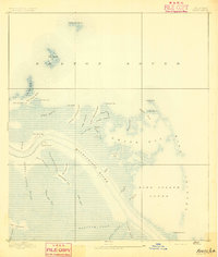
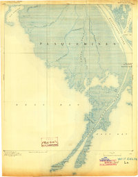
Plaquemines Parish, LA maps
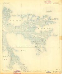
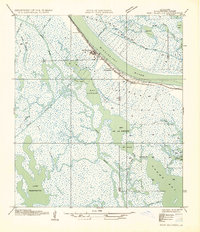
(248)- 1891 Map of Pointe a La Hache
 1891 Pointe a La Hache1891 Print · USGSCovers Plaquemines Parish, including Burnbridge, Carlisle, and other nearby areas
 - 1891 Map of New Orleans
 1891 New Orleans1891 Print · USGSCovers Plaquemines Parish, including New Orleans, Metairie, and other nearby areas5 unique versions available
 - 1892 Map of Barataria
 1892 Barataria1892 Print · USGSCovers Plaquemines Parish, including Jean Lafitte, Ollie, and other nearby areas3 unique versions available
 - 1892 Map of Quarantine
 1892 Quarantine1892 Print · USGSCovers Plaquemines Parish, including Port Sulphur, Home Place, and other nearby areas5 unique versions available
 - 1892 Map of St. Bernard
 1892 St. Bernard1892 Print · USGSCovers Plaquemines Parish, including New Orleans, Chalmette, and other nearby areas4 unique versions available
 - 1892 Map of Pointe a La Hache, 1898 Print
 1892 Pointe a La Hache1898 Print · USGSCovers Plaquemines Parish, including Burnbridge, Carlisle, and other nearby areas
 - 1893 Map of East Delta
 1893 East Delta1893 Print · USGSCovers Plaquemines Parish, including Port Eads, United States, and other nearby areas6 unique versions available
 - 1893 Map of La Fortuna
 1893 La Fortuna1893 Print · USGSCovers Plaquemines Parish, including Saint Bernard Parish, United States, and other nearby areas3 unique versions available
 - 1893 Map of Forts
 1893 Forts1893 Print · USGSCovers Plaquemines Parish, including Boothville, Duvic, and other nearby areas4 unique versions available
 - 1893 Map of Shell Beach
 1893 Shell Beach1893 Print · USGSCovers Plaquemines Parish, including Old Shell Beach, Hopedale, and other nearby areas3 unique versions available
 - 1893 Map of Fort Livingston
 1893 Fort Livingston1893 Print · USGSCovers Plaquemines Parish, including Grand Isle, Bassa Bassa, and other nearby areas3 unique versions available
 - 1893 Map of Dime, 1901 Print
 1893 Dime1901 Print · USGSCovers Plaquemines Parish, including Happy Jack, Encalade, and other nearby areas2 unique versions available
 - 1893 Map of West Delta, 1904 Print
 1893 West Delta1904 Print · USGSCovers Plaquemines Parish, including Pilottown, United States, and other nearby areas3 unique versions available
 - 1932 Map of New Orleans NE
 1932 New Orleans NE1932 Print · USGSCovers Plaquemines Parish, including New Orleans, Algiers, and other nearby areas
 - 1932 Map of New Orleans SE
 1932 New Orleans SE1932 Print · USGSCovers Plaquemines Parish, including Gretna, Jean Lafitte, and other nearby areas
 - 1935 Map of Taylor Pass
 1935 Taylor Pass1935 Print · USGSCovers Plaquemines Parish, including United States, Louisiana, and other nearby areas
 - 1935 Map of Port Sulphur
 1935 Port Sulphur1935 Print · USGSCovers Plaquemines Parish, including Port Sulphur, Home Place, and other nearby areas
 - 1935 Map of Garden Island Pass
 1935 Garden Island Pass1935 Print · USGSCovers Plaquemines Parish, including United States, Louisiana, and other nearby areas
 - 1935 Map of Lake Athanasio
 1935 Lake Athanasio1935 Print · USGSCovers Plaquemines Parish, including Saint Bernard Parish, United States, and other nearby areas
 - 1935 Map of Delacroix
 1935 Delacroix1935 Print · USGSCovers Plaquemines Parish, including Reggio, Toca, and other nearby areas
 - 1935 Map of Bastian Bay
 1935 Bastian Bay1935 Print · USGSCovers Plaquemines Parish, including United States, Louisiana, and other nearby areas
 - 1935 Map of South Pass
 1935 South Pass1935 Print · USGSCovers Plaquemines Parish, including Port Eads, United States, and other nearby areas3 unique versions available
 - 1935 Map of Lake Calebasse
 1935 Lake Calebasse1935 Print · USGSCovers Plaquemines Parish, including Saint Bernard Parish, United States, and other nearby areas
 - 1935 Map of Bay Ronquille
 1935 Bay Ronquille1935 Print · USGSCovers Plaquemines Parish, including United States, Louisiana, and other nearby areas
 - 1935 Map of Lake Batola
 1935 Lake Batola1935 Print · USGSCovers Plaquemines Parish, including United States, Louisiana, and other nearby areas
Showing maps 1-25 of 248
Top cities of Plaquemines Parish
Frequently asked questions
- What are the different types of historical maps available for Plaquemines Parish?
- What is the oldest map of Plaquemines Parish?
- Where can I purchase historical maps of Plaquemines Parish for my home or office?
- Where can I download high-res historical maps of Plaquemines Parish?
- Are there historical topographic maps available for Plaquemines Parish?
- Is there historical aerial imagery available for Plaquemines Parish?
- Where are historical maps of Plaquemines Parish sourced from?