Old Maps of Plaquemines Parish, Louisiana for Genealogy
Trace your family roots with 248 historic maps of Plaquemines Parish. These high-res maps reveal old neighborhoods, homesites, landmarks, and streets — helping you uncover where your ancestors lived and how the area evolved over time.
- Explore historic neighborhoods: Identify where your relatives may have lived in the 1800s or 1900s.
- Compare maps over time: Trace the changes in streets, buildings, and landmarks for multi-generational research.
- Perfect for genealogy & ancestry research: Used by family historians and researchers to map out lineage and migration.
These maps are an incredible resource for exploring your personal connection to Plaquemines Parish's past.
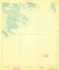
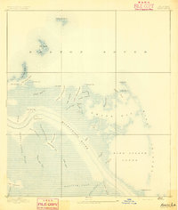
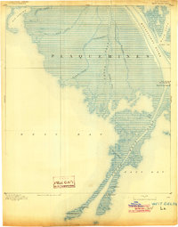
Plaquemines Parish, LA maps
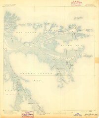
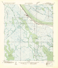
(248)- 1891 Map of Pointe a La Hache
 1891 Pointe a La Hache1891 Print · USGSCovers Plaquemines Parish, including Burnbridge, Carlisle, and other nearby areas
 - 1891 Map of New Orleans
 1891 New Orleans1891 Print · USGSCovers Plaquemines Parish, including New Orleans, Metairie, and other nearby areas5 unique versions available
 - 1892 Map of Barataria
 1892 Barataria1892 Print · USGSCovers Plaquemines Parish, including Jean Lafitte, Ollie, and other nearby areas3 unique versions available
 - 1892 Map of Quarantine
 1892 Quarantine1892 Print · USGSCovers Plaquemines Parish, including Port Sulphur, Home Place, and other nearby areas5 unique versions available
 - 1892 Map of St. Bernard
 1892 St. Bernard1892 Print · USGSCovers Plaquemines Parish, including New Orleans, Chalmette, and other nearby areas4 unique versions available
 - 1892 Map of Pointe a La Hache, 1898 Print
 1892 Pointe a La Hache1898 Print · USGSCovers Plaquemines Parish, including Burnbridge, Carlisle, and other nearby areas
 - 1893 Map of East Delta
 1893 East Delta1893 Print · USGSCovers Plaquemines Parish, including Port Eads, United States, and other nearby areas6 unique versions available
 - 1893 Map of La Fortuna
 1893 La Fortuna1893 Print · USGSCovers Plaquemines Parish, including Saint Bernard Parish, United States, and other nearby areas3 unique versions available
 - 1893 Map of Forts
 1893 Forts1893 Print · USGSCovers Plaquemines Parish, including Boothville, Duvic, and other nearby areas4 unique versions available
 - 1893 Map of Shell Beach
 1893 Shell Beach1893 Print · USGSCovers Plaquemines Parish, including Old Shell Beach, Hopedale, and other nearby areas3 unique versions available
 - 1893 Map of Fort Livingston
 1893 Fort Livingston1893 Print · USGSCovers Plaquemines Parish, including Grand Isle, Bassa Bassa, and other nearby areas3 unique versions available
 - 1893 Map of Dime, 1901 Print
 1893 Dime1901 Print · USGSCovers Plaquemines Parish, including Happy Jack, Encalade, and other nearby areas2 unique versions available
 - 1893 Map of West Delta, 1904 Print
 1893 West Delta1904 Print · USGSCovers Plaquemines Parish, including Pilottown, United States, and other nearby areas3 unique versions available
 - 1932 Map of New Orleans NE
 1932 New Orleans NE1932 Print · USGSCovers Plaquemines Parish, including New Orleans, Algiers, and other nearby areas
 - 1932 Map of New Orleans SE
 1932 New Orleans SE1932 Print · USGSCovers Plaquemines Parish, including Gretna, Jean Lafitte, and other nearby areas
 - 1935 Map of Taylor Pass
 1935 Taylor Pass1935 Print · USGSCovers Plaquemines Parish, including United States, Louisiana, and other nearby areas
 - 1935 Map of Port Sulphur
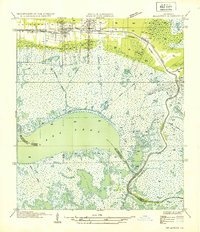
 1935 Port Sulphur1935 Print · USGSCovers Plaquemines Parish, including Port Sulphur, Home Place, and other nearby areas
 - 1935 Map of Garden Island Pass
 1935 Garden Island Pass1935 Print · USGSCovers Plaquemines Parish, including United States, Louisiana, and other nearby areas
 - 1935 Map of Lake Athanasio
 1935 Lake Athanasio1935 Print · USGSCovers Plaquemines Parish, including Saint Bernard Parish, United States, and other nearby areas
 - 1935 Map of Delacroix
 1935 Delacroix1935 Print · USGSCovers Plaquemines Parish, including Reggio, Toca, and other nearby areas
 - 1935 Map of Bastian Bay
 1935 Bastian Bay1935 Print · USGSCovers Plaquemines Parish, including United States, Louisiana, and other nearby areas
 - 1935 Map of South Pass
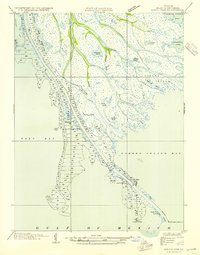 1935 South Pass1935 Print · USGSCovers Plaquemines Parish, including Port Eads, United States, and other nearby areas3 unique versions available
 - 1935 Map of Lake Calebasse
 1935 Lake Calebasse1935 Print · USGSCovers Plaquemines Parish, including Saint Bernard Parish, United States, and other nearby areas
 - 1935 Map of Bay Ronquille
 1935 Bay Ronquille1935 Print · USGSCovers Plaquemines Parish, including United States, Louisiana, and other nearby areas
 - 1935 Map of Lake Batola
 1935 Lake Batola1935 Print · USGSCovers Plaquemines Parish, including United States, Louisiana, and other nearby areas
Showing maps 1-25 of 248
Top cities of Plaquemines Parish
Frequently asked questions
- What are the different types of historical maps available for Plaquemines Parish?
- What is the oldest map of Plaquemines Parish?
- Where can I purchase historical maps of Plaquemines Parish for my home or office?
- Where can I download high-res historical maps of Plaquemines Parish?
- Are there historical topographic maps available for Plaquemines Parish?
- Is there historical aerial imagery available for Plaquemines Parish?
- Where are historical maps of Plaquemines Parish sourced from?