1900s (20th Century) Maps of Maryland
Explore 922 historic maps of Maryland from the 1900s (20th Century). These maps offer a rare glimpse into what life looked like during the 1900s — showing old roads, neighborhoods, homes, and landmarks that have changed or disappeared over time.
Whether you're researching your family's past, planning a metal detecting trip, or studying how Maryland's landscape evolved across the 1900s, these high-resolution maps are a powerful tool for exploring the history of this region.
- Focus on a specific era: All maps on this page are from the 1900s, giving you a focused view of this time period.
- See what’s changed: Compare century-old streets, trails, and buildings to today's modern landscape using overlays and satellite layers.
- Research with precision: Use these maps for genealogy, historical research, land use analysis, or educational projects.
- View, download, or print: Maps are fully viewable online in high resolution, and can be downloaded or printed for your own records.
Start exploring Maryland's history through authentic maps from the 1900s. This is your window into the past.
Maryland maps
(922)- 1900 Map of Accident
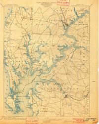
 1900 Accident1900 Print · USGSGarrett County highlands at the turn of the century reveal a landscape of mountain settlements and river-valley industry. Genealogists can trace family roots through the Blooming Rose Settlement, early milling sites like Speelman Mills, and the Baltimore and Ohio RR corridor.6 unique versions available
 - 1900 Map of Pawpaw
 1900 Pawpaw1900 Print · USGSThe Potomac River's intricate meanders define this borderland at the close of the nineteenth century. Researchers can trace the parallel routes of the Chesapeake and Ohio Canal and the Baltimore and Ohio Railroad past Magnolia, Dam No. 6, and Fisher Ford.8 unique versions available
 - 1900 Map of Oakland
 1900 Oakland1900 Print · USGSGarrett County and the West Virginia borderlands appear at the turn of the century as a landscape of mountain resorts and rail towns. Genealogists can trace family names at Gnegy Church, locate old stations like Altamont, and explore early settlements from Crellin to Bayard.5 unique versions available
 - 1900 Map of Elkton
 1900 Elkton1900 Print · USGSMaryland's tidewater and rail corridors meet at the turn of the century in this detailed survey of Cecil County. Genealogists can trace family roots through old settlements like McClellandville and Singerly or locate ancestors near the Pivot Bridge.7 unique versions available
 - 1900 Map of Washington
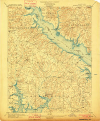
 1900 Washington1900 Print · USGSThe capital region at the turn of the century shows a landscape of river-borne commerce and expanding rail lines. Genealogists and historians can trace defunct transport links like the Shepherd Ferry and early suburbs like North Takoma and Jackson City.2 unique versions available
 - 1900 Map of Cecilton
 1900 Cecilton1900 Print · USGSUpper Chesapeake life at the turn of the century was defined by the deep tidal necks of the Sassafras River. You can trace old steamboat landings like Wilson Point Whf. and rural rail stops along the Baltimore and Delaware Bay R. R.6 unique versions available
 - 1900 Map of Havre De Grace
 1900 Havre De Grace1900 Print · USGSThe Susquehanna River valley at the turn of the century shows a landscape transitioning from the canal era to the railroad age. Genealogists and historians can trace defunct transport routes like the Tidewater Canal alongside active hubs like Rising Sun and Port Deposit.7 unique versions available
 - 1900 Map of Betterton
 1900 Betterton1900 Print · USGSThe Upper Chesapeake Bay at the turn of the century reveals a landscape of thriving steamboat wharves and primary rail corridors. Local historians can trace early landings and forgotten infrastructure at Harris Wharf, Gales Whf., and the Fishing Battery L.H.6 unique versions available
 - 1900 Map of Parkton
 1900 Parkton1900 Print · USGSThe Pennsylvania-Maryland borderlands in the early 1900s were defined by the busy Northern Central RR and the many mills along Gunpowder Falls. Researchers can trace old family locales and crossroads like Philopolis, Mount Carmel Ch, and Gorsuchs Mills.
 - 1900 Map of Flintstone
 1900 Flintstone1900 Print · USGSThe Maryland and West Virginia border at the close of the nineteenth century centers on the vital Potomac River transportation corridor. Researchers can trace the Chesapeake and Ohio Canal, the B. & O. R. R., and early settlements like Oldtown, Flintstone, and Wolf Mill.6 unique versions available
 - 1901 Map of Belair
 1901 Belair1901 Print · USGSThe Harford County borderlands at the start of the twentieth century show a landscape defined by rail corridors and early mining. Genealogists can trace family names and small settlements along the Maryland and Pennsylvania RR, such as Fawn Grove, McIntyre Minefield, and Delta.7 unique versions available
 - 1901 Map of Snow Hill
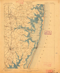
 1901 Snow Hill1901 Print · USGSSnow Hill and the surrounding Worcester County wetlands are captured at the opening of the twentieth century, when the Pocomoke River was a vital Steamboat Route. Researchers can trace the Waterman culture through historic sites like Public Landing and the railway hubs at Girdletree and Stockton.4 unique versions available
 - 1901 Map of Chestertown
 1901 Chestertown1901 Print · USGSThe Eastern Shore of Maryland comes alive in this turn-of-the-century survey of the Chester River and its surrounding necks. Genealogists and historians can trace the early rail lines and numerous river landings like Spaniards Landing, Tolchester Beach, and Leary's Mill Whf.4 unique versions available
 - 1901 Map of Salisbury
 1901 Salisbury1901 Print · USGSWicomico County at the turn of the century centered on the steamboat and rail traffic through Salisbury. Trace historic family-named locations and rural infrastructure like Fooks School, Minksville, and the steam route at Shad Pt.4 unique versions available
 - 1901 Map of Hancock
 1901 Hancock1901 Print · USGSMaryland and West Virginia met at the turn of the century along a busy corridor of river transport and rail expansion. Genealogists can trace family roots through old landmarks like Yeakle Mill, Fairview Church, and early hamlets such as Stotlers Crossroads.8 unique versions available
 - 1901 Map of Frostburg
 1901 Frostburg1901 Print · USGSMaryland's coal country and the critical mountain pass at Cumberland are shown in detail at the turn of the century. Genealogists and industrial historians can locate old mining works at Eckhart Mines, the path of the C. & O. Canal, and the early layout of Frostburg.2 unique versions available
 - 1901 Map of Drum Point
 1901 Drum Point1901 Print · USGSThe maritime heart of the lower Chesapeake Bay comes alive in this turn-of-the-century survey of the Calvert and St. Mary’s coastline. Genealogists and historians can trace old landings and light stations like Millstone Landing, Spencers Wharf, and the Drum Pt. L.H. at the mouth of the Patuxent River.
 - 1901 Map of Prince Frederick
 1901 Prince Frederick1901 Print · USGSThe Tidewater region of Maryland is captured here at the dawn of the twentieth century, when river travel and steamship wharves still defined the local economy. Researchers can locate vanished landings and ferry crossings like Magruder Ferry, Leitch Wharf, and Lower Marlboro.
 - 1901 Map of Leonardtown
 1901 Leonardtown1901 Print · USGSMaryland's tidewater country at the turn of the century is defined by its deep reliance on the river and bay. Genealogists and historians can trace the vital maritime economy through old landings and wharves like Sotterly Wharf, Abells Wharf, and Coburns Wharf.3 unique versions available
 - 1901 Map of Gunpowder
 1901 Gunpowder1901 Print · USGSCoastal Baltimore and Harford Counties are captured here at the turn of the century as the Chesapeake shoreline met a growing rail network. Genealogists and historians can trace old homesteads and landings near Abingdon, Joppa, and the Battle Monument.7 unique versions available
 - 1901 Map of Green Run
 1901 Green Run1901 Print · USGSThe Maryland and Virginia coastline at the start of the century was a land of life-saving stations and isolated landings. Trace the maritime heritage of the barrier islands through North Beach L.S.S. and the commercial roots of Scotts Landing.4 unique versions available
 - 1901 Map of Ocean City
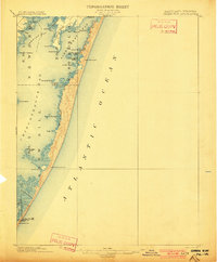
 1901 Ocean City1901 Print · USGSThe Maryland and Delaware coastlines were still largely defined by maritime labor and new rail lines at the turn of the century. You can trace the early streets of Ocean City and Berlin or locate landmarks like the Fenwick Island Lighthouse and Muskrattown.5 unique versions available
 - 1901 Map of Piney Point
 1901 Piney Point1901 Print · USGSThe Potomac River tidewater at the opening of the twentieth century was a landscape of remote landings and river-bound commerce. Researchers can trace historic ferry crossings at Mount Holly, find the L.H. at Piney Point, or locate old mill sites like Clifton Mills.5 unique versions available
 - 1902 Map of Pittsville
 1902 Pittsville1902 Print · USGSEastern Shore life at the turn of the century is centered on the Baltimore Chesapeake and Atlantic rail line and the Pocomoke River. Genealogists can locate family-named sites like Tilghman Pond and Hearns or trace the old rail stop at Ironshire Station.4 unique versions available
 - 1902 Map of Parkton
 1902 Parkton1902 Print · USGSMaryland and Pennsylvania borders were still defined by active rail and milling economies when this survey was completed. Genealogists can trace family homesteads near Gorsuchs Mills, the Northern Central R.R. corridor, and the historic Maryland Line.7 unique versions available
Showing maps 1-25 of 922
Top cities of Maryland
- Baltimore historical maps
- Columbia historical maps
- Germantown historical maps
- Waldorf historical maps
- Glen Burnie historical maps
- Frederick historical maps
See more
Top counties of Maryland
- Montgomery County historical maps
- Prince George's County historical maps
- Baltimore historical maps
- Anne Arundel County historical maps
- Howard County historical maps
- Harford County historical maps
See more
Frequently asked questions
- What are the different types of historical maps available for Maryland?
- What is the oldest map of Maryland?
- Where can I purchase historical maps of Maryland for my home or office?
- Where can I download high-res historical maps of Maryland?
- Are there historical topographic maps available for Maryland?
- Is there historical aerial imagery available for Maryland?
- Where are historical maps of Maryland sourced from?