1970s Maps of Maryland
Explore 34 historic maps of Maryland from the 1970s. These maps offer a rare glimpse into what life looked like during the 1970s — showing old roads, neighborhoods, homes, and landmarks that have changed or disappeared over time.
Whether you're researching your family's past, planning a metal detecting trip, or studying how Maryland's landscape evolved across the 1970s, these high-resolution maps are a powerful tool for exploring the history of this region.
- Focus on a specific era: All maps on this page are from the 1970s, giving you a focused view of this time period.
- See what’s changed: Compare century-old streets, trails, and buildings to today's modern landscape using overlays and satellite layers.
- Research with precision: Use these maps for genealogy, historical research, land use analysis, or educational projects.
- View, download, or print: Maps are fully viewable online in high resolution, and can be downloaded or printed for your own records.
Start exploring Maryland's history through authentic maps from the 1970s. This is your window into the past.
Maryland maps
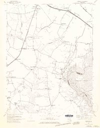
(34)- 1970 Map of Waterford, 1971 Print
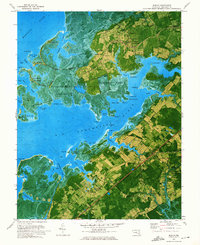
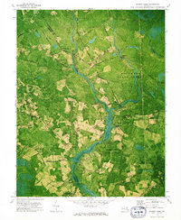
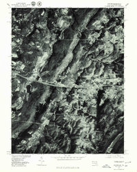
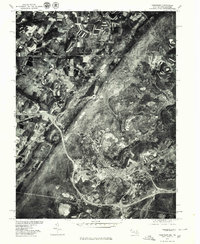
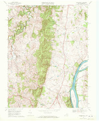 1970 Waterford1971 Print · USGSLoudoun County’s rural landscape is captured here in the early seventies, featuring the prominent ridge of Catoctin Mountain and the winding Potomac River. Genealogists and local historians can locate long-standing landmarks like Union Cemetery, Faith Chapel, and the historic settlement of Waterford.4 unique versions available
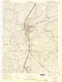
 - 1970 Map of Poolesville, 1972 Print
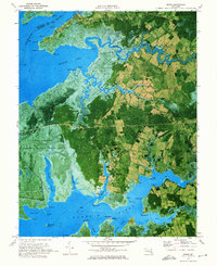
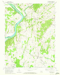 1970 Poolesville1972 Print · USGSUpper Montgomery County and the Potomac River shoreline are detailed here in the 1970s, showcasing a landscape of historic canal engineering and rural crossroads. You can trace the Chesapeake and Ohio Canal to the Monocacy Aqueduct or find local landmarks like Elijah Ch and Mt Pleasant Cem.2 unique versions available
 - 1970 Map of Point Of Rocks, 1972 Print
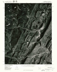
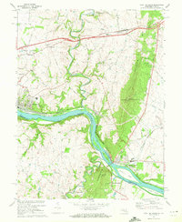 1970 Point Of Rocks1972 Print · USGSMaryland and Virginia meet along the Potomac River corridor in the early 1970s, where rail and canal history remains visible. Genealogists and historians can trace riverside settlements like Brunswick and Lander, or locate rural landmarks like St Pauls Ch and Lewis Mill.2 unique versions available
 - 1971 Map of Delmar
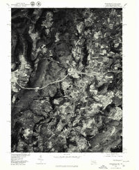
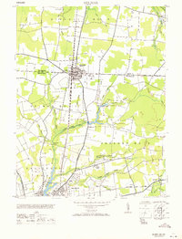 1971 Delmar1971 Print · USGSThe border town of Delmar and northern Salisbury appear here during the mid-twentieth century as rail and air transport reshaped the Delmarva landscape. Trace the Pennsylvania railroad line, the Salisbury Airport, and the Charity church.
 - 1972 Map of Kingston, 1973 Print
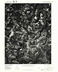
 1972 Kingston1973 Print · USGSSomerset County in the early seventies shows a landscape of tidal creeks and deep-rooted rural communities. Genealogists can trace family footprints across numerous sites like Moores Chapel, Frogeye, and the crossroads at Pauls Corner.3 unique versions available
 - 1972 Map of Princess Anne, 1974 Print
 1972 Princess Anne1974 Print · USGSSomerset County's historic center is captured in the early seventies, showing the traditional Maryland landscape before late-century expansion. Genealogists can locate family landmarks like Antioch Ch, Somerset High Sch, and the rail stops at Arden Station and Westover.2 unique versions available
 - 1972 Map of Passapatanzy, 1974 Print
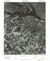 1972 Passapatanzy1974 Print · USGSCoastal Virginia in the early seventies is revealed here through detailed aerial imagery of the peninsula between two great rivers. Trace the rural development around Passapatanzy and study the shoreline details along Potomac Creek and the Rappahannock River.
 - 1972 Map of Deal Island, 1974 Print
 1972 Deal Island1974 Print · USGSThe Eastern Shore of Maryland in the early seventies reveals a landscape defined by tide and timber. Trace the water-based communities of Wenona, Chance, and Dames Quarter or locate family landmarks like Somerset Ch and St Pauls Ch among the marshes.2 unique versions available
 - 1972 Map of Marion, 1975 Print
 1972 Marion1975 Print · USGSSomerset County’s tidal necks and marshlands are captured in detail during the early seventies as the maritime economy shifted toward recreation and preservation. Researchers can trace family roots through landmarks like St Andrews Ch, the Pennsylvania Central rail line, and the old cemetery at Upper Hill.2 unique versions available
 - 1972 Map of Monie, 1975 Print
 1972 Monie1975 Print · USGSSomerset County's tidal marshes and small coastal hamlets are frozen in time during the early seventies. Genealogists and local historians can trace family roots through the many small churches and roads like St James Ch, Oriole Cem, and Millard Long Road.2 unique versions available
 - 1972 Map of Kedges Straits, 1975 Print
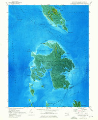
 1972 Kedges Straits1975 Print · USGSThe maritime landscape of the Chesapeake Bay is captured in the early 1970s, showcasing the intricate wetlands of Somerset and Dorchester counties. Researchers can trace the shifting shorelines of Holland Island or locate the Solomons Lump Lighthouse and the Lookout Tower within the Martin National Wildlife Refuge.2 unique versions available
 - 1972 Map of Wilmington, 1976 Print
 1972 Wilmington1976 Print · USGSThe Delaware Valley and Jersey Shore are seen here in the 1970s, showcasing the region's dense transport networks and vast state forests. Trace early coastal development near Atlantic City or locate rural landmarks like Mount Holly and Dover Air Force Base.2 unique versions available
 - 1973 Map of Terrapin Sand Point
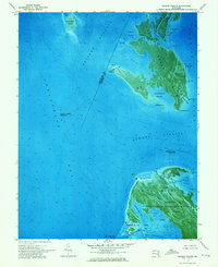
 1973 Terrapin Sand Point1973 Print · USGSThe marshy fringes of Somerset County appear just after the early seventies in this aerial-based survey of the Chesapeake's Eastern Shore. Trace the tidal channels and points of Smith Island and Little Deal Island or explore the protected bounds of the Martin National Wildlife Refuge.3 unique versions available
 - 1973 Map of Richmond, 1974 Print
 1973 Richmond1974 Print · USGSThe Virginia Tidewater and Piedmont come alive in the early seventies, showcasing a region defined by its great rivers and massive military installations. Researchers can trace the mid-century growth of Richmond or locate family sites near Amelia Court House and Highland Springs.2 unique versions available
 - 1973 Map of Dividing Creek, 1975 Print
 1973 Dividing Creek1975 Print · USGSThe borderlands of Worcester and Somerset counties remained a landscape of dense timber and quiet rural settlements in the early seventies. Genealogists and historians can trace family roots at Emanuel Cem or locate old community centers like Whiteburg and Friendship Ch.
 - 1973 Map of Richland Point, 1975 Print
 1973 Richland Point1975 Print · USGSLower and Middle Hooper Island are documented at the start of the 1970s in this detailed aerial study of the Dorchester County shoreline. Researchers can locate the Applegarth settlement, the Meeks Burial Pl, and waterway passages like The Thorofare.
 - 1973 Map of Bloodsworth Island, 1975 Print
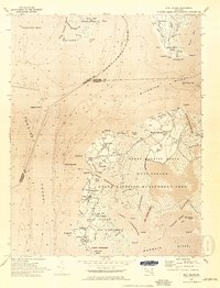
 1973 Bloodsworth Island1975 Print · USGSThe marshlands and tidal reaches of the lower Chesapeake are captured here in the early seventies, detailing a landscape defined by the U S Naval Reservation. Researchers can trace the remote settlements of Crockeron and Bishop or locate the Bethany Ch Cem.2 unique versions available
 - 1973 Map of Vienna, 1980 Print
 1973 Vienna1980 Print · USGSNorthern Virginia undergoes a dramatic transformation into a suburban hub during the late seventies. Researchers can trace the development of Reston and Vienna alongside historic landmarks like Colvin Run Mill and the Wolf Trap Farm Park.
 - 1977 Map of Hanesville
 1977 Hanesville1977 Print · USGSKent County's eastern shore in the late twentieth century reveals a landscape of quiet tidewater necks and historic landings. You can trace the rural church sites of St Georges Church and St James Church or locate the shoreline at Buck Neck Landing.
 - 1977 Map of Avilton, 1979 Print
 1977 Avilton1979 Print · USGSGarrett County in the late seventies is captured in this detailed aerial perspective of the ridgelines and rural settlements. Researchers can trace the exact footprint of family farms near Avilton and identify the shoreline of the Frostburg Reservoir.
 - 1977 Map of Accident, 1979 Print
 1977 Accident1979 Print · USGSWestern Maryland's agricultural landscape is seen in detail during the late seventies through this aerial survey of Garrett County. Genealogists and local historians can trace the specific layouts of family farms and homesteads near Accident and the slopes of Rich Hill.
 - 1977 Map of Cumberland, 1979 Print
 1977 Cumberland1979 Print · USGSWestern Maryland settlements follow the narrow valley floors in the late seventies, clustered around the gap at Cumberland. Trace the residential growth and industrial layouts from Ellerslie to the ridges of Little Allegheny Mountain.
 - 1977 Map of Grantsville, 1979 Print
 1977 Grantsville1979 Print · USGSMaryland's high mountain country is captured during the late seventies, showing the rural landscape around the Pennsylvania border. Researchers can trace the riverbank layout of Casselman, the cross-border influence of Springs, and the forested slopes of Meadow Mountain.
 - 1977 Map of Friendsville, 1979 Print
 1977 Friendsville1979 Print · USGSThe tri-state border region of Maryland, Pennsylvania, and West Virginia is seen in the late seventies through this detailed aerial orthophoto. Researchers can trace the rural layouts of Friendsville and Markleysburg alongside the Youghiogheny River Lake.
 - 1977 Map of Frostburg, 1979 Print
 1977 Frostburg1979 Print · USGSMaryland's western highlands come into sharp focus in the late seventies, showing the mountain communities around the Frostburg State campus. Genealogists and historians can trace the road and rail patterns connecting Frostburg to Eckhart Mines and Midlothian.
Showing maps 1-25 of 34
Top cities of Maryland
- Baltimore historical maps
- Columbia historical maps
- Germantown historical maps
- Waldorf historical maps
- Glen Burnie historical maps
- Frederick historical maps
See more
Top counties of Maryland
- Montgomery County historical maps
- Prince George's County historical maps
- Baltimore historical maps
- Anne Arundel County historical maps
- Howard County historical maps
- Harford County historical maps
See more
Frequently asked questions
- What are the different types of historical maps available for Maryland?
- What is the oldest map of Maryland?
- Where can I purchase historical maps of Maryland for my home or office?
- Where can I download high-res historical maps of Maryland?
- Are there historical topographic maps available for Maryland?
- Is there historical aerial imagery available for Maryland?
- Where are historical maps of Maryland sourced from?