1940s Maps of Maryland
Explore 327 historic maps of Maryland from the 1940s. These maps offer a rare glimpse into what life looked like during the 1940s — showing old roads, neighborhoods, homes, and landmarks that have changed or disappeared over time.
Whether you're researching your family's past, planning a metal detecting trip, or studying how Maryland's landscape evolved across the 1940s, these high-resolution maps are a powerful tool for exploring the history of this region.
- Focus on a specific era: All maps on this page are from the 1940s, giving you a focused view of this time period.
- See what’s changed: Compare century-old streets, trails, and buildings to today's modern landscape using overlays and satellite layers.
- Research with precision: Use these maps for genealogy, historical research, land use analysis, or educational projects.
- View, download, or print: Maps are fully viewable online in high resolution, and can be downloaded or printed for your own records.
Start exploring Maryland's history through authentic maps from the 1940s. This is your window into the past.
Maryland maps
(327)- 1940 Map of Quantico
 1940 Quantico1940 Print · USGSCoastal Virginia and Maryland are captured here during the late pre-war era, showing the growing military footprint around the Potomac. Genealogists can trace family names and landmarks like Sinclairs Mill, Bacon Race School, and the historic Dumfries settlement.2 unique versions available
 - 1941 Map of Gunpowder
 1941 Gunpowder1941 Print · USGSThe Chesapeake tidewater and the Gunpowder River valley are caught in their pre-war rural state in this early 1940s survey. Researchers can trace the paths of the P.R.R. System and locate historic sites like Harford Furnace and Osbornes Ruins.
 - 1942 Map of Laurel
 1942 Laurel1942 Print · USGSMaryland's corridor between Baltimore and Washington is seen here in the early 1940s as a land of rural schoolhouses and riverside mills. Researchers can trace family sites near Muirkirk, find the original Christian Brothers College, or locate historic river crossings like Brock Bridge and Duvall Bridge.
 - 1942 Map of Love Point
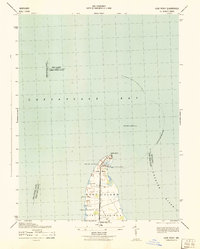 1942 Love Point1942 Print · USGSNorthern Kent Island served as a vital Chesapeake transit hub during the early forties. Trace the rail-to-ferry connection at Love Point Landing and locate landmarks like the Love Point Lighthouse and Cupola Barn.
 - 1942 Map of Havre De Grace
 1942 Havre De Grace1942 Print · USGSThe Susquehanna riverfront and Mason-Dixon borderlands are captured here in the early 1940s, just as modern infrastructure began to reshape the region. Genealogists can trace family roots through landmarks like Smith Chapel, Lees Mill, and the Brookview Cem near Rising Sun.4 unique versions available
 - 1942 Map of Hagerstown
 1942 Hagerstown1942 Print · USGSThe Cumberland Valley and Potomac corridor are captured here at the height of the Second World War rail-and-river era. Genealogists and historians can trace the industrial landscape of Richmond Furnace, the route of the Chesapeake and Ohio Canal, and the grounds of Camp Ritchie.
 - 1942 Map of Bel Air
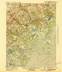
 1942 Bel Air1942 Print · USGSHarford and York counties at the start of the 1940s show a landscape shaped by the Maryland and Pennsylvania R.R. and deep-cut creek valleys. Trace the local rail-and-mill economy through Clermont Mills, Whiteford, and the village of Delta near the state line.
 - 1942 Map of Elkton
 1942 Elkton1942 Print · USGSElkton and the tristate borderlands of Maryland, Delaware, and Pennsylvania are captured here just before the mid-century expansion. Genealogists can trace family names and landmarks like Old Frenchtown Wharf, St Johns Ch, and the historic Tangent Stone.4 unique versions available
 - 1942 Map of Swan Point
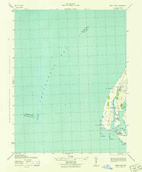 1942 Swan Point1942 Print · USGSKent County's shoreline and the waters of the Chesapeake are captured here in the early 1940s. Genealogists and maritime historians can trace the settlements of Gratitude and Edesville No 5 alongside landmarks like Swan Point and The Haven.
 - 1942 Map of Tilghman
 1942 Tilghman1942 Print · USGSChesapeake maritime life is captured here during the early war years, focusing on the communities of the Talbot County peninsula. Genealogists can trace family footprints through the Tilghman and Fairbank settlements, Peoples Chapel, and the Tilghman Island Landing.3 unique versions available
 - 1942 Map of Ocean City
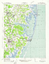 1942 Ocean City1942 Print · USGSThe Maryland and Delaware coastline at the onset of the 1940s reveals a region of tidal bays and rail-dependent coastal towns. Genealogists and historians can trace family roots in early settlements like Berlin, Sinepuxent, and Bishopville or locate maritime landmarks including Fenwick Island Lighthouse.2 unique versions available
 - 1942 Map of Frederick
 1942 Frederick1942 Print · USGSMid-century Maryland's central corridor is centered on Frederick as it appeared before the modern interstate system. Researchers can trace the routes of the B & O Canal, locate the Montevue Almshouse, and see the intersection of the Northern Central RR with early turnpikes.
 - 1942 Map of Oxford
 1942 Oxford1942 Print · USGSThe Tred Avon and Choptank rivers dominate this coastal Maryland landscape during the early 1940s. Genealogists can trace family roots through the St Paul Church, John Wesley Church, and the Choptank River Lighthouse that guided local mariners.3 unique versions available
 - 1942 Map of Drum Point
 1942 Drum Point1942 Print · USGSThe Chesapeake Bay shoreline in the early 1940s reveals a world of maritime activity and isolated coastal communities. Genealogists and local historians can trace the foundations of Solomons, locate Spencers Wharf, and explore the marshes of Taylors Island.
 - 1942 Map of Gettysburg, 1944 Print
 1942 Gettysburg1944 Print · USGSGettysburg and its surrounding borderlands are shown in great detail during the early 1940s, capturing the region's dense network of rural schools and mills. Genealogists can trace family-named landmarks such as Galt Kump PO, Hafers Mill, and Philips Delight Sch.
 - 1942 Map of Terrapin Sand Point, 1957 Print
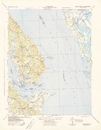
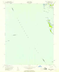
 1942 Terrapin Sand Point1957 Print · USGSCoastal Somerset County is captured here in the early 1940s, documenting a maritime landscape of marshes and tidal creeks. Researchers can trace historical shoreline features and remote outposts such as Barnes Landing, Hazard Pt, and the northern reaches of Smith Island.
 - 1942 Map of Kedges Straits, 1957 Print
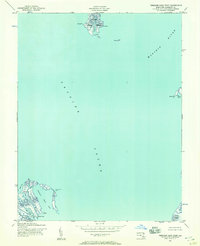
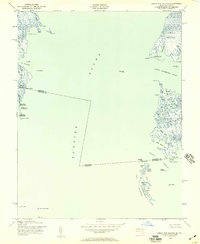
 1942 Kedges Straits1957 Print · USGSThe mid-century Chesapeake Bay shoreline comes to life through the tidal guts and marshes of the Somerset County islands. Trace the old waterway navigation routes past Holland Island Bar Lighthouse, Solomons Lump Lighthouse, and the landings at Smith Island.
 - 1942 Map of Ewell, 1957 Print
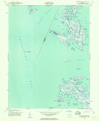
 1942 Ewell1957 Print · USGSSmith Island and its isolated waterman communities are captured here in the early 1940s, split by the Maryland and Virginia state line. Genealogists and historians can trace the small settlements of Ewell, Rhodes Point, and Tylerton alongside cemeteries and the Smith Island Light.
 - 1942 Map of Bloodsworth Island, 1957 Print
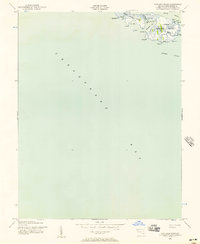
 1942 Bloodsworth Island1957 Print · USGSThe Dorchester County archipelago comes into focus during the early war years, revealing the complex marshes and tidal guts of the lower Chesapeake. Researchers can trace the maritime landscape of Bloodsworth Island and locate vanished landmarks like the Hooper Strait Lighthouse and the small settlement at Crocheron.
 - 1942 Map of Richland Point, 1957 Print
 1942 Richland Point1957 Print · USGSDorchester County's island communities are captured here during the 1940s, showing the delicate maritime landscape of the lower bay. Genealogists and historians can locate the small settlement at Applegarth and the family-named Mens Burial Pt on Lower Hooper Island.2 unique versions available
 - 1942 Map of Barren Island, 1957 Print
 1942 Barren Island1957 Print · USGSChesapeake Bay waters surround the isolated marshes of Dorchester County during the early 1940s. Maritime researchers can locate key navigational aids like the Cedar Point Lighthouse and trace the tidal channels of The Big Broads and Barren I Thorofare.3 unique versions available
 - 1942 Map of Great Fox Island, 1957 Print
 1942 Great Fox Island1957 Print · USGSThe maritime borderlands of Maryland and Virginia appear in the early 1940s as a complex network of sounds, guts, and marshes. Genealogists and historians can trace local landmarks like Horse Hammock, the James Island Light, and the remote Great Fox Island.
 - 1942 Map of Church Creek, 1958 Print
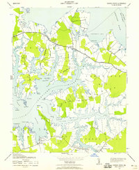 1942 Church Creek1958 Print · USGSThe Dorchester County tidewater region during the early 1940s is shown here through its intricate shoreline and rural peninsula settlements. Genealogists and historians can trace family roots through landmarks like Mace Cemetery, Gethsemane Church, and the village of Madison.2 unique versions available
 - 1942 Map of Honga, 1958 Print
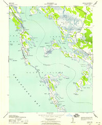 1942 Honga1958 Print · USGSDorchester County’s water-bound communities come alive in this wartime-era survey of the Eastern Shore. Genealogists and historians can trace the foundations of Hoopersville and Crapo, or locate forgotten docks like CARROLS LDG and the HOOPER ISLAND PIER.3 unique versions available
 - 1942 Map of Marion, 1958 Print
 1942 Marion1958 Print · USGSSomerset County's coastal reaches are documented here during the early war years, highlighting the intricate marshlands and rail-dependent villages. Genealogists can locate family landmarks like Samuel Webster Ch or trace the old rail stops at Marion and Hopewell.2 unique versions available
Showing maps 1-25 of 327
Top cities of Maryland
- Baltimore historical maps
- Columbia historical maps
- Germantown historical maps
- Waldorf historical maps
- Glen Burnie historical maps
- Frederick historical maps
See more
Top counties of Maryland
- Montgomery County historical maps
- Prince George's County historical maps
- Baltimore historical maps
- Anne Arundel County historical maps
- Howard County historical maps
- Harford County historical maps
See more
Frequently asked questions
- What are the different types of historical maps available for Maryland?
- What is the oldest map of Maryland?
- Where can I purchase historical maps of Maryland for my home or office?
- Where can I download high-res historical maps of Maryland?
- Are there historical topographic maps available for Maryland?
- Is there historical aerial imagery available for Maryland?
- Where are historical maps of Maryland sourced from?