1950s Maps of Maryland
Explore 223 historic maps of Maryland from the 1950s. These maps offer a rare glimpse into what life looked like during the 1950s — showing old roads, neighborhoods, homes, and landmarks that have changed or disappeared over time.
Whether you're researching your family's past, planning a metal detecting trip, or studying how Maryland's landscape evolved across the 1950s, these high-resolution maps are a powerful tool for exploring the history of this region.
- Focus on a specific era: All maps on this page are from the 1950s, giving you a focused view of this time period.
- See what’s changed: Compare century-old streets, trails, and buildings to today's modern landscape using overlays and satellite layers.
- Research with precision: Use these maps for genealogy, historical research, land use analysis, or educational projects.
- View, download, or print: Maps are fully viewable online in high resolution, and can be downloaded or printed for your own records.
Start exploring Maryland's history through authentic maps from the 1950s. This is your window into the past.
Maryland maps
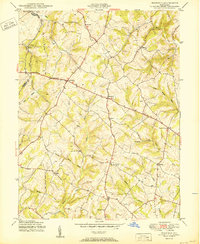
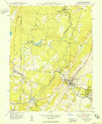
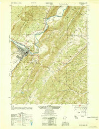
(223)- 1950 Map of Libertytown
 1950 Libertytown1950 Print · USGSMaryland's Piedmont region is captured here at mid-century, showing the rural landscapes of Frederick and Carroll Counties. Genealogists can locate family-named landmarks and institutions like Ridge Sch No 4, the Lime Mill, and settlements including Dorceytown and Woodville.2 unique versions available
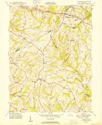
 - 1950 Map of Gorman
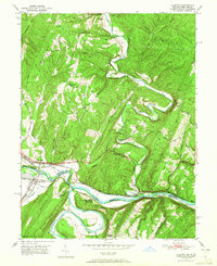
 1950 Gorman1950 Print · USGSThe Potomac River's North Branch divides Maryland and West Virginia in the late 1940s, a landscape defined by timber, coal, and the Western Maryland railroad. Trace family history at Fort Pendleton or the Chisholm-Nydegger Cemetery and explore vanished sites like Tasker Corners.2 unique versions available
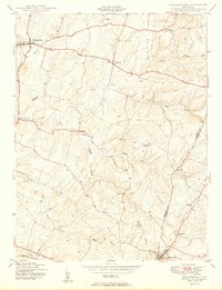
 - 1950 Map of Pittsville
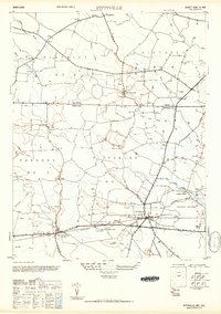 1950 Pittsville1950 Print · USGSThe Maryland-Delaware borderlands come into focus at the midpoint of the twentieth century. Genealogists can trace family homesteads near Pittsville and Parsonsburg, or locate the historic Line Church Line and Race Bridge.
 - 1950 Map of Sandy Spring
 1950 Sandy Spring1950 Print · USGSMid-century Montgomery County is captured here just as the rural crossroads began to evolve into modern suburbs. Genealogists and local historians can trace family locations near Brookeville, Olney, and Sherwood High Sch.2 unique versions available
 - 1950 Map of Winfield
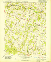
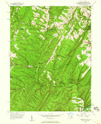
 1950 Winfield1950 Print · USGSMid-century Carroll County life is centered here on the prominence of Parrs Ridge and a network of rural crossroads. Genealogists and local historians can trace family locations near Taylorsville, Winfield, and the Woodbine Sch.5 unique versions available
 - 1950 Map of Damascus
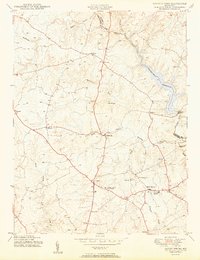
 1950 Damascus1950 Print · USGSMid-century Maryland rural life is captured here at the intersection of four counties as agricultural communities thrived. Genealogists can trace family lands near Damascus or locate early settlements like Bartholows and Browningsville along the Baltimore and Ohio RR.2 unique versions available
 - 1950 Map of Relay
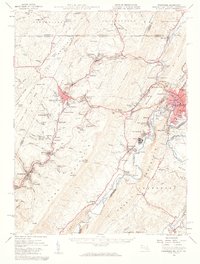
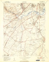 1950 Relay1950 Print · USGSMaryland's corridor between Baltimore and Anne Arundel County is captured here just as the post-war suburban and industrial expansion takes flight. Genealogists and local historians can trace the early layout of Friendship International Airport and find local landmarks like the Thomas Viaduct and All Saints Convent.2 unique versions available
 - 1950 Map of Savage
 1950 Savage1950 Print · USGSHoward County and parts of Anne Arundel County are shown here at mid-century, just as suburban expansion began to reshape these rural settlements. Genealogists and historians can trace family-named sites and institutions like St Marys College, Westley Grove, and the Maryland House of Correction.2 unique versions available
 - 1950 Map of Oakland
 1950 Oakland1950 Print · USGSGarrett County and the West Virginia border are mapped here in the late 1940s as the rail and river economy thrived. Genealogists and historians can trace family roots through Sines Cem, the Baltimore and Ohio RR corridor, and rural sites like Crellin.2 unique versions available
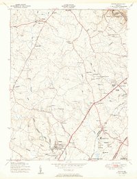
 - 1950 Map of Woodbine
 1950 Woodbine1950 Print · USGSMid-century Howard County remains a landscape of independent milling hubs and quiet crossroads hamlets. Trace the heritage of family operations like Hipsleys Mill and Roxbury Mills, or locate early rural school sites such as Mt Gregory Sch.2 unique versions available
 - 1950 Map of Kitzmiller
 1950 Kitzmiller1950 Print · USGSThe Potomac River border and the coal-rich slopes of Backbone Mountain are captured here just after the war. Researchers can trace the rail-and-river economy of Kitzmiller, find family roots at Odd Fellows Cem, and locate the mining hamlet of Potomac Manor.3 unique versions available
 - 1950 Map of Gaithersburg
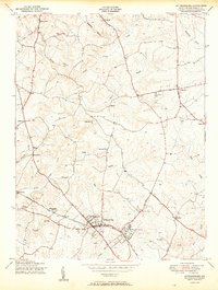 1950 Gaithersburg1950 Print · USGSMontgomery County was a landscape of small crossroads and rail-side villages mid-century, before the post-war building boom. Genealogists and local historians can trace the foundations of Gaithersburg and Washington Grove or locate the Brookgrove Sch and St Marys Home.2 unique versions available
 - 1950 Map of Keyser, 1954 Print
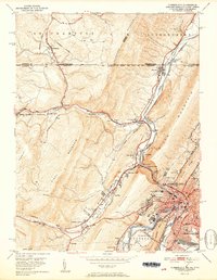
 1950 Keyser1954 Print · USGSMid-century Mineral County is defined by the heavy rail and river industrial corridor centered on Keyser. Genealogists and local historians can trace landmarks like the County Farm, the Fountain Sch, and several family cemeteries including Meadow View Cem.
 - 1950 Map of Frostburg, 1960 Print
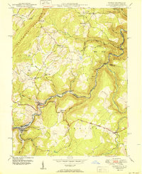
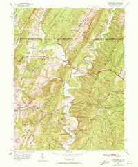
 1950 Frostburg1960 Print · USGSMid-century Allegany County is defined here by its intensive coal mining operations and the intricate rail network of the Western Maryland and other lines. Researchers can trace the lineage of vanished mining hamlets and local landmarks like Borden Shaft, Klondike, and the scenic heights of Lovers Leap.3 unique versions available
 - 1950 Map of Artemas, 1960 Print
 1950 Artemas1960 Print · USGSAllegany County and the Pennsylvania border are shown here in the mid-twentieth century as a landscape of deep hollows and narrow ridge farming. Researchers can trace the Mason and Dixon Line and find sites like White Sulphur Spring and St Patrick Ch.6 unique versions available
 - 1950 Map of Leonardtown, 1964 Print
 1950 Leonardtown1964 Print · USGSMid-century Southern Maryland comes alive on this peninsula bounded by the Patuxent and Potomac estuaries. Genealogists and historians can trace family-named points and rural infrastructure through landmarks like St Andrews Ch, Williams Wharf, and Broomes Island.
 - 1950 Map of Oldtown, 1965 Print
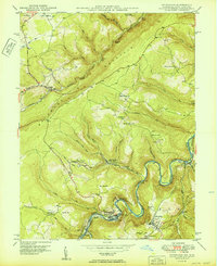
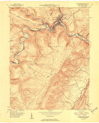
 1950 Oldtown1965 Print · USGSThe Potomac River valley on the Maryland-West Virginia border comes alive in this mid-century survey of the historic Oldtown vicinity. Researchers can trace the path of the Chesapeake and Ohio Canal and locate rural landmarks like Mount Olive Church and Pumpkin Center.2 unique versions available
 - 1950 Map of Paw Paw, 1967 Print
 1950 Paw Paw1967 Print · USGSThe Potomac River oxbows at the West Virginia-Maryland border in the mid-century, where the rail-and-canal economy shaped the mountain landscape. Trace the historic route of the Baltimore and Ohio Railroad past Magnolia and find rural sites like Milo School and Sulphur Springs Ch.3 unique versions available
 - 1950 Map of Lonaconing, 1968 Print
 1950 Lonaconing1968 Print · USGSThe coal and rail corridors of Allegany County are shown here at mid-century, before modernization altered the industrial landscape. Researchers can trace the legacy of mining towns like Lonaconing, Midland, and Ocean, alongside the path of the Pennsylvania RR.3 unique versions available
 - 1950 Map of Westernport, 1970 Print
 1950 Westernport1970 Print · USGSThe Potomac riverfront buzzed with rail and paper mill industry mid-century as the coal economy transformed the Alleghenies. Genealogists can trace family connections at rural sites like Bethel Ch, Sinkler Cem, and the small settlement at Barnum.3 unique versions available
 - 1950 Map of Flintstone, 1972 Print
 1950 Flintstone1972 Print · USGSAllegany County and the Maryland-Pennsylvania border are captured here just as post-war infrastructure began to overlay traditional mountain life. Genealogists and historians can trace family locations through Oakdale Cem, the Paradise Ch, and the remote farmsteads of Possum Hollow.5 unique versions available
 - 1951 Map of Washington East
 1951 Washington East1951 Print · USGSThe Maryland and District of Columbia borderlands are caught in a period of intense post-war development. Local historians can trace the foundations of the University of Maryland, find the Franciscan Monastery, and locate vanished landmarks like Riggs Mill.
 - 1951 Map of Cresaptown
 1951 Cresaptown1951 Print · USGSThe Potomac River borderlands and the ridges of the Appalachians are captured here in the early fifties during a period of heavy rail and industrial activity. Researchers can trace the Chesapeake and Ohio Canal, family burial sites like Frankfort Cem, and the layout of Fort Ashby.
 - 1951 Map of Cumberland
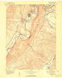
 1951 Cumberland1951 Print · USGSThe industrial and rail hub of Cumberland is captured here at mid-century, where the Potomac River meets a complex web of mountain ridges and state lines. Genealogists and local historians can trace family roots through St Patricks Cem, the streets of Mount Savage, or the historic route of the National Pike.3 unique versions available
 - 1951 Map of Westernport
 1951 Westernport1951 Print · USGSThe industrial Potomac valley comes to life in the early 1950s, showing the dense rail and river networks connecting Maryland and West Virginia. Genealogists and historians can trace families near Cross School, the Tichnell Cem, or the hilltop Pinnacle Lookout Tower.
Showing maps 1-25 of 223
Top cities of Maryland
- Baltimore historical maps
- Columbia historical maps
- Germantown historical maps
- Waldorf historical maps
- Glen Burnie historical maps
- Frederick historical maps
See more
Top counties of Maryland
- Montgomery County historical maps
- Prince George's County historical maps
- Baltimore historical maps
- Anne Arundel County historical maps
- Howard County historical maps
- Harford County historical maps
See more
Frequently asked questions
- What are the different types of historical maps available for Maryland?
- What is the oldest map of Maryland?
- Where can I purchase historical maps of Maryland for my home or office?
- Where can I download high-res historical maps of Maryland?
- Are there historical topographic maps available for Maryland?
- Is there historical aerial imagery available for Maryland?
- Where are historical maps of Maryland sourced from?