1980s Maps of Maryland
Explore 70 historic maps of Maryland from the 1980s. These maps offer a rare glimpse into what life looked like during the 1980s — showing old roads, neighborhoods, homes, and landmarks that have changed or disappeared over time.
Whether you're researching your family's past, planning a metal detecting trip, or studying how Maryland's landscape evolved across the 1980s, these high-resolution maps are a powerful tool for exploring the history of this region.
- Focus on a specific era: All maps on this page are from the 1980s, giving you a focused view of this time period.
- See what’s changed: Compare century-old streets, trails, and buildings to today's modern landscape using overlays and satellite layers.
- Research with precision: Use these maps for genealogy, historical research, land use analysis, or educational projects.
- View, download, or print: Maps are fully viewable online in high resolution, and can be downloaded or printed for your own records.
Start exploring Maryland's history through authentic maps from the 1980s. This is your window into the past.
Maryland maps
(70)- 1980 Map of Selbyville, 1982 Print
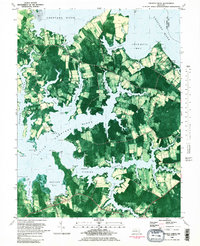
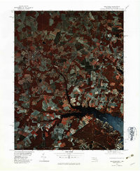 1980 Selbyville1982 Print · USGSThe Delaware-Maryland borderlands appear in striking infrared detail during the early 1980s, showing a landscape defined by traditional agriculture and winding waterways. Researchers can trace the rural layouts of Selbyville, Bishopville, and Roxana as they existed forty years ago.
 - 1980 Map of Assawoman Bay, 1982 Print
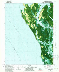
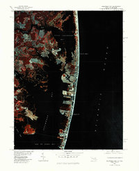 1980 Assawoman Bay1982 Print · USGSCoastal Maryland and Delaware are seen here in the early eighties as beachfront development reshaped the barrier islands. Trace the growth of Ocean City and Fenwick Island between the Atlantic Ocean and Assawoman Bay.
 - 1981 Map of Kingwood, 1982 Print
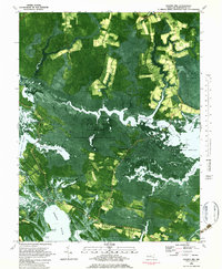
 1981 Kingwood1982 Print · USGSThe West Virginia highlands in the early eighties were a hub of mountain railroading and wilderness conservation. Trace the path of the Baltimore & Ohio RR through Kingwood or explore the early footprints of Canaan Valley State Park and Dolly Sods.
 - 1981 Map of Cumberland, 1982 Print
 1981 Cumberland1982 Print · USGSThe tri-state region of Maryland, Pennsylvania, and West Virginia is captured here in the early eighties as a landscape of industrial history and ridgeline geography. Researchers can trace the heritage of the C & O Canal and the B & O RR through mountain gaps and coal towns like Eckhart Mines and Frostburg.2 unique versions available
 - 1981 Map of Golden Hill, 1982 Print
 1981 Golden Hill1982 Print · USGSDorchester County's marshlands and coastal hamlets are captured here during the early eighties, showcasing the interface of land and water. Researchers can locate family landmarks like St Marys Star of the Sea Ch or trace the roads through Golden Hill and Woolford.2 unique versions available
 - 1981 Map of Chincoteague, 1982 Print
 1981 Chincoteague1982 Print · USGSThe Delmarva Eastern Shore at the start of the eighties shows a unique blend of traditional coastal life and modern aerospace technology. Researchers can trace the Penn Central rail line through rural towns like Modest Town and Bloxom or explore the marshlands of the Saxis Marsh Waterfowl Management Area and Refuge.
 - 1981 Map of Stratford Hall, 1985 Print
 1981 Stratford Hall1985 Print · USGSThe Potomac River tidewater region is captured in the early 1980s through high-altitude aerial photography. Researchers can trace the wooded shorelines near Stratford Hall or examine the Maryland docks and marshes at Coltons Point.2 unique versions available
 - 1981 Map of Woodbine, 1986 Print
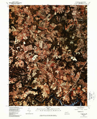
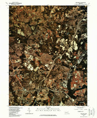
 1981 Woodbine1986 Print · USGSHoward County's agricultural landscape is seen in transition during the early eighties, showcasing a patchwork of farms and woodland. Genealogists and local historians can trace the rural layouts of Lisbon, Woodbine, and the area around Cattail Creek.
 - 1981 Map of Clarksville, 1986 Print
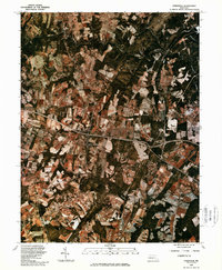
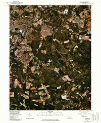
 1981 Clarksville1986 Print · USGSHoward County's landscape undergoes a transformation in the early eighties as suburban growth meets rural Maryland. Trace the development of Columbia and Clarksville alongside the waters of the Rocky Gorge Reservoir.
 - 1981 Map of Savage, 1986 Print
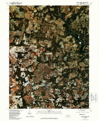
 1981 Savage1986 Print · USGSDuring the early 1980s, Howard County saw the rapid expansion of planned communities and transit corridors. Genealogists and historians can trace the growth of Columbia and locate the historic footprints of Savage, Jessup, and the Baltimore Washington Parkway.
 - 1981 Map of Sykesville, 1986 Print
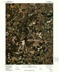
 1981 Sykesville1986 Print · USGSMaryland's changing rural landscape is captured in the early eighties as agricultural fields and suburban expansion meet. Researchers can trace land use and property boundaries around Sykesville and the forks of the Little Patuxent River.
 - 1981 Map of Gaithersburg, 1986 Print
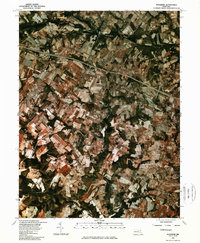
 1981 Gaithersburg1986 Print · USGSMontgomery County was undergoing a period of significant suburban growth when this 1981 survey was conducted. Trace the developing street patterns of Montgomery Village and Gaithersburg alongside established spots like Washington Grove.
 - 1981 Map of Beltsville, 1986 Print
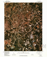
 1981 Beltsville1986 Print · USGSMaryland's suburban corridor was rapidly maturing in the early eighties as highway networks integrated the communities between D.C. and Baltimore. Genealogists and local researchers can trace residential growth from Beltsville and Laurel to the borders of Greenbelt.
 - 1981 Map of Laurel, 1986 Print
 1981 Laurel1986 Print · USGSThe Patuxent River valley in the early 1980s reveals a Maryland landscape in the midst of significant suburban transformation. Researchers can trace the development of Laurel and Maryland City alongside water landmarks like Cash Lake and the Baltimore Washington Parkway.
 - 1981 Map of Damascus, 1986 Print
 1981 Damascus1986 Print · USGSDamascus and Mount Airy appear at the start of the 1980s in this detailed orthophoto study of the Maryland Piedmont. Researchers can trace land use patterns and property boundaries near the Patuxent River, Bennett Creek, and Cedar Heights.
 - 1981 Map of Sandy Spring, 1986 Print
 1981 Sandy Spring1986 Print · USGSMontgomery County in the early eighties exhibits a landscape of evolving farmland and emerging residential hubs. Trace the historical boundaries of rural Maryland through the aerial footprints of Brookeville, Sandy Spring, and the waters of the Triadelphia Reservoir.
 - 1981 Map of Relay, 1986 Print
 1981 Relay1986 Print · USGSMaryland's transportation corridor is captured in the early eighties as suburban expansion and aviation infrastructure began to reshape the region. Trace the footprints of Relay and Linthicum Heights or the massive layout of the Baltimore Washington International Airport.
 - 1982 Map of Church Creek
 1982 Church Creek1982 Print · USGSThe Dorchester County shoreline is revealed in this early 1980s survey, showing the intricate tidal necks and agricultural plots of the Eastern Shore. Trace local history at the St Johns Cem Chapel, or locate old crossroads in Cornersville and Dailsville.2 unique versions available
 - 1982 Map of Taylors Island
 1982 Taylors Island1982 Print · USGSThe Dorchester County coast is captured in the early eighties, showcasing the resilient island communities of the Maryland Eastern Shore. Genealogists can locate family landmarks like Bethlehem Ch, Smithville, and Old Trinity Cem among the marshlands.2 unique versions available
 - 1982 Map of Hudson
 1982 Hudson1982 Print · USGSDorchester County's shoreline and tidal flats are documented in high detail during the early eighties, capturing a landscape shaped by the Choptank River. Researchers can trace local history through the settlements of Hudson and Thomas or locate family cemeteries near Hills Point and Susquehanna Neck.
 - 1982 Map of Vienna
 1982 Vienna1982 Print · USGSFairfax County underwent significant transformation in the early eighties as federal centers and modern suburbs rose alongside old mills. Trace the evolution of Reston and Vienna or find historic sites like Colvin Run Mill and Browns Chapel Cem.
 - 1982 Map of Washington West, 1983 Print
 1982 Washington West1983 Print · USGSThe Virginia and Maryland suburbs were undergoing intense development in the early eighties as the capital region expanded outward. Researchers can trace the footprint of Cold War-era defense sites like Fort Belvoir and Vint Hill Farms Station alongside growing academic centers like George Mason University.
 - 1982 Map of Chicamacomico River, 1983 Print
 1982 Chicamacomico River1983 Print · USGSDorchester County's intricate shoreline and tidal marshes are captured here in the late seventies, showing a landscape defined by the Chicamacomico River. Researchers can locate family landmarks like Eagle Hall and Griffith Neck, or trace old landings at Cedar Landing and Brick House Landing.2 unique versions available
 - 1982 Map of East Of Point Lookout, 1983 Print
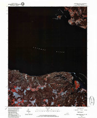
 1982 East Of Point Lookout1983 Print · USGSChesapeake Bay waters in the early 1980s are revealed in this detailed bathymetric study of the Maryland coast. Researchers can trace the submerged boundary between St Marys Co and Somerset Co and study the deep-water floor of the Chesapeake Bay.
 - 1982 Map of Blackwater River, 1983 Print
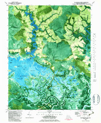 1982 Blackwater River1983 Print · USGSThe Dorchester County wetlands come into sharp focus in the early eighties, showing a landscape defined by tidal guts and isolated landings. Trace family roots at Scotts Chapel or explore the river economy at Shorters Wharf and Barnes Landing.2 unique versions available
Showing maps 1-25 of 70
Top cities of Maryland
- Baltimore historical maps
- Columbia historical maps
- Germantown historical maps
- Waldorf historical maps
- Glen Burnie historical maps
- Frederick historical maps
See more
Top counties of Maryland
- Montgomery County historical maps
- Prince George's County historical maps
- Baltimore historical maps
- Anne Arundel County historical maps
- Howard County historical maps
- Harford County historical maps
See more
Frequently asked questions
- What are the different types of historical maps available for Maryland?
- What is the oldest map of Maryland?
- Where can I purchase historical maps of Maryland for my home or office?
- Where can I download high-res historical maps of Maryland?
- Are there historical topographic maps available for Maryland?
- Is there historical aerial imagery available for Maryland?
- Where are historical maps of Maryland sourced from?