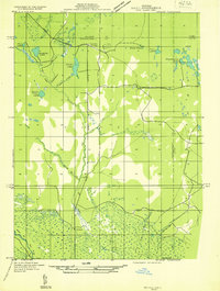
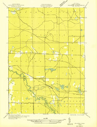
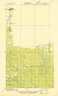
1930s Maps of Michigan
Explore 202 historic maps of Michigan from the 1930s. These maps offer a rare glimpse into what life looked like during the 1930s — showing old roads, neighborhoods, homes, and landmarks that have changed or disappeared over time.
Whether you're researching your family's past, planning a metal detecting trip, or studying how Michigan's landscape evolved across the 1930s, these high-resolution maps are a powerful tool for exploring the history of this region.
- Focus on a specific era: All maps on this page are from the 1930s, giving you a focused view of this time period.
- See what’s changed: Compare century-old streets, trails, and buildings to today's modern landscape using overlays and satellite layers.
- Research with precision: Use these maps for genealogy, historical research, land use analysis, or educational projects.
- View, download, or print: Maps are fully viewable online in high resolution, and can be downloaded or printed for your own records.
Start exploring Michigan's history through authentic maps from the 1930s. This is your window into the past.
Michigan maps
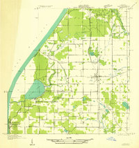
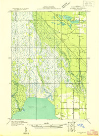
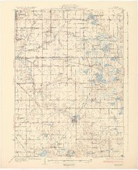
(202)- 1930 Map of Three Oaks
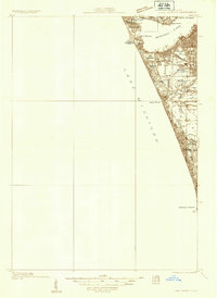
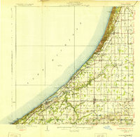 1930 Three Oaks1930 Print · USGSSouthwest Michigan's lakeshore and interior townships are captured in detail during the late twenties. Genealogists and historians can trace family roots through numerous rural schoolhouses like California Sch or visit the settled blocks of Three Oaks and New Buffalo.3 unique versions available
 - 1930 Map of South Haven
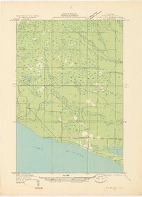
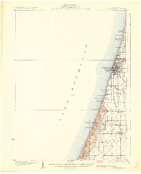 1930 South Haven1930 Print · USGSSouthwest Michigan's lakeshore comes alive in this early Depression-era survey, showing the bustling port of South Haven and its surrounding resort beaches. Genealogists and local historians can trace rural school districts like Fish Sch and landmarks such as the Emanuel Home and Thunder Mtn.4 unique versions available
 - 1930 Map of Shepherd
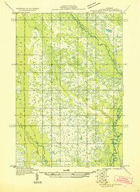
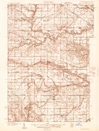 1930 Shepherd1930 Print · USGSIsabella and Midland counties are shown during the 1930s oil boom, centered on the infrastructure around Oil City. Genealogists and researchers can trace family lands near dozens of rural schoolhouses like McNelly Sch or visit the Coleman Cem.3 unique versions available
 - 1930 Map of Benton Harbor
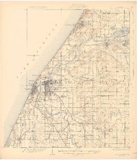 1930 Benton Harbor1930 Print · USGSBerrien County's lakefront and river valleys appear in high detail during the late Prohibition era. Genealogists can trace family names through dozens of rural landmarks like Twelve Corners, Crystal Springs Cem, and the House of David.4 unique versions available
 - 1930 Map of Lake Harbor
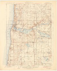
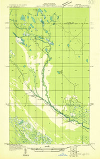
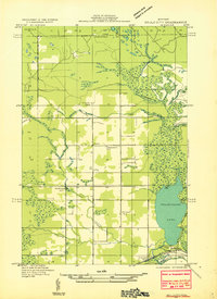
 1930 Lake Harbor1930 Print · USGSThe industrial and recreational shoreline of Lake Michigan comes alive in this pre-war survey of the Muskegon region. Genealogists can trace family roots through specific locations like Indian Village, Port Sherman, and the Maple Grove Sch.
 - 1930 Map of Niles
 1930 Niles1930 Print · USGSBerrien County's rural heartland is captured here at the onset of the 1930s, showing the agricultural and riverine landscape before modern development. Genealogists can trace family roots through numerous country schools like Bedinger Sch and landmark sites such as Salem Ch or Pennellwood.4 unique versions available
 - 1930 Map of Muskegon, 1960 Print
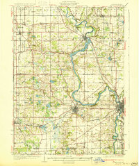
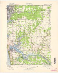 1930 Muskegon1960 Print · USGSThe Lake Michigan shoreline and the winding Grand River valley appear here as they were in the late 1920s. Researchers can locate dozens of country schools like Carr Sch and Jones Sch, or trace the tracks of the Pere Marquette railroad.2 unique versions available
 - 1931 Map of Custer NW
 1931 Custer NW1931 Print · USGSMason County’s rural landscape during the early thirties is anchored by the rail-and-road junction at Custer. Genealogists and historians can trace the distribution of early twentieth-century country schools like Weldon Cr Sch and Ressigue Sch along the Pere Marquette River.
 - 1931 Map of St Ignace NW
 1931 St Ignace NW1931 Print · USGSMackinac County's shoreline and offshore islands are captured here in the early 1930s, showing the region's rural character before modern expansion. Genealogists and local historians can locate early landmarks like Fort Algonquin, Rabbits Back Sch, and the docks at British Landing.
 - 1931 Map of Fennville
 1931 Fennville1931 Print · USGSCoastal Allegan County was a thriving hub of lakefront tourism and rail-based agriculture in the years before the Great Depression. Genealogists and historians can trace family-named schools like Reid Sch and Loomis Sch, or find the Old Saugatuck Light Ho near the river's bend.4 unique versions available
 - 1931 Map of Cooks NE
 1931 Cooks NE1931 Print · USGSCoastal Schoolcraft County comes alive in this early 1930s survey of the northern Lake Michigan shoreline. Genealogists and local historians can trace the rail lines of the Manistique Ry and locate family landmarks like Heights Sch and Dufour.
 - 1931 Map of Seney SW
 1931 Seney SW1931 Print · USGSUpper Peninsula wetlands and rail corridors are preserved in this early 1930s survey of Schoolcraft County. Genealogists and historians can trace the foundations of Seney and Germfask along the Manistique River and the Duluth South Shore and Atlantic railroad.
 - 1931 Map of Hart NW
 1931 Hart NW1931 Print · USGSOceana County’s coast and interior farmsteads are captured in the early 1930s, showing a landscape defined by small rural school districts and the lakefront. Researchers can trace family locations through sites like Wesley M E Ch, the village of Mears, and schools like Young Sch and Garver Sch.
 - 1931 Map of Seney NW
 1931 Seney NW1931 Print · USGSUpper Peninsula wetlands and timberlands are captured here in the early 1930s as State Highway 77 began to define regional travel. Researchers can trace the complex headwaters of the Tahquamenon Lakes and the isolated settlement at Lavender Corner.2 unique versions available
 - 1931 Map of Baldwin NW
 1931 Baldwin NW1931 Print · USGSLake County's timber and river country is captured here in the early thirties, just as federal forest management was taking hold. Researchers can locate the settlement of Wingleton, the local Town Hall, and the original path of U S Highway No 10.
 - 1931 Map of Pickford SE
 1931 Pickford SE1931 Print · USGSMackinac and Chippewa counties are shown during the early thirties as the rural road network began to solidify through the Upper Peninsula wetlands. Researchers can locate vanished landmarks like Tripp Sch and Izzard Sch or trace the early course of US Hy No 2.
 - 1931 Map of Steuben SE
 1931 Steuben SE1931 Print · USGSUpper Peninsula timberlands and wetlands are surveyed here in the early thirties. Genealogists and local researchers can trace the rail stops and rural schools of Schoolcraft County, from Hiawatha Sta to the Maple Grove Sch near Indian Lake.
 - 1931 Map of Epoufette SE
 1931 Epoufette SE1931 Print · USGSThe Mackinac County shoreline appears in the early 1930s as a quiet stretch of coastal wetlands and new highway development. Researchers can trace early settlements like Manitou Payment and Brevoort along the banks of Little Brevoort Lake and the Brevoort River.
 - 1931 Map of Manistique River NE
 1931 Manistique River NE1931 Print · USGSSchoolcraft County’s hydrologic network is captured in the early 1930s as the U.S. Army Air Corps began utilizing aerial photography for land surveys. This sheet allows you to trace the intricate meanders of the Manistique River and Driggs River through Doyle and across vast Marsh lands.
 - 1931 Map of Steuben SW
 1931 Steuben SW1931 Print · USGSThe Upper Peninsula wilderness in the early 1930s is documented here through a dense network of glacial lakes and river systems. Historians and outdoor researchers can trace the old water routes of the Indian River and locate landmarks like Thunder Lake and Frankes Lake.
 - 1931 Map of Custer SW
 1931 Custer SW1931 Print · USGSThe borderlands of Oceana and Mason County are captured in the early 1930s when rural education and township government anchored the community. Genealogists can locate family homesteads near Crystal and trace the paths to Fern Sch, Kidder Sch, or the Town Hall.
 - 1931 Map of Driggs Lake NE
 1931 Driggs Lake NE1931 Print · USGSThe Upper Peninsula wilderness at the start of the 1930s is documented here through a network of lakes and winding river bends. Trace the early trails and water routes used by foresters and hunters, from the Fox River to the distinctive Little Devils Elbow.2 unique versions available
 - 1931 Map of Bangor
 1931 Bangor1931 Print · USGSCoastal resorts and interior farmsteads meet in this early 1930s survey of the Michigan lakefront and the Black River basin. Researchers can trace the PERE MARQUETTE rail line through Grand Junction or locate family sites like Kibbie Chapel and Gardner of Eden Sch.3 unique versions available
 - 1931 Map of Custer NE
 1931 Custer NE1931 Print · USGSMason County in the early 1930s is a landscape of winding rivers and country schoolhouses. Genealogists and local historians can trace the foundations of Tallman and Walhalla, or locate landmarks like the Dunbar Fire Tower and the Swedish Settlement Sch.
 - 1931 Map of Gould City NE
 1931 Gould City NE1931 Print · USGSMackinac County's Upper Peninsula landscape in the early thirties shows a network of rural schoolhouses and emerging lakeside recreation. Genealogists and historians can locate family-named landmarks like Elsner Sch or the Millecoquins Lake Resort near the Greylock Spur.
Showing maps 1-25 of 202
Top cities of Michigan
- Detroit historical maps
- Grand Rapids historical maps
- Sterling Heights historical maps
- Warren historical maps
- Ann Arbor historical maps
- Lansing historical maps
See more
Top counties of Michigan
- Wayne County historical maps
- Oakland County historical maps
- Macomb County historical maps
- Kent County historical maps
- Genesee County historical maps
- Washtenaw County historical maps
See more
Frequently asked questions
- What are the different types of historical maps available for Michigan?
- What is the oldest map of Michigan?
- Where can I purchase historical maps of Michigan for my home or office?
- Where can I download high-res historical maps of Michigan?
- Are there historical topographic maps available for Michigan?
- Is there historical aerial imagery available for Michigan?
- Where are historical maps of Michigan sourced from?