1950s Maps of Michigan
Explore 361 historic maps of Michigan from the 1950s. These maps offer a rare glimpse into what life looked like during the 1950s — showing old roads, neighborhoods, homes, and landmarks that have changed or disappeared over time.
Whether you're researching your family's past, planning a metal detecting trip, or studying how Michigan's landscape evolved across the 1950s, these high-resolution maps are a powerful tool for exploring the history of this region.
- Focus on a specific era: All maps on this page are from the 1950s, giving you a focused view of this time period.
- See what’s changed: Compare century-old streets, trails, and buildings to today's modern landscape using overlays and satellite layers.
- Research with precision: Use these maps for genealogy, historical research, land use analysis, or educational projects.
- View, download, or print: Maps are fully viewable online in high resolution, and can be downloaded or printed for your own records.
Start exploring Michigan's history through authentic maps from the 1950s. This is your window into the past.
Michigan maps
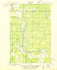
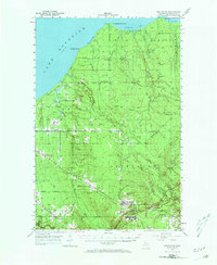
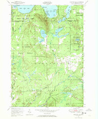
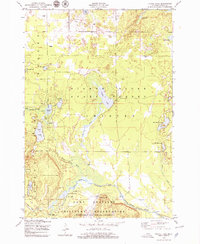
(361)- 1950 Map of Leonidas
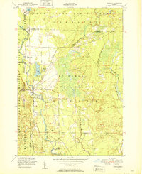
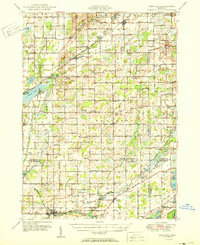 1950 Leonidas1950 Print · USGSSouthern Michigan’s borderlands at mid-century are defined by the winding St Joseph River and a patchwork of rural school districts. Genealogists can trace family roots through landmarks like Gilson Cem, Dutton Cem, and the numerous rural schools including Factoryville Sch.2 unique versions available
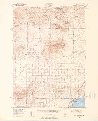
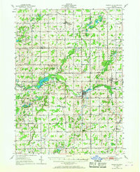
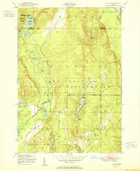
 - 1950 Map of Galesburg
 1950 Galesburg1950 Print · USGSSouthwestern Michigan at mid-century shows a landscape defined by the expansion of Fort Custer and the busy rail corridors of Galesburg. Researchers can trace old family schoolhouses like Hoover Sch and Toad Hollow Sch alongside the summer resorts of Gull Lake.2 unique versions available
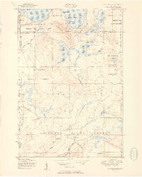
 - 1950 Map of Phelps
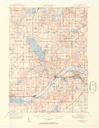
 1950 Phelps1950 Print · USGSVilas County's lake country is captured here during the mid-century, showing the development of Phelps and Land O' Lakes along the state line. Researchers can trace the Chicago and Northwestern rail line and locate the Augustus Adolphus Ch or the C C C Camp near Afterglow Lake.
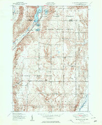
 - 1950 Map of Skandia NW
 1950 Skandia NW1950 Print · USGSThe Marquette County shoreline and timberlands come into focus at mid-century, where rail lines and river forks meet. Genealogists and historians can trace the foundations of Yalmer and New Dalton through the Yalmer Sch and Skandia Cem.
 - 1950 Map of Battle Creek
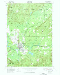
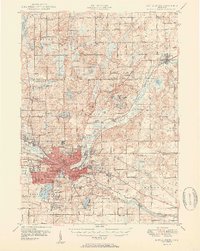 1950 Battle Creek1950 Print · USGSBattle Creek and its surrounding townships thrive in the early post-war years as a vital hub of Michigan industry and aviation. Genealogists and historians can trace family roots through numerous country schools like Cobblestone Sch and cemeteries such as Oak Hill Cem.3 unique versions available
 - 1950 Map of Union City
 1950 Union City1950 Print · USGSBranch and Calhoun counties are captured here in the mid-century, showcasing a landscape of riverside towns and agricultural hamlets. Researchers can trace family history through numerous rural landmarks like Burr Oak Cem, Newton Ch, and the Burlington Sta rail stop.2 unique versions available
 - 1950 Map of Gladstone NW
 1950 Gladstone NW1950 Print · USGSThe Upper Peninsula logging and rail landscape comes alive in this mid-century survey of the Escanaba River valley. Genealogists can locate family-named landmarks like Larsons Camp and rural sites such as St Nicholas Sch and the hamlet of Cornell.
 - 1950 Map of Star Lake
 1950 Star Lake1950 Print · USGSVilas County's lake-strewn borderlands are captured here at mid-century, showing a landscape defined by timber management and early rail travel. Researchers can trace the Chicago and Northwestern Ry through Conover and locate remote outposts like Camp 5 or the Monahan Fire Tower.
 - 1950 Map of Cote Dame Marie, 1953 Print
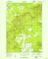
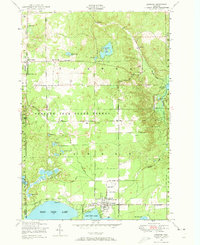
 1950 Cote Dame Marie1953 Print · USGSMid-century northern Michigan comes to life in this study of the hills and forests west of Higgins Lake. Genealogists and local historians can trace family landmarks like the Beaver Creek Cem, Beaver Creek Sch, and the unique early settlement at Tent City.4 unique versions available
 - 1950 Map of Fletcher, 1953 Print
 1950 Fletcher1953 Print · USGSUpper Michigan's interior river valleys were largely dedicated to state forests and military use by the mid-twentieth century. Genealogists and researchers can trace the vicinity of the Fletcher Sch or follow the winding Manistee River and the rural route of Fletcher Road.4 unique versions available
 - 1950 Map of Lake Margrethe, 1953 Print
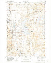
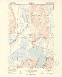 1950 Lake Margrethe1953 Print · USGSCrawford County's military and natural landscapes intersect in the early fifties at Lake Margrethe. Researchers can trace the layout of Camp Grayling and its Rifle Range, or locate family-named landings like McIntyre Landing and Collens Landing.4 unique versions available
 - 1950 Map of Greenland, 1956 Print
 1950 Greenland1956 Print · USGSThe Upper Peninsula copper country is seen here at mid-century, where logging camps and mining operations defined the inland landscape. Researchers can trace the Copper Range Railroad and find historic sites like Adventure Mine or the remote Abbott-Fox Camp.2 unique versions available
 - 1950 Map of Nashville, 1967 Print
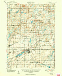
 1950 Nashville1967 Print · USGSThe Thornapple River valley in the mid-twentieth century shows a landscape of rail-connected villages and rural school districts. Genealogists can locate family landmarks like Woodlawn Cem, McKelvey Sch, and the New York Central rail line.
 - 1950 Map of Grayling, 1973 Print
 1950 Grayling1973 Print · USGSGrayling is shown here at mid-century as a vital hub for conservation and military training in Crawford County. Researchers can trace the development of Camp Grayling and local landmarks like the State Fish Hatchery or Elmwood Cemetery.2 unique versions available
 - 1950 Map of Lewiston, 1973 Print
 1950 Lewiston1973 Print · USGSIn the early 1950s, this area of northern Michigan transitioned from a timber-driven landscape into a growing lakefront community. Researchers can locate family landmarks like the Charlton Cemetery, Doubles School, and the Vienna Township Hall.3 unique versions available
 - 1950 Map of Comstock Hills, 1973 Print
 1950 Comstock Hills1973 Print · USGSThe northern lower peninsula comes alive in the fifties as a premier outdoor destination. Trace the development of lakeside retreats like Birchwood Beach or locate the Comstock Fire Tower and the Indian Village Boys Camp deep in the woods.3 unique versions available
 - 1950 Map of Johannesburg, 1977 Print
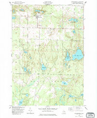 1950 Johannesburg1977 Print · USGSOtsego County's lake-rich landscape is captured here in the mid-century, centered on the community of Johannesburg and the deep woods of the Pigeon River State Forest. Genealogists and local historians can locate the Johannesburg Cemetery, the Full Gospel Church, and family landmarks like Hill Side Farm.
 - 1950 Map of Lovells, 1977 Print
 1950 Lovells1977 Print · USGSCrawford County and the Au Sable River valley are captured at mid-century, just as the region’s outdoor sporting culture was firmly established. Researchers can trace family sites at Lovells, locate the Lovells Cemetery, or explore the boundaries of Camp Grayling.2 unique versions available
 - 1950 Map of Roscommon North, 1978 Print
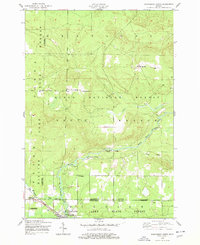 1950 Roscommon North1978 Print · USGSCrawford and Roscommon Counties in the mid-century were defined by the deep woods of the National Forest and the waters of the Au Sable. Researchers can trace the legacy of early settlers at Pioneer Cemetery or locate old industrial sites like the local Sawmill and Northern Block and Supply Company.2 unique versions available
 - 1950 Map of Turtle Lake, 1979 Print
 1950 Turtle Lake1979 Print · USGSOtsego County in the mid-twentieth century was a landscape of state forests and military grounds dotted with named fishing camps and glacial lakes. You can trace early river landings and remote outposts like Whites Landing, Triple K Ranch, and the Viking Club.2 unique versions available
 - 1951 Map of Helena SW
 1951 Helena SW1951 Print · USGSMarquette County's logging and rail corridor is captured here in the early 1950s, showing the intersection of timber camps and rural school life. Researchers can trace the Escanaba and Lake Superior line to Watson, the Arnold PO, and the Finnish Sch.
 - 1951 Map of K P Lake
 1951 K P Lake1951 Print · USGSCrawford County's military and forest lands are captured here during the early fifties, showing the expansive training grounds of the Michigan National Guard. Researchers can trace the winding Au Sable River and locate remote landmarks like Camp Grayling, K P Lake, and Bear Lake.3 unique versions available
 - 1951 Map of Comstock Hills
 1951 Comstock Hills1951 Print · USGSOscoda County was a prime destination for postwar tourism in the early fifties, characterized by a dense network of lakeside retreats and hunting camps. You can trace the development of Garland Village or locate secluded spots like Birdhaven Resort and Werners Hotel.2 unique versions available
 - 1951 Map of Big Bradford Lake
 1951 Big Bradford Lake1951 Print · USGSCrawford County's vast timberlands and military tracts are frozen in time during the early fifties. Researchers can trace the legacy of remote settlements and early tourism at Forbush Corner, Maple Forest Cemetery, and the Bass Lake Cabins.3 unique versions available
 - 1951 Map of Lovells
 1951 Lovells1951 Print · USGSCrawford County's river-driven landscape is captured here in the early fifties, showing the area's growth as a sporting and military hub. Genealogists and historians can trace Lovells town sites like the Community Chapel and Lovells Cemetery alongside the North Branch Au Sable River.2 unique versions available
Showing maps 1-25 of 361
Top cities of Michigan
- Detroit historical maps
- Grand Rapids historical maps
- Sterling Heights historical maps
- Warren historical maps
- Ann Arbor historical maps
- Lansing historical maps
See more
Top counties of Michigan
- Wayne County historical maps
- Oakland County historical maps
- Macomb County historical maps
- Kent County historical maps
- Genesee County historical maps
- Washtenaw County historical maps
See more
Frequently asked questions
- What are the different types of historical maps available for Michigan?
- What is the oldest map of Michigan?
- Where can I purchase historical maps of Michigan for my home or office?
- Where can I download high-res historical maps of Michigan?
- Are there historical topographic maps available for Michigan?
- Is there historical aerial imagery available for Michigan?
- Where are historical maps of Michigan sourced from?