1980s Maps of Michigan
Explore 645 historic maps of Michigan from the 1980s. These maps offer a rare glimpse into what life looked like during the 1980s — showing old roads, neighborhoods, homes, and landmarks that have changed or disappeared over time.
Whether you're researching your family's past, planning a metal detecting trip, or studying how Michigan's landscape evolved across the 1980s, these high-resolution maps are a powerful tool for exploring the history of this region.
- Focus on a specific era: All maps on this page are from the 1980s, giving you a focused view of this time period.
- See what’s changed: Compare century-old streets, trails, and buildings to today's modern landscape using overlays and satellite layers.
- Research with precision: Use these maps for genealogy, historical research, land use analysis, or educational projects.
- View, download, or print: Maps are fully viewable online in high resolution, and can be downloaded or printed for your own records.
Start exploring Michigan's history through authentic maps from the 1980s. This is your window into the past.
Michigan maps
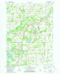
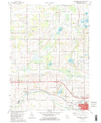
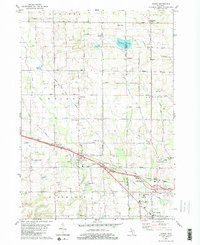
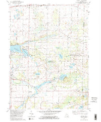
(645)- 1980 Map of Duck Lake
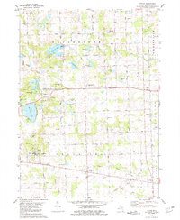
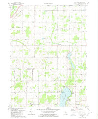 1980 Duck Lake1980 Print · USGSThe Eaton and Calhoun county borderlands in the 1980s show a landscape of quiet lakeside landings and crossroads hamlets. Genealogists and local historians can trace family locations near Partello, Clarence Center, and numerous local burial grounds like Perry Cem.2 unique versions available
 - 1980 Map of Chicago
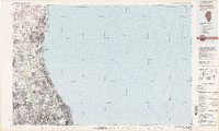
 1980 Chicago1980 Print · USGSThe Chicago metropolitan area and the industrial shores of Northwest Indiana are captured here at the start of the 1980s. Genealogists and local historians can trace the vast urban landscape through landmarks like Loyola University, St Casimir Cemetery, and the busy docks of Calumet Harbor.
 - 1980 Map of Marshall
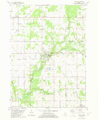
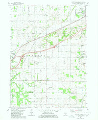
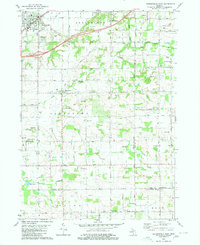
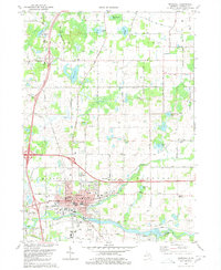 1980 Marshall1980 Print · USGSMarshall and the surrounding Calhoun County townships are shown here as they appeared in 1980, centered on the historic river-and-rail corridor. Genealogists and local historians can locate numerous rural burial grounds like Oakridge Cemetery and Hotchkiss Cem, alongside landmarks such as the Fairground and Walnut Point.
 - 1980 Map of Litchfield
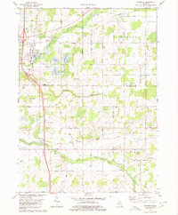
 1980 Litchfield1980 Print · USGSSouth-central Michigan farmland is captured here in the 1970s at the convergence of Hillsdale, Calhoun, and Branch counties. Local researchers can locate family sites near Bentleys Corners, South Litchfield Ch, and Shooks Prairie Cem.
 - 1980 Map of Tekonsha
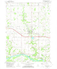
 1980 Tekonsha1980 Print · USGSTekonsha and the surrounding rural townships are captured in the early eighties as a network of river-side villages and rail-connected farms. Genealogists can trace family names and sites through Riverside Cem, Dayburg Ch, and the outlying settlement of South Butler.
 - 1980 Map of Olivet
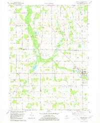
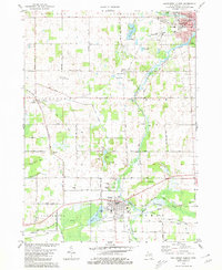
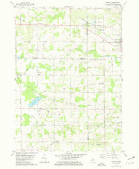
 1980 Olivet1980 Print · USGSOlivet and the Eaton-Calhoun county line are shown in the early 1980s as a landscape of small college-town life and rural industry. Researchers can trace the Grand Trunk Western rail line and locate Bosworth Cem or the Oil Field near Lee Center.
 - 1980 Map of Lyon Lake
 1980 Lyon Lake1980 Print · USGSCalhoun County's lake country is captured here in the early eighties, showing a landscape of scattered family farms and quiet shorelines. Genealogists can locate family sites near Wrights Corners, West Eckford Cem, or the rural Little Polly Ch.
 - 1980 Map of Ironwood
 1980 Ironwood1980 Print · USGSThe Michigan-Wisconsin borderlands appear in the late twentieth century as a landscape defined by iron mining and deep forests. Researchers can trace the rail-and-river economy through the Soo Line and Chicago and North Western tracks connecting Mellen, Glidden, and Hurley.
 - 1980 Map of Ravenna
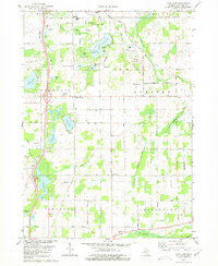
 1980 Ravenna1980 Print · USGSThe rural landscapes of Muskegon and Ottawa counties are captured here in the 1970s. Trace family history at McNitt Cemetery, explore the Old Railroad Grade, or locate the Wayside Chapel near Ravenna.
 - 1980 Map of Coopersville
 1980 Coopersville1980 Print · USGSThe Grand River valley in the early eighties shows a landscape shaped by both the river's edge and the rail line. Researchers can locate family sites near Coopersville Cemetery, trace the Grand Trunk Western railroad, or find the riverside settlement of Eastmanville.
 - 1980 Map of Northwest Albion
 1980 Northwest Albion1980 Print · USGSCalhoun County in the early eighties shows a transition from the industrial edges of Albion to the quiet township cemeteries and river-fed farms of Marengo. Genealogists can locate family plots at Marengo Village Cem or Krenerick Cem and trace the campus layout of the Starr Commonwealth for Boys.2 unique versions available
 - 1980 Map of Waukegan
 1980 Waukegan1980 Print · USGSThe Illinois North Shore and Lake Michigan coastline appear at a point of high development in the early eighties. Trace the expansive grounds of the Great Lakes Naval Training Center, Fort Sheridan, and historic Northwestern University.
 - 1980 Map of Hudsonville West
 1980 Hudsonville West1980 Print · USGSThe Ottawa County farming country south of the Grand River was transitioning between its rural roots and suburban growth in the 1970s. Genealogists can trace family names through landmarks like Beaverdam Cem and the small rail stop at Forest Grove Station.
 - 1980 Map of Southwest Albion
 1980 Southwest Albion1980 Print · USGSSouth-central Michigan farmland meets the industrial corridors of the late twentieth century in this detailed survey. Genealogists and local historians can trace family locations near Cooks Prairie, identify rural schools like Fletcher School, and locate several historic cemeteries including Fairview Cemetery.
 - 1980 Map of Marne
 1980 Marne1980 Print · USGSThe West Michigan landscape of the late 1970s reveals a mix of growing townships and traditional farming centers near Marne. Genealogists and local historians can trace the foundations of the community at St Marys Ch, Wells Cem, and Walker Station Sch.2 unique versions available
 - 1980 Map of Hudsonville East
 1980 Hudsonville East1980 Print · USGSOttawa County in the mid-seventies shows a mix of growing suburban hubs and active rural industry. Genealogists and historians can trace family plots at Jamestown Cem or explore the southern Oil and Gas Field near New Salem.
 - 1980 Map of Casnovia, 1981 Print
 1980 Casnovia1981 Print · USGSThe West Michigan borderlands of Kent and Muskegon counties are captured here in the early 1980s as traditional farming and local rail lines shaped the landscape. Researchers can trace family-named landmarks like Hilton Cem, early settlements at Lisbon, and rural centers like North Chester Ch.
 - 1980 Map of Oronto Bay, 1981 Print
 1980 Oronto Bay1981 Print · USGSThe Wisconsin-Michigan borderlands come alive in this early 1980s survey of the Montreal River and the shores of Oronto Bay. Researchers can trace family history at Saxon Union Cem or explore the river’s power at Superior Falls and Saxon Falls.
 - 1980 Map of Norvell, 1981 Print
 1980 Norvell1981 Print · USGSThe Jackson County countryside during the late seventies reveals a landscape of lakeside retreats and small-town junctions. Genealogists and local historians can trace family locations near Napoleon, Norvell, and rural landmarks like Long School and Maple Grove Cem.2 unique versions available
 - 1980 Map of Garden Island West, 1981 Print
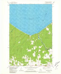
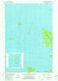 1980 Garden Island West1981 Print · USGSGarden Island and the northern reaches of Beaver Island are captured in the early 1980s, documenting a remote archipelago before modern development. Researchers can find old island settlements like Garden and Graves, or locate heritage sites such as Indian Cem and the Abandoned Lighthouse on Squaw Island.
 - 1980 Map of Milwaukee, 1981 Print
 1980 Milwaukee1981 Print · USGSThe Lake Michigan shoreline and Milwaukee's urban sprawl are captured here at the start of the 1980s. Local researchers can trace family landmarks like Graceland Cemetery, educational sites like Milwaukee-Downer College, and the northern rail lines of the Chicago and North Western.
 - 1980 Map of Manchester, 1981 Print
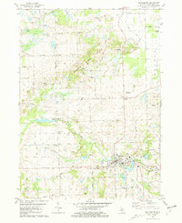 1980 Manchester1981 Print · USGSManchester and its rural surroundings in Washtenaw County are shown here in the early eighties, centered on the Raisin River and the village core. Genealogists and local historians can locate several family burial sites like Oak Grove Cem and community landmarks such as Rowes Corner and Sharon Ch.
 - 1980 Map of Little Girls Point, 1981 Print
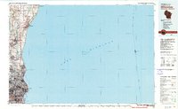
 1980 Little Girls Point1981 Print · USGSThe Michigan-Wisconsin borderlands along the Lake Superior shoreline come into focus during the early eighties. Genealogists and local historians can locate the Little Girls Point burial grounds or trace the winding Montreal River past Saxon Falls Flowage.
 - 1980 Map of Tipton, 1981 Print
 1980 Tipton1981 Print · USGSLenawee County and the Irish Hills region appear in the late 1970s as a landscape of glacial lakes and quiet crossroads. Genealogists and local historians can locate several family cemeteries like Franklin Cem and trace the path of the Old Railroad Grade near Tipton.
 - 1980 Map of Carp River, 1981 Print
 1980 Carp River1981 Print · USGSThe northern wilderness of the Upper Peninsula is documented here in the early eighties, centered on the high ridges above Lake Superior. Trace the footpaths of the Porcupine Mountains to find the Old LaFayette Mine and Lake of the Clouds.2 unique versions available
Showing maps 1-25 of 645
Top cities of Michigan
- Detroit historical maps
- Grand Rapids historical maps
- Sterling Heights historical maps
- Warren historical maps
- Ann Arbor historical maps
- Lansing historical maps
See more
Top counties of Michigan
- Wayne County historical maps
- Oakland County historical maps
- Macomb County historical maps
- Kent County historical maps
- Genesee County historical maps
- Washtenaw County historical maps
See more
Frequently asked questions
- What are the different types of historical maps available for Michigan?
- What is the oldest map of Michigan?
- Where can I purchase historical maps of Michigan for my home or office?
- Where can I download high-res historical maps of Michigan?
- Are there historical topographic maps available for Michigan?
- Is there historical aerial imagery available for Michigan?
- Where are historical maps of Michigan sourced from?