1940s Maps of Michigan
Explore 215 historic maps of Michigan from the 1940s. These maps offer a rare glimpse into what life looked like during the 1940s — showing old roads, neighborhoods, homes, and landmarks that have changed or disappeared over time.
Whether you're researching your family's past, planning a metal detecting trip, or studying how Michigan's landscape evolved across the 1940s, these high-resolution maps are a powerful tool for exploring the history of this region.
- Focus on a specific era: All maps on this page are from the 1940s, giving you a focused view of this time period.
- See what’s changed: Compare century-old streets, trails, and buildings to today's modern landscape using overlays and satellite layers.
- Research with precision: Use these maps for genealogy, historical research, land use analysis, or educational projects.
- View, download, or print: Maps are fully viewable online in high resolution, and can be downloaded or printed for your own records.
Start exploring Michigan's history through authentic maps from the 1940s. This is your window into the past.
Michigan maps
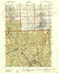
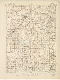
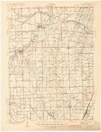
(215)- 1940 Map of Ida
 1940 Ida1940 Print · USGSMonroe County farmland and the village of Ida are captured here just before the war, when the New York Central railroad still fueled local transit. Researchers can trace rural school districts like King Sch and find family sites near Immanuel Cem.2 unique versions available
 - 1940 Map of Highland Park
 1940 Highland Park1940 Print · USGSGreater Detroit was expanding rapidly just before the war, as residential grids replaced the agricultural lands of southern Macomb and Oakland Counties. Genealogists and historians can locate family landmarks like the Michigan State Fair Grounds and St Clements Cem.2 unique versions available
 - 1940 Map of Deer Lake
 1940 Deer Lake1940 Print · USGSThe Keweenaw Peninsula shoreline comes alive in the late 1930s as aerial photography reveals the remote coastal reaches of Lake Superior. Researchers can trace the drainage of the Big Betsy River or locate the site of the Betsy River Sch and Black Rock Pt.
 - 1940 Map of Grosse Pointe
 1940 Grosse Pointe1940 Print · USGSCoastal Wayne County and the rising Detroit suburbs are captured here just before the war. Researchers can trace the development of the Pointes and find family landmarks like St Peters Ch, Jefferson Beach, and Gratiot Airport.
 - 1940 Map of Manitou Island
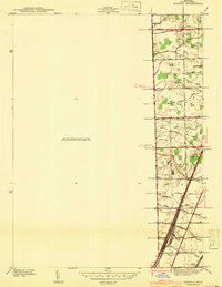
 1940 Manitou Island1940 Print · USGSThe tip of Michigan's Keweenaw Peninsula and the outlying Manitou Island are shown in 1940 just before the war. Marine historians and local researchers can locate navigation landmarks like the Manitou Island L H and Gull Rock L H.
 - 1940 Map of Fort Wilkins
 1940 Fort Wilkins1940 Print · USGSThe northern tip of the Keweenaw Peninsula is captured here in the late 1930s as the region's wilderness and maritime history began to be preserved. Researchers can trace the layout of Fort Wilkins State Park and locate landmarks like the Copper Harbor L H and Keystone Pt.2 unique versions available
 - 1940 Map of Clear Lake
 1940 Clear Lake1940 Print · USGSThe tri-state border region of Indiana, Michigan, and Ohio is captured here just before the 1940s, centered on the activity surrounding Clear Lake. Researchers can trace early school sites and family landmarks like Powers Sch, Stallman Bridge, and the Teeters Cem.2 unique versions available
 - 1940 Map of Central
 1940 Central1940 Print · USGSKeweenaw Peninsula's rugged copper country comes into focus in this pre-war survey of the Lake Superior coastline. Genealogists and historians can trace the legacy of mining at Central and Copper Falls or locate the historic Eagle Harbor L H and the local Central Fire Tower.
 - 1940 Map of Detroit
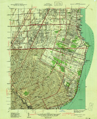
 1940 Detroit1940 Print · USGSDetroit and its Canadian neighbors thrive as a unified industrial corridor during the late thirties. Researchers can trace the massive rail-and-river network through the Detroit-Windsor Tunnel, Union Depot, and industrial sites like Zug Island.
 - 1940 Map of Maybee
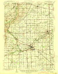
 1940 Maybee1940 Print · USGSSoutheast Michigan's rural townships are documented here in the early 1940s as the railroad fueled local growth. You can trace early family homesteads near the Stony Creek Cem or locate old school sites like Clayton Sch and Columbia Sch.
 - 1940 Map of Dundee
 1940 Dundee1940 Print · USGSMonroe County's rural landscape is captured here in the late 1930s, showing a network of rail-side towns and country schools. Genealogists can locate family landmarks like St Joseph Cem, Hull Sch, and the riverside settlement of Dundee.
 - 1940 Map of Lake Medora
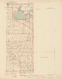
 1940 Lake Medora1940 Print · USGSKeweenaw's rugged northern tip is captured in the 1940s as a landscape of mining history and new tourism. Trace the early routes of Brockway Mountain Drive and find the site of Aetna near Lake Manganese.
 - 1941 Map of Ahmeek
 1941 Ahmeek1941 Print · USGSThe Keweenaw copper district thrived in the early 1940s, when mining towns were connected by a dense web of steam rail. Genealogists and historians can trace the foundations of Allouez, Wolverine, and the Ahmeek Mine as they stood before mid-century changes.
 - 1941 Map of Samaria
 1941 Samaria1941 Print · USGSMonroe County was a hub of rail traffic and rural farming just before the war, with dense networks of drainage canals and country schools. Researchers can trace family roots through the St Joseph Cem, find the old Dean Sch, or explore the rail works at Ottawa Yard.
 - 1941 Map of Blissfield
 1941 Blissfield1941 Print · USGSSoutheastern Michigan is captured here just before the war, showcasing a landscape defined by the winding Raisin River and its busy rail corridors. Genealogists and historians can trace dozens of country schoolhouses like Centennial Sch and family landmarks near Blissfield and Lenawee Junction.2 unique versions available
 - 1941 Map of Dundee
 1941 Dundee1941 Print · USGSMonroe County was a thriving network of rail lines and rural school districts in the years just before the war. Genealogists can trace family landmarks and local institutions like St Anthonys Ch, Maplegrove Cem, and dozens of named schools including Hull Sch.2 unique versions available
 - 1941 Map of Florence
 1941 Florence1941 Print · USGSFlorence and the surrounding lake country appear in this early 1940s survey just as modern highways began to bypass the old rail corridors. Local researchers can trace rural schoolhouse locations like Fern Sch and landmarks like the Rainbow Firetower.
 - 1941 Map of Mohawk
 1941 Mohawk1941 Print · USGSThe Keweenaw Peninsula's copper country comes into focus just before World War II, showing a landscape shaped by mining and rail. Researchers can trace the industrial corridor from Mohawk to Hebards via the Keweenaw Central Railroad and find the Gratiot Mine.
 - 1941 Map of Iron Mountain
 1941 Iron Mountain1941 Print · USGSThe Menominee River borderlands thrive with hydroelectric power and iron mining during the late thirties. Genealogists can trace family footprints at Woodlawn Cem or find early rural schoolhouses like Golden Rule Sch and Hauserman Sch.
 - 1941 Map of Royal Oak
 1941 Royal Oak1941 Print · USGSThe Detroit and Oakland County borderlands come into sharp focus in the late thirties as suburban neighborhoods began to fill the grid. Genealogists and local researchers can trace early residential blocks, parish schools like Gesu Sch, and prominent landmarks including the Detroit Zoological Park and Oakview Cem.2 unique versions available
 - 1941 Map of Neebish
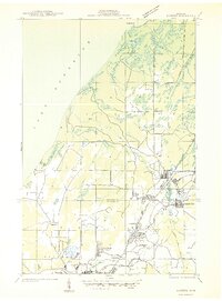
 1941 Neebish1941 Print · USGSChippewa County island life and maritime traffic are captured here in the early 1940s, showing the vital shipping channels along the Canadian border. Genealogists can trace the rural community through landmarks like the Neebish Ferry, Homestead, and the Stone School.
 - 1941 Map of Sault Sainte Marie
 1941 Sault Sainte Marie1941 Print · USGSUpper Peninsula life centered on the locks and river during the early years of the war. Genealogists and historians can trace family-named schools and rural landmarks from Algonquin down to the Parkerville Church and Dafter.
 - 1941 Map of Strongs, 1947 Print
 1941 Strongs1947 Print · USGSChippewa County in the early 1940s centers on the rail-side life of Strongs and the northern shore of Pendills Bay. Researchers can locate vanished landmarks like the Jones School, the Demond Hill Fire Tower, and the early layout of Raco Field.
 - 1941 Map of Brimley, 1947 Print
 1941 Brimley1947 Print · USGSThe Lake Superior shoreline and St. Marys River come alive in this wartime-era survey of the Upper Peninsula. Genealogists can trace family roots at the Finnish Church or locate vanished school sites like the Maple Grove School and Dorgan School.
 - 1941 Map of Saginaw, 1958 Print
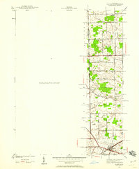
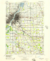 1941 Saginaw1958 Print · USGSThe Saginaw River Valley in the early 1940s reveals a bustling network of river-and-rail industry and rural district schools. Genealogists can trace family landmarks like Frankentrost Sta, Birch Run, and the Crow Island Sch.2 unique versions available
Showing maps 1-25 of 215
Top cities of Michigan
- Detroit historical maps
- Grand Rapids historical maps
- Sterling Heights historical maps
- Warren historical maps
- Ann Arbor historical maps
- Lansing historical maps
See more
Top counties of Michigan
- Wayne County historical maps
- Oakland County historical maps
- Macomb County historical maps
- Kent County historical maps
- Genesee County historical maps
- Washtenaw County historical maps
See more
Frequently asked questions
- What are the different types of historical maps available for Michigan?
- What is the oldest map of Michigan?
- Where can I purchase historical maps of Michigan for my home or office?
- Where can I download high-res historical maps of Michigan?
- Are there historical topographic maps available for Michigan?
- Is there historical aerial imagery available for Michigan?
- Where are historical maps of Michigan sourced from?