Old Maps of Michigan
Explore 2,330 old maps of Michigan, spanning from 1895 to today. These high-resolution historic maps reveal how streets, neighborhoods, landmarks, and natural features evolved over time — perfect for genealogy, metal detecting, research, and local history exploration.
What you can do with these maps:
- See how Michigan changed over time: Compare historical maps to modern-day views to trace roads, homesites, rail lines & more.
- View detailed metadata: Each map includes creators, publishers, year, scale, and archive source.
- Overlay maps with satellite & LiDAR: Visualize the past alongside modern tools to explore terrain & human change.
- Trusted historical sources: Maps sourced from the USGS, Library of Congress, and other archives.
- Access maps your way: View online, download high-res files, or order prints for personal or research use.
Start exploring old maps of Michigan to uncover forgotten places, hidden landmarks, and the deep history beneath your feet.
Michigan maps
(2,330)- 1895 Map of Ned Lake
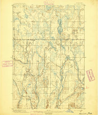 1895 Ned Lake1895 Print · USGSCovers Michigan, including Hematite Township, Covington Township, and other nearby areas4 unique versions available
 - 1895 Map of Passage Island
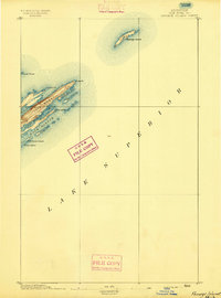 1895 Passage Island1895 Print · USGSCovers Michigan, including Houghton Township, Keweenaw County, and other nearby areas3 unique versions available
 - 1895 Map of Perch Lake
 1895 Perch Lake1895 Print · USGSCovers Michigan, including Hematite Township, Iron River Township, and other nearby areas3 unique versions available
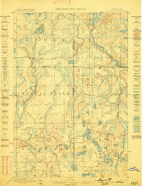
 - 1898 Map of Iron River, 1899 Print
 1898 Iron River1899 Print · USGSCovers Michigan, including Iron River, Stambaugh, and other nearby areas2 unique versions available
 - 1899 Map of Sagola
 1899 Sagola1899 Print · USGSCovers Michigan, including Sagola, Mansfield, and other nearby areas3 unique versions available
 - 1899 Map of Witbeck
 1899 Witbeck1899 Print · USGSCovers Michigan, including Witbeck, Mansfield Township, and other nearby areas3 unique versions available
 - 1899 Map of Crystal Falls
 1899 Crystal Falls1899 Print · USGSCovers Michigan, including Crystal Falls, Mastodon, and other nearby areas2 unique versions available
 - 1900 Map of Maumee Bay, 1921 Print
 1900 Maumee Bay1921 Print · USGSCovers Michigan, including Toledo, Oregon, and other nearby areas2 unique versions available
 - 1900 Map of Toledo, 1932 Print
 1900 Toledo1932 Print · USGSCovers Michigan, including Toledo, Bedford Township, and other nearby areas
 - 1902 Map of South Lyon, 1954 Print
 1902 South Lyon1954 Print · USGSCovers Michigan, including Ann Arbor, Canton Township, and other nearby areas
 - 1902 Map of Ypsilanti, 1958 Print
 1902 Ypsilanti1958 Print · USGSCovers Michigan, including Ann Arbor, Ypsilanti Charter Township, and other nearby areas
 - 1902 Map of Dexter, 1962 Print
 1902 Dexter1962 Print · USGSCovers Michigan, including Ann Arbor, Pittsfield Charter Township, and other nearby areas
 - 1904 Map of Ann Arbor
 1904 Ann Arbor1904 Print · USGSCovers Michigan, including Ann Arbor, Canton Township, and other nearby areas2 unique versions available
 - 1905 Map of Wayne
 1905 Wayne1905 Print · USGSCovers Michigan, including Detroit, Canton Township, and other nearby areas4 unique versions available
 - 1905 Map of Detroit
 1905 Detroit1905 Print · USGSCovers Michigan, including Detroit, Windsor, and other nearby areas2 unique versions available
 - 1905 Map of Grosse Pointe
 1905 Grosse Pointe1905 Print · USGSCovers Michigan, including Detroit, Warren, and other nearby areas4 unique versions available
 - 1906 Map of Ypsilanti
 1906 Ypsilanti1906 Print · USGSCovers Michigan, including Ann Arbor, Ypsilanti Charter Township, and other nearby areas3 unique versions available
 - 1906 Map of Wyandotte
 1906 Wyandotte1906 Print · USGSCovers Michigan, including Taylor, Lincoln Park, and other nearby areas2 unique versions available
 - 1906 Map of Dexter
 1906 Dexter1906 Print · USGSCovers Michigan, including Ann Arbor, Pittsfield Charter Township, and other nearby areas4 unique versions available
 - 1906 Map of Saline
 1906 Saline1906 Print · USGSCovers Michigan, including Ann Arbor, Pittsfield Charter Township, and other nearby areas4 unique versions available
 - 1906 Map of Romulus
 1906 Romulus1906 Print · USGSCovers Michigan, including Taylor, Brownstown Charter Township, and other nearby areas2 unique versions available
 - 1906 Map of South Lyon
 1906 South Lyon1906 Print · USGSCovers Michigan, including Ann Arbor, Canton Township, and other nearby areas6 unique versions available
 - 1907 Map of Marquette
 1907 Marquette1907 Print · USGSCovers Michigan, including Marquette, Trowbridge Park, and other nearby areas3 unique versions available
 - 1907 Map of Pontiac
 1907 Pontiac1907 Print · USGSCovers Michigan, including Farmington Hills, Southfield, and other nearby areas5 unique versions available
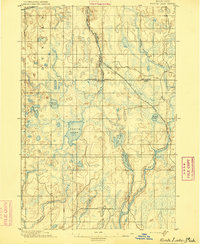
 - 1907 Map of Howell, 1959 Print
 1907 Howell1959 Print · USGSCovers Michigan, including Hamburg Township, Genoa Charter Township, and other nearby areas2 unique versions available
Showing maps 1-25 of 2,330
Top cities of Michigan
- Detroit historical maps
- Grand Rapids historical maps
- Sterling Heights historical maps
- Warren historical maps
- Ann Arbor historical maps
- Lansing historical maps
See more
Top counties of Michigan
- Wayne County historical maps
- Oakland County historical maps
- Macomb County historical maps
- Kent County historical maps
- Genesee County historical maps
- Washtenaw County historical maps
See more
Frequently asked questions
- What are the different types of historical maps available for Michigan?
- What is the oldest map of Michigan?
- Where can I purchase historical maps of Michigan for my home or office?
- Where can I download high-res historical maps of Michigan?
- Are there historical topographic maps available for Michigan?
- Is there historical aerial imagery available for Michigan?
- Where are historical maps of Michigan sourced from?